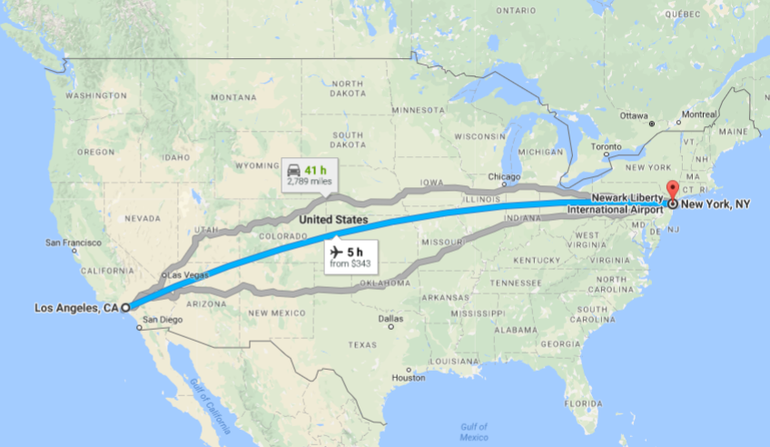
Last week I flew most of the way across the country: I departed Las Vegas at 11am local time, and landed in New York City at 7pm right around sunset. I almost never fly in the daytime — it didn’t occur how unusual this was for me until I was in the air and had to keep my sunglasses on because it was so bright. When flying west to east, I take a red eye so that I don’t lose a whole day traveling. And when flying east to west, I usually depart around dinner time so that I can enjoy most of the day on the east coast and then land in Los Angeles around 11pm and go right to bed. It’s just generally more schedule-efficient to fly at night. But every once in a blue moon I end up with a daytime flight, and I’m reminded that it is SO INCREDIBLE to look outside the window at the topography below.
I always book a window seat because I like having a little extra space to fall asleep on cross-country flights, but also because I’m slightly obsessed with geography: I follow our flight path on that little digital map, and even at night, I’ll routinely peer outside to notice which cities we’re flying over. But during the day it’s a whole different ballgame. Last week on my flight from Vegas to JFK, I flew over Canyonlands National Park in Utah… the Rocky Mountains… Chicago… and over New York City just as the sun was setting. (I dozed off for a good hour over the midwest — sorry Kansas.) This five-hour journey gave me an appreciation for just how enormous and varied our landscapes are in the U.S. And if you don’t have time to see everything on the ground below… well, it’s not a bad idea to book a window seat on your next daytime cross-country flight and admire it all from above.
I’m going to combine the photos I took last week — all taken on a small point-and-shoot camera — with a dozen others I’ve snapped from airplane windows over the past few years. Let’s start out west and work our way back east…
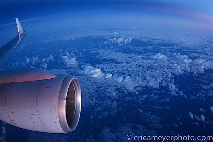
This photo was taken on our way to Hawaii in 2012. Endless ocean and clouds below.
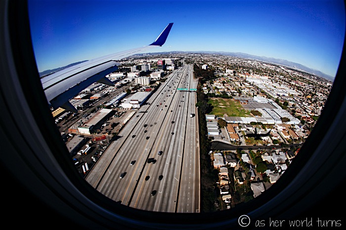
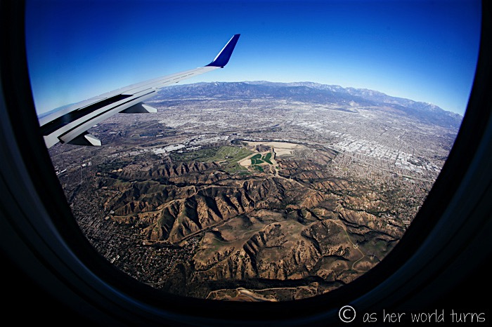
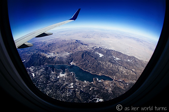
The next four photos were taken in January 2015. Soaring above Los Angeles… and the not-so-scenic 405 freeway which has remarkably little traffic at this moment:
Mountainous canyons spotted while heading east out of Los Angeles, towards San Bernardino:
Big Bear Lake, California:
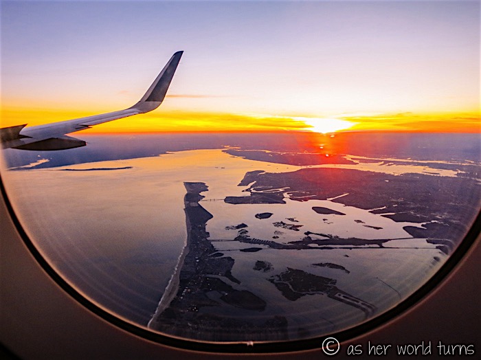
And now back to the present; I snapped this just after taking off from Las Vegas last week. (Apologies that most of the remaining photos were taken on my point-and-shoot camera, not quite the same quality as my DSLR.)
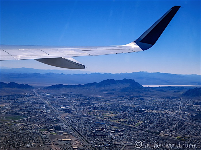
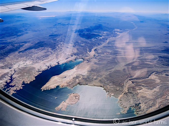
By process of elimination, this must be Lake Mead and the Colorado River because there are no other bodies of water near Las Vegas:
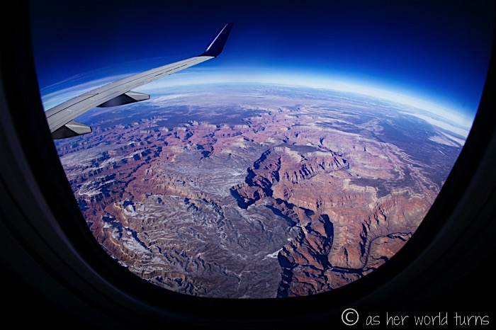
While I did not fly over the Grand Canyon on this last trip (we went northeast from Las Vegas right towards Utah), I did capture it in January 2015, at the same time I took the photos in the earlier part of this post. You can see a dusting of snow since it’s the middle of winter:
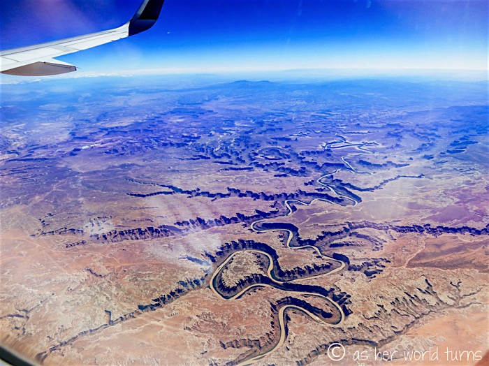
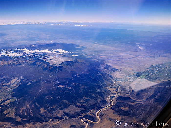
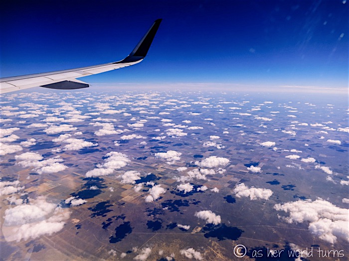
But last week I did appreciate that same desert scenery as we flew over Utah. I snapped this photo over Canyonlands National Park:
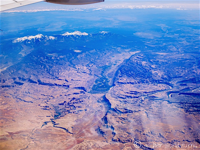
And that’s Moab, Utah in the green valley below — Arches National Park is also located just nearby (it’s sort of a two-for-one deal with Canyonlands). These parks are incredible and I have great memories of exploring here on family trips when I was a kid. How crazy that the desert and those snow-covered peaks below are literally right next to each other?
I think this next photo is overlooking Grand Mesa, Colorado but I’m not 100% certain. How incredible is that tabletop mountain? I got a closer look as we flew directly over it, and it looks like a very cool place to hike. There’s even a lake up there. I don’t see a lake in that spot over Grand Mesa on Google Maps so if I’m wrong, I want to know exactly where this is. Can anyone help me out?
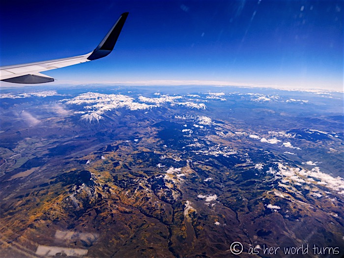
Flying over the Rocky Mountains — notice the yellow foliage as leaves were just starting to turn color:
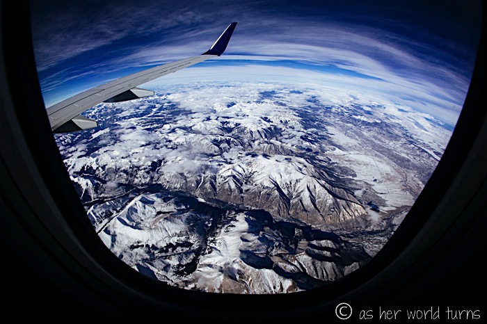
Quick flashback to that January 2015 flight when we flew right over the Rockies at the height of winter:
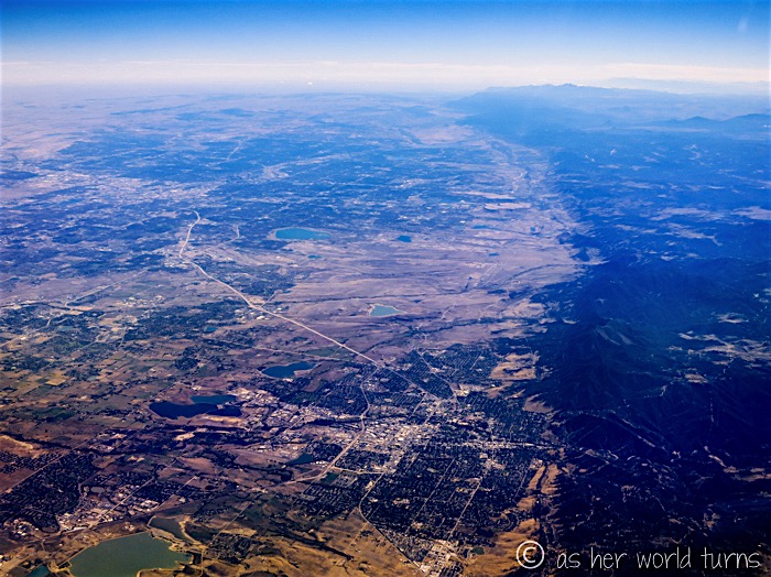
Flying over Boulder, Colorado — I was just here hiking with my uncle six months ago!
And then things got really flat for a long time. I took a nap. I think I snapped this over Iowa or Illinois.
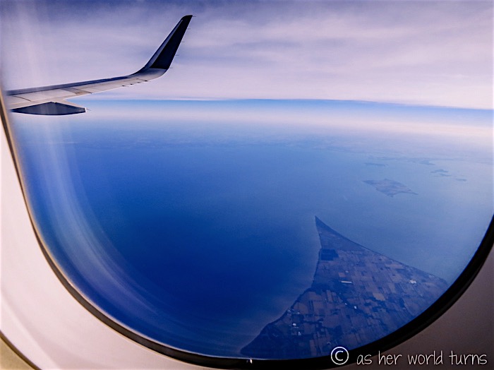
I had the window up for Chicago, which in retrospect was stupid as it would flesh out this post nicely. But I peeked out as we flew over Lake Erie — this is the Canadian side, and that very distinctive point is called Pointe Pelee National Park in the province of Ontario. Ohio is on the other side.
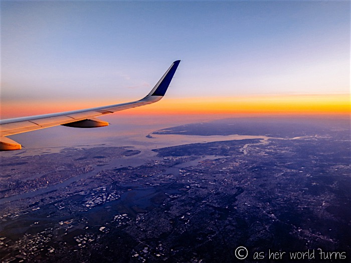
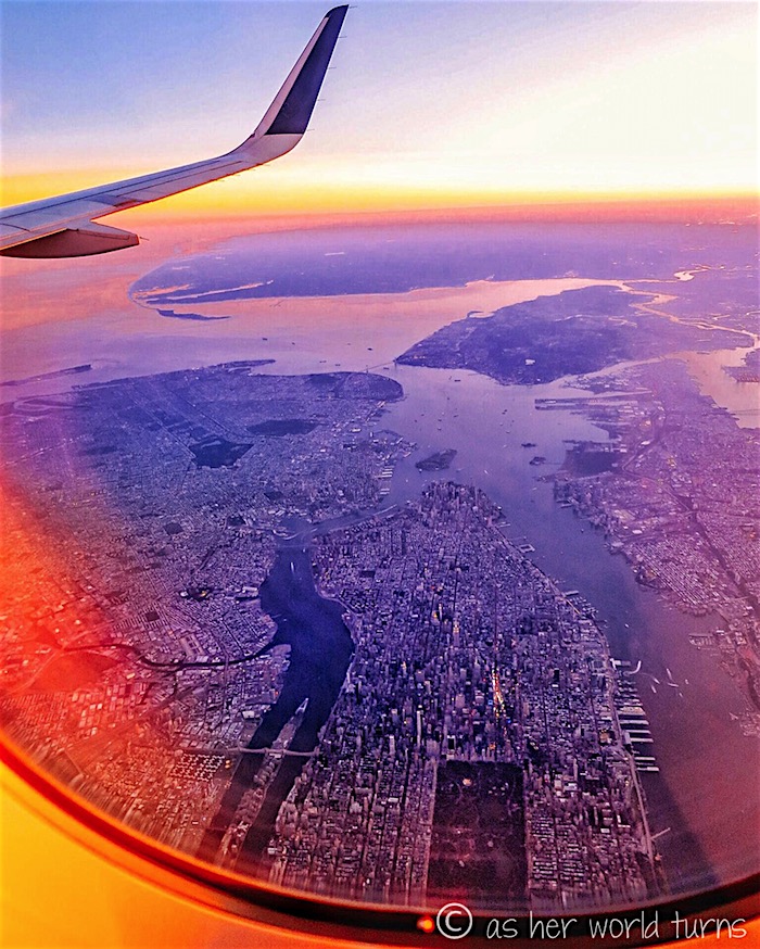
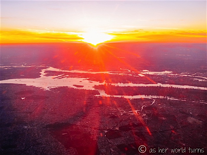
And just in time for sunset, our plane flies directly over Manhattan.
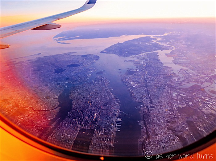
I spy Times Square and Central Park… I was positively giddy the moment I snapped this photos:
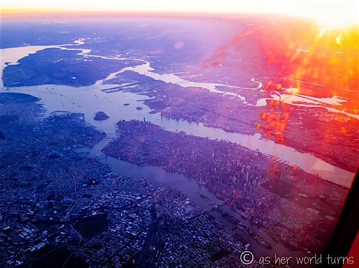
The expanse of Brooklyn:
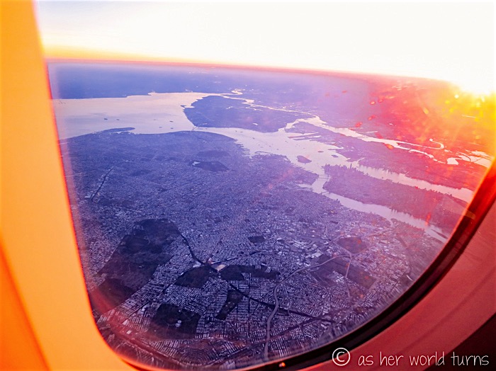
And one last glimpse of Queens as the sun officially sets and we’re about to land. That timed out pretty well.
So… here’s my business pitch: a company should sell day-long flight tours over the continental United States. They can fly at a lower altitude so that guests can see everything better, and it would last a little longer. The pilots would take a flight path to maximize scenic areas. Happy hour would happen over Kansas. These flights would be one-way; you pick the direction you want to fly in, and then it can be part of your vacation or you can just book a normal commercial flight back to where you started. I think it would get the most business from non-American tourists. Whenever I meet people abroad from other countries who have visited the United States, I’m always curious to hear what parts they saw because our country is HUGE, and their experience would be very different depending on where they went — like New Orleans vs. New York City, or the Grand Canyon vs. Hawaii, or Washington D.C. vs. Seattle. All of those places are uniquely different, and it would take forever to see them all. I think some tourists would embrace the chance to take a half-day air tour over the continental U.S. to get a visual on a wide variety of areas in such a short time span. It doesn’t replace visiting the cities or national parks down below, but life is short and this five-hour flight could round out their visit to a few different places. Just an idea.
(I’m patenting this now… what to call it?! If I’m running the show, “Erica’s America Tour” has a nice ring to it. I jest.)
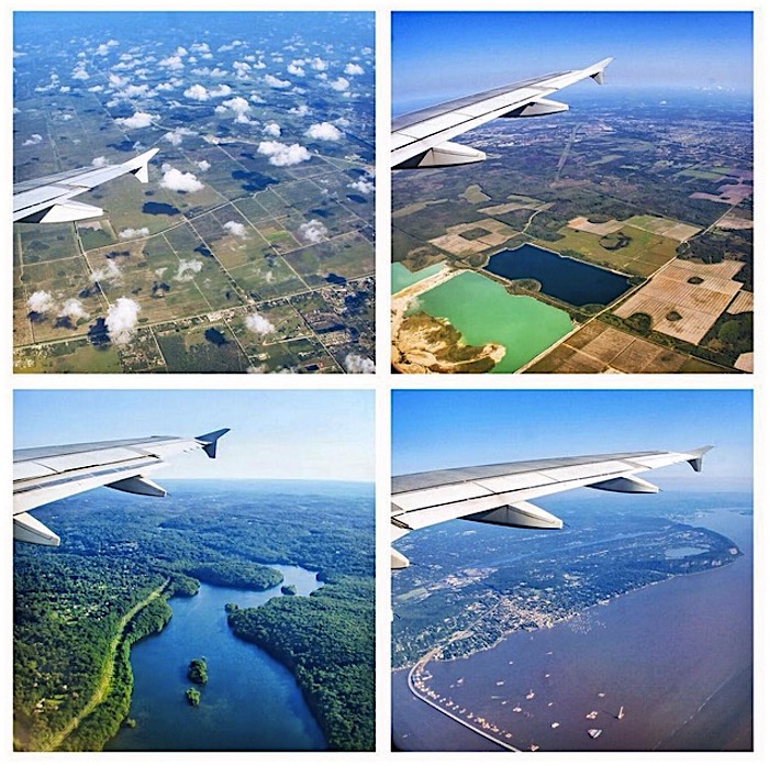
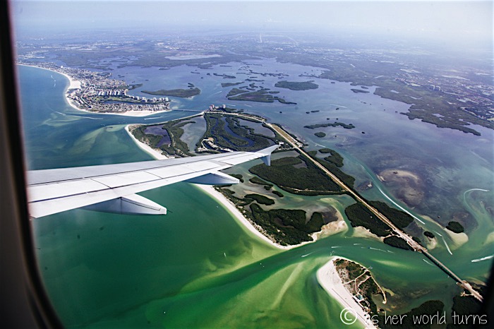
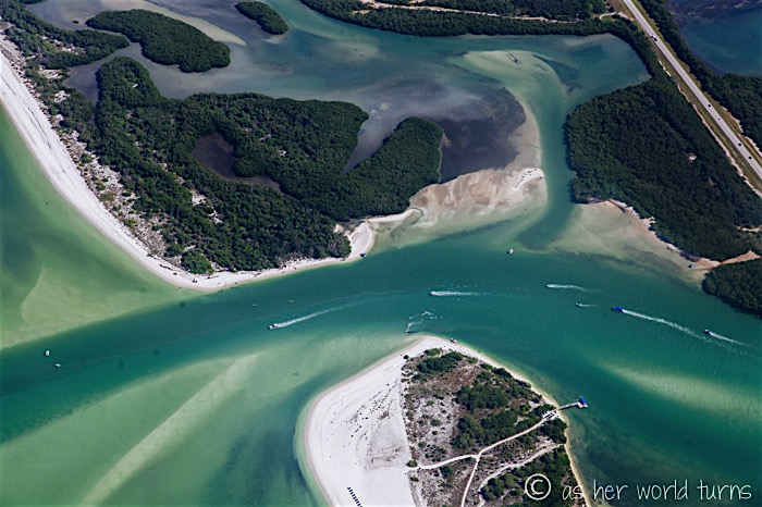
P.S. I’m going to throw in some more airplane photos I took in July 2015 while flying to Ft. Myers, Florida — as you can see, this sort of island geography is totally different from the shots in the rest of this post. What an incredible world we live in.
TL;DR: Book a window seat and choose a daytime flight the next time you have to fly across the country.


What a fun post!! This was so fun to read!! I love when pilots point out landmarks on flights. Beautiful from above!!
Thank you Kelley! I love when pilots point out landmarks too!