Disclaimer: this is the most challenging post I’ve ever written, due to the complex nature of the Israel-Palestine conflict. I did a lot of research while writing it, but if I’ve overlooked facts or have not fully understood / explained aspects of this history, please go easy on me. My goal for this post is to make sense of what I witnessed on this intensely fascinating tour of Hebron.
On my last day in Jerusalem, I sign up for a day-long tour of Bethlehem & Hebron with Green Olive Tours, a company I’d heard about from fellow travelers in Jordan who raved about their experience. Plus Green Olive’s Trip Advisor reviews are outstanding.
We’ll explore parts of Palestine to learn about the area’s contentious history and witness what it’s like to live there now. I’ll start with Hebron in today’s post, and tomorrow share photos from our visit to Bethlehem, a refugee camp, the separation wall, and more.

Our tour guide is Mohannet. He’s outstanding and provides excellent commentary all day.
Hebron, located about 20 miles from Jerusalem, is the largest city on the West Bank.
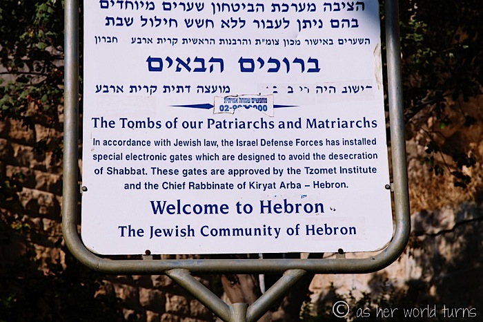
It’s considered the second-holiest site in Judaism after Jerusalem because it hosts the Cave of the Patriarchs and Matriarchs of the Bible — Abraham, his wife Sarah, their sons and son’s wives are all buried here.
Since Abraham is also a revered prophet in the Koran, this area is important to Muslims, too.
Which is why Hebron has been a coveted stretch of land for centuries millennia. Jews, Palestinians, and other groups in history have wrestled for control of land that each believes belonged to their forefathers.
Here’s some more background info, since this is a complex situation.
Even after taking this tour and doing extensive Googling, I still struggle to wrap my head around the historical, religious, and political dynamics that come into play here.
The West Bank is a large territory that includes East Jerusalem and areas north and south of it (plus a quarter of the Dead Sea).

The West Bank is divided into three zones, called Areas A, B, and C —

Area A is entirely controlled by Palestinian Authority. It’s the smallest geographic area, but it contains most of the Palestinian cities and towns. These cities / towns are marked like islands on the map, surrounded by Area B land — so when considered by itself, Area A is split up and rather isolated. But the Palestinians are free and self-ruled in Area A.
Area B is mostly filled with infrastructure surrounding and connecting the ‘islands’ of Area A. It’s under Palestine civil authority but largely off-limits to Palestine security forces (so Palestinians have very little control in Area B). Instead, it’s mostly controlled by the Israeli military. If there’s any trouble in one of the Area A ‘islands’ — say, a terrorist attack — that activity can be controlled quickly by Israeli troops if they lock down Area B. And since the Israeli military doesn’t care to enforce Palestine law in Area B, it tends to be a more lawless place and serves as a convenient garbage dump, in the words of travel writer Rick Steves (his HuffPo piece was invaluable in understanding these areas).
Area C is under complete Israeli authority. It’s largely uninhabited land, plus Israeli settlements, which are considered illegal by the international community because they’re on occupied land. I’ll write more about them tomorrow.
So in the clearest terms: most Palestinians live in Area A, some Israelis live in Area C, and they overlap in Area B. Worth noting: Israelis also have unrestricted access to the rest of Israel, as the West Bank is only a part of the entire country.
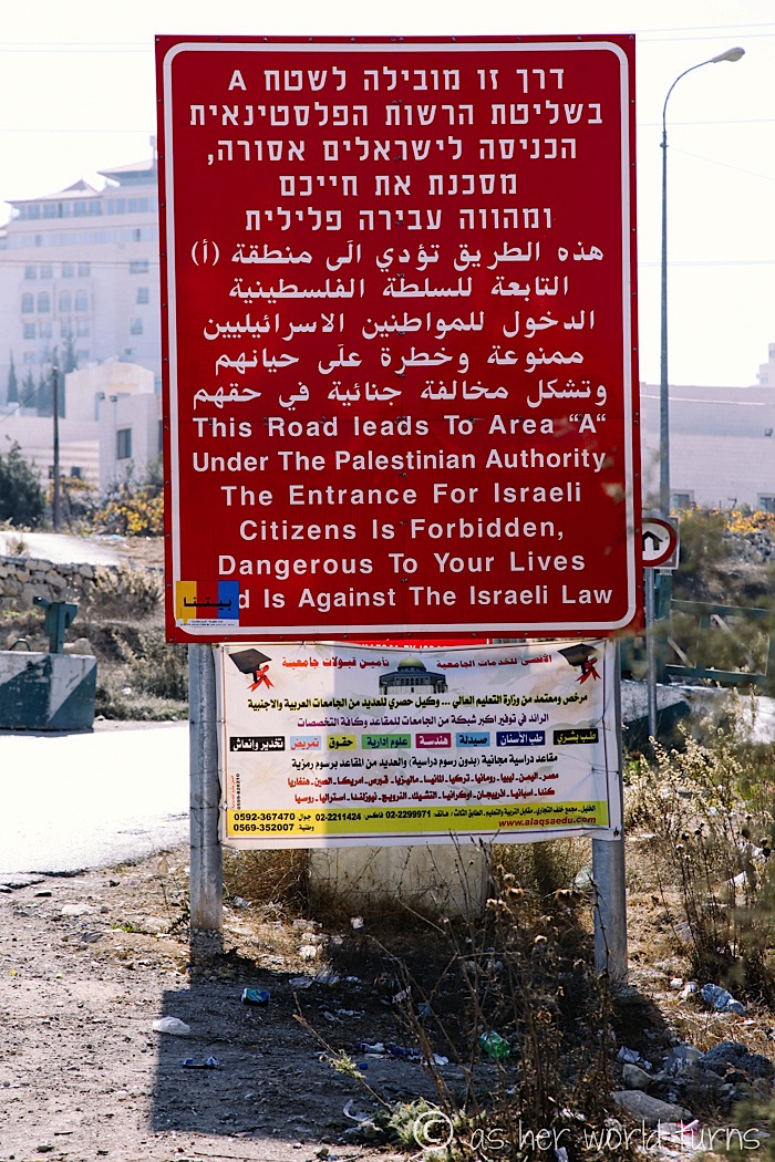
These large red signs mark each point where Area B passes into Area A, a warning from the Israeli government to its citizens:
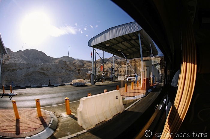
Checkpoints are in place, which can make traveling from one area to another difficult, although we didn’t experience any delays while driving to Masada, Ein Gedi, and the Dead Sea. Here’s a photo I snapped out the window as our tour van breezed past this checkpoint:
It’s more complicated for Palestinian citizens — their license plates are green, and Israeli license plates are yellow. Green license plates have limited access.
Also, both Palestine and Israel have separate mail systems and stamps. There is no reliable mail service between Palestine and the rest of the world, so many Palestinians keep an address with a friend in Jerusalem to work around this. For what it’s worth: I mailed myself a postcard from both places, and each one arrived in a similar timely fashion.
And this might not come as a surprise, but I find it interesting: Israel does not allow Google to map the West Bank for security reasons.
There is no 3G allowed in Palestine. Since smartphones need an internet connection to work, nearly every restaurant provides free Wifi. Israeli settlements in Area C of the West Bank do have 3G so some Palestinians surreptitiously access it by getting an Israeli SIM card.
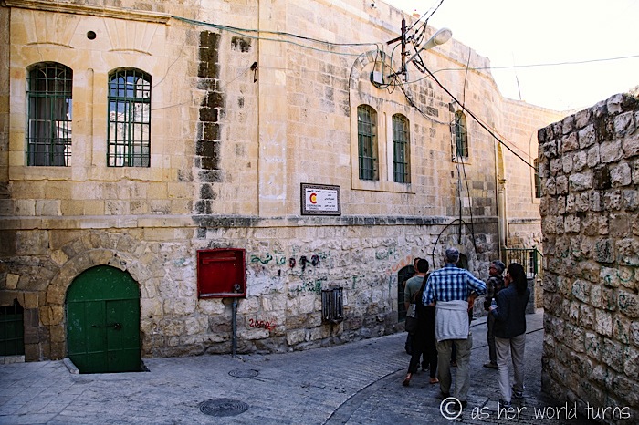
Back to Hebron, the city we’re visiting today.
So you know everything I just explained about areas A, B, and C? It’s a bit more complicated in Hebron. As I wrote earlier, this city is very important to both Judaism and Islam because of the holy caves where Biblical and Koran figures are buried. So it’s not enough to simply designate it as Area B where both Israelis and Palestinians can co-exist… it needs stronger boundaries.
So Hebron is split into two sectors, H1 and H2 —
H1 is controlled by Palestine Authority.
H2 is controlled by Israel.
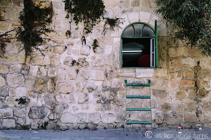
The city is divided, and yet each side must live in close quarters with the other. It’s uncomfortable to witness the extreme measures taken so that both groups may reside in the same city. For example, the front door of this home below is located on a street in the H2 sector. But a Palestinian family lives there, and it would be a giant inconvenience if they had to pass through Israeli security checkpoints every time they walked into or out of their house. So they added a ladder on the back window which is on an H1 street, and now it’s the primary entrance to their house.
We pass this security gate separating H1 and H2.
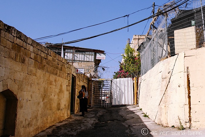
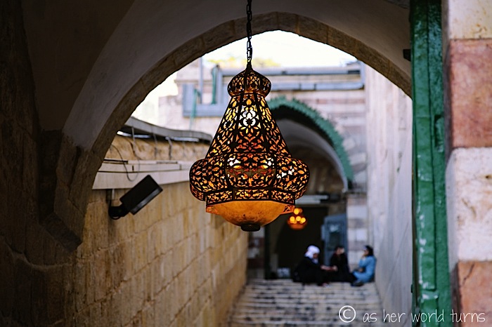
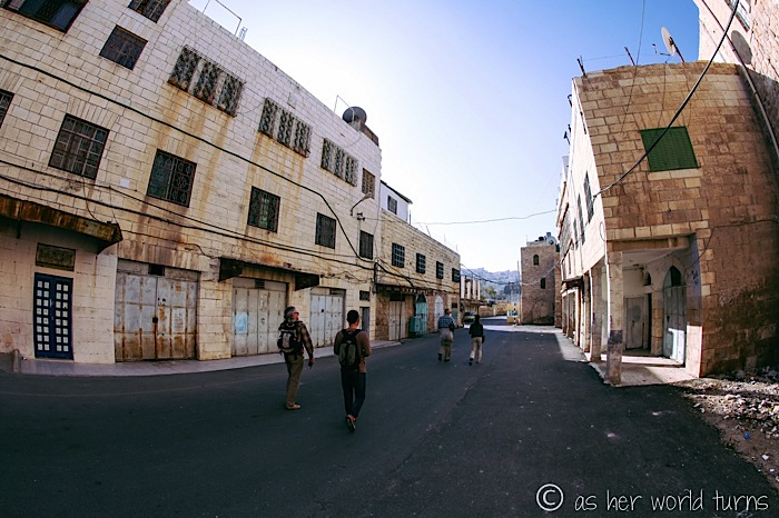
Our walking tour of Hebron begins in the H1 Palestinian side.
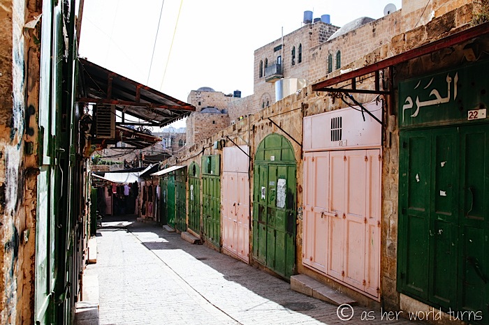
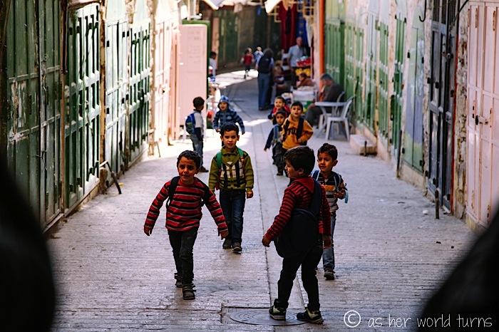
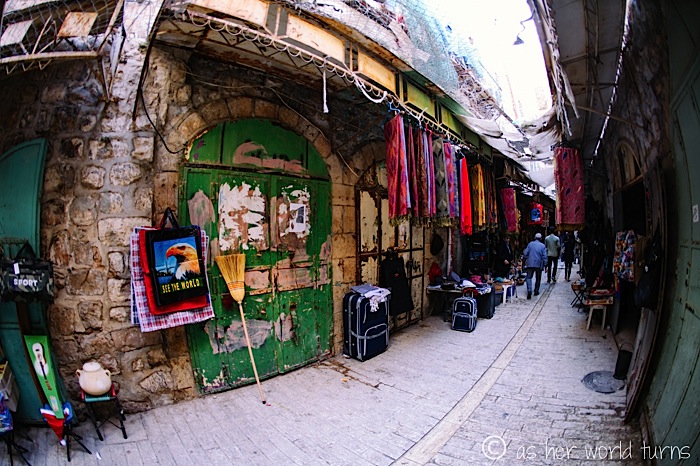
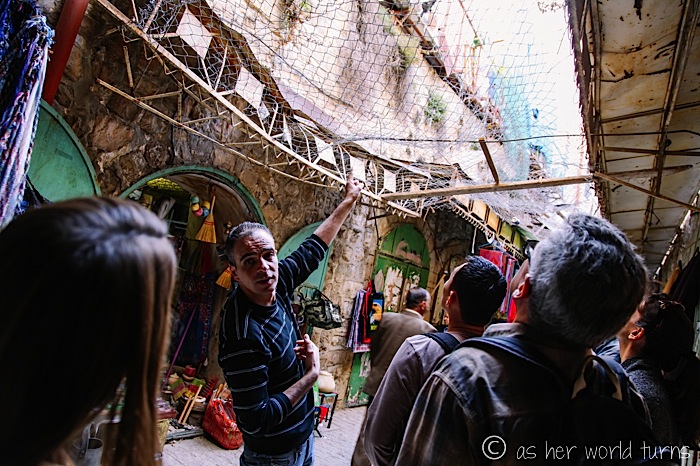
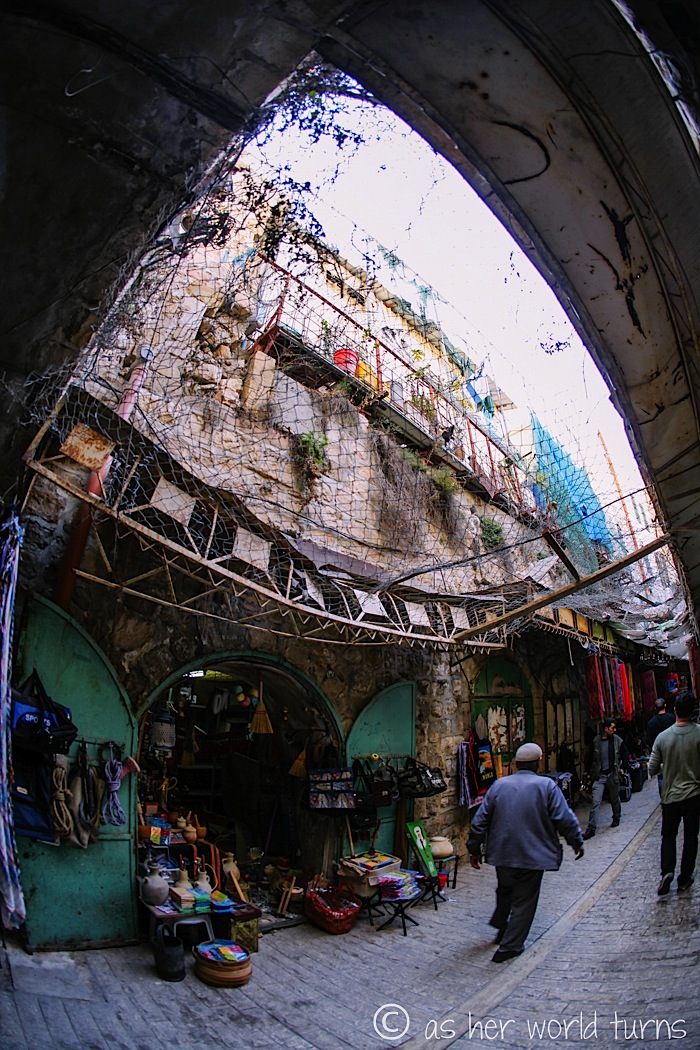
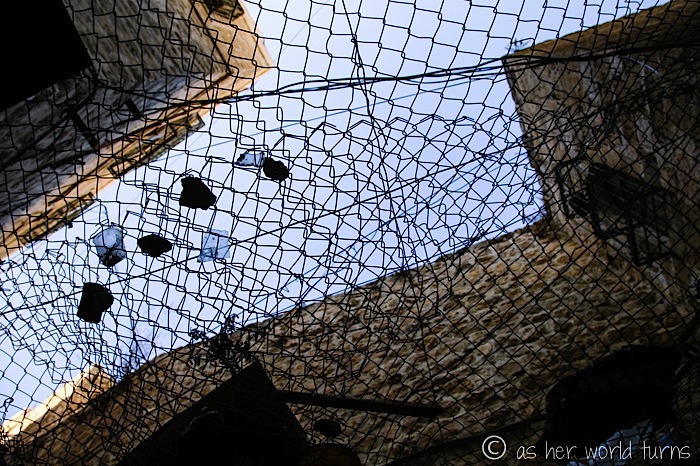
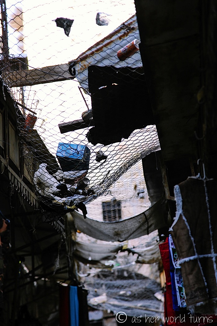
Around 120,000 Palestinians live in the H1 sector. But some of their main streets border the H2 sector, and Israelis in these homes throw trash and even rocks (!) at the Palestinians below. So these streets are covered with a metal net to protect pedestrians and shopkeepers from getting pelted with debris from above.
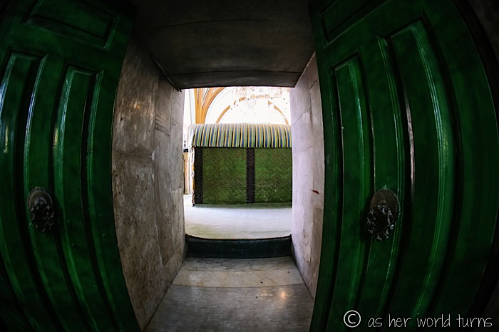
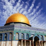
Now we are en route to the Ibrahimi Mosque on the Palestinian side… which, as you might’ve gathered from that name, refers to Abraham. This mosque is the SAME SITE as the Cave of the Patriarchs and Matriarchs on the Israeli side — where Abraham, his wife Sarah, sons Isaac, Jacob, and wives Leah and Rebecca are buried. The only Matriarch missing is Rachel, who is believed to be buried near Bethlehem where she died in childbirth.
Anyone have Sunday School flashbacks? No, just me?
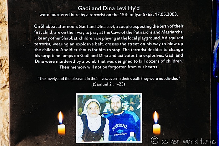
Perhaps you’re wondering how two major religions share this sacred site. As you can imagine, there’s a lot of friction surrounding this space and sharing is complicated. There was a major massacre here 20 years ago.
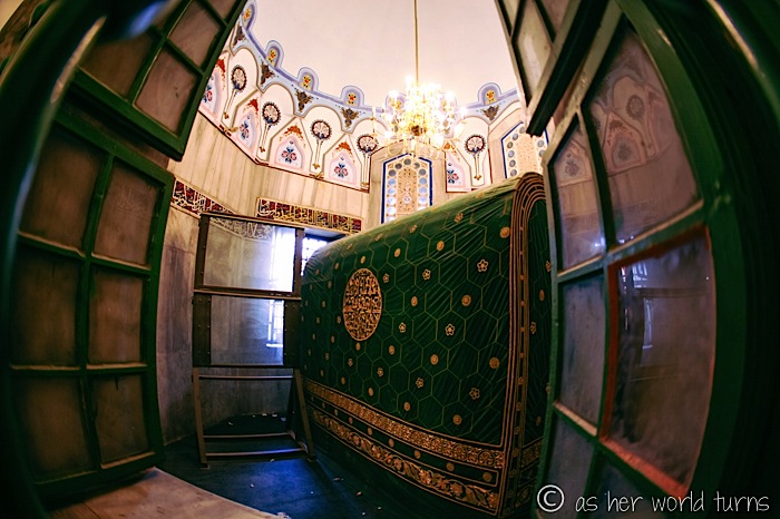
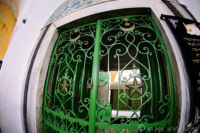
The solution was to essentially divide it in two sections separated by a wall. Abraham and Sarah’s cenotaphs (giant tombs) have corridors running alongside them on each side, so that both Jews and Muslims can see them from their respective halves.
This is Abraham’s tomb / cenotaph as viewed from the mosque side. When we visit the other side later on, we’ll stand at that window in the back — just behind the panel of bulletproof glass.
And I believe this is his wife Sarah’s cenotaph:
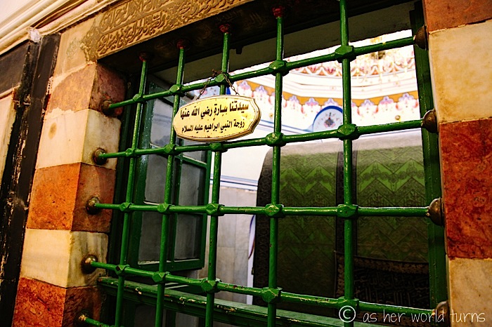
Isaac and Rebecca are buried on the mosque side (their cenotaphs are pictured below), and Jacob and Leah are buried on the other side.
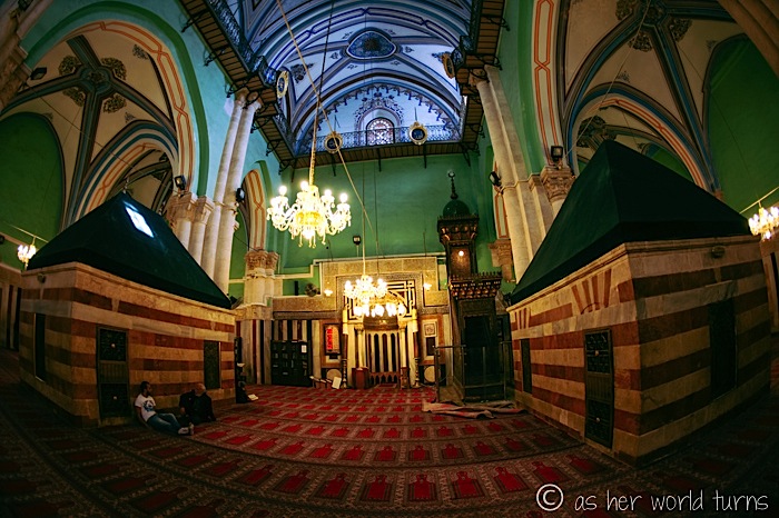
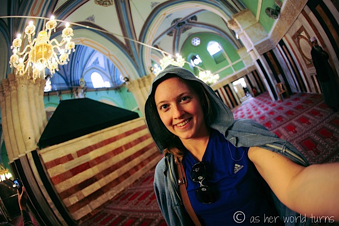
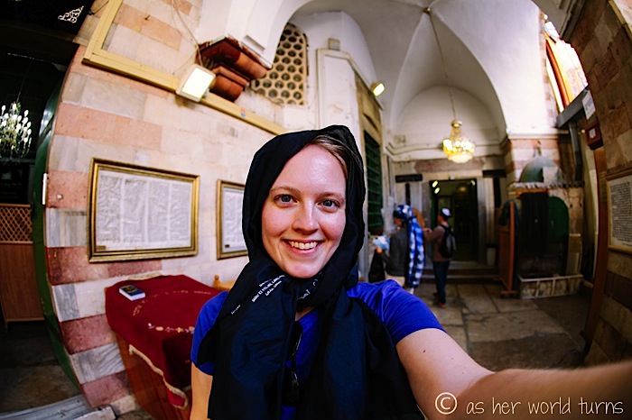
Women must wear a cape-like covering on the mosque side (provided at the entrance at no cost). We’ll wear a similar covering on the other side, too.
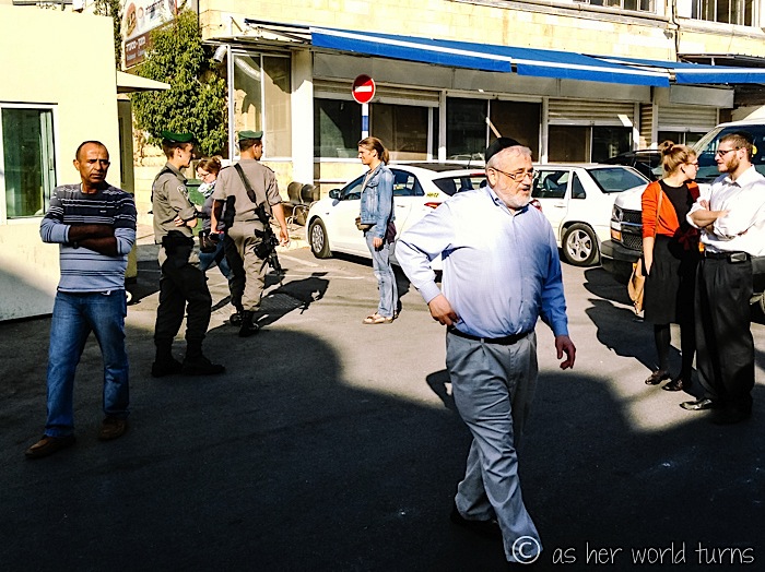
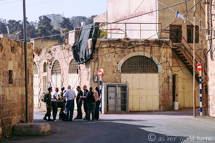
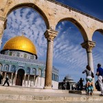
Armed members of the IDF (Israel Defense Forces) patrol this street below.
Everyone on our tour has their passports in hand. They’re checked a few times. As a largely American and European crowd, we have no problem getting around and are welcome anywhere. Our Palestinian guide, however, does not have that same luxury — as Mohannet attempts to walk us towards the Cave of the Patriarchs, as he normally does with his tours, they stop him well before the official barrier. He stays behind to wait near the barrier as we continue onward.
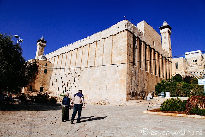
This is the exterior of the Cave of the Patriarchs — again, the Ibrahimi Mosque where we just walked around is on the other side (Mohannet was allowed to accompany us there since he’s Palestinian).
Here is my head covering on this side:
The view of Abraham’s cenotaph from this side… exactly opposite from where I took a photo an hour before. See that same panel of bulletproof glass?
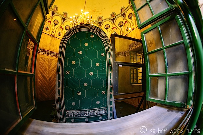
And Sarah’s cenotaph, as seen from this side:
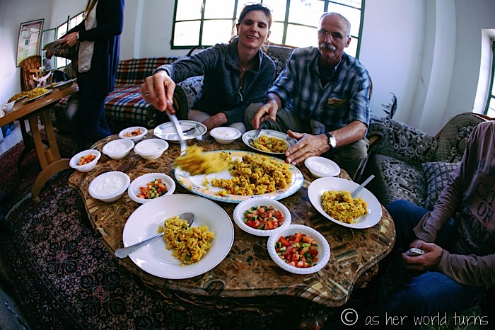
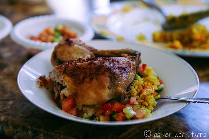
We eat lunch with a local Palestinian family. They’ve cooked up chicken, rice, and veggies — delicious.
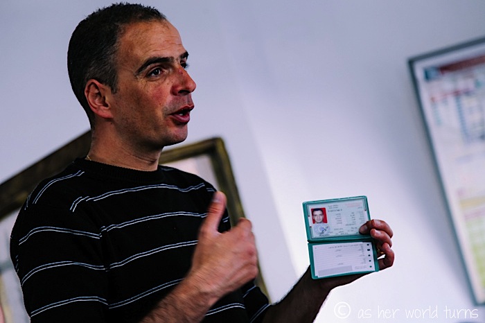
Our guide Mohannet shows us his ID identifying him as a Palestine.
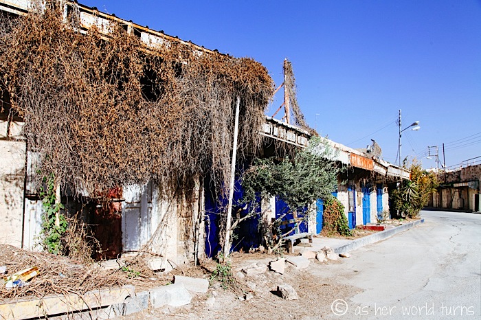
We end our tour of Hebron by walking down al-Shuhada Street. It used to be a major corridor lined with Palestine shops but has come under Israeli control within the last 10-ish years, so our guide is not permitted to walk with us. We show our passports at the checkpoint below and walk up and down the now-deserted street.
The street is lined with propaganda against the Palestinians who used to live in this area.
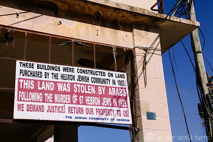
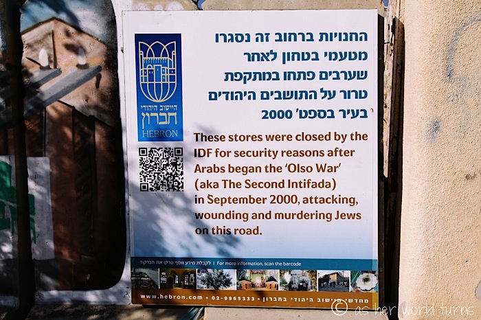
Every year, demonstrations are held world-wide to call for the reopening of al-Shuhada Street to Palestinians. Until something changes, it continues to look like this:
This is easily the most fascinating tour I’ve even been on and I feel privileged to have witnessed what’s happening in Hebron with my own eyes.
Tomorrow I’ll write about the rest of our Palestine tour — visiting Bethlehem, a refugee camp, the separation wall, and more.
Many thanks to Green Olive Tours for generously hosting my day-trip to Bethlehem & Hebron. Opinions are my own.

Hello Erika,
I didn’t read all of you post, just the begining where you stress the division of the city and that Jewish residents throw trash on the houses of Palestinians.
I want to give you a background about this town that you don’t seem to know of:
Hebron, like ALL cities in the west banks, like all of the west bank had NO barriers, walls, checkpoints or divisions up until the 2000’s.
The west bank was under Israeli control since 1967. Until the first “Palestinian” Intifadah (uprising in Arabic) the west bank was totally open to the Arabs and Jews alike. Total free movement for all inside the west bank and from the west bank to Israel and vice versa. No checkpoints, no other limitations.
The Arabs who lived in the west bank travelled freely from it to Israel, some worked daily in Israel and some travelled to Israel with their cars.
The first Intifada – from late 1980’s to early 1990’s started to change things – the Arabs became violent (I’m not going into who’s right or wrong here).
It resulted in the Oslo accord – that was the first time THE Palestinian leader Yasser Arafat was willing to reach a compromise with Israel, which led to the signing of this peace accord.
It was basically the first time a “Palestinian” leader was willing to accept Israel’s right to exist at all.
I put the word Palestinian in brackets because I think it is a misleading word. The Arabs in Palestine started calling themselves Palestinians only after 1967. Before that they, and everyone else referred to them as Arabs. There were also Jews who lived in Palestine but they started to call themselves Israelis after Israel was established in 1948. By using the name “Palestinians”, the Arabs try to make it look like they are the true natural and long time inhabitants of the land of Palestine and that it is their land which in my opinion, if you learn the history of the place, it not the case. That’s why I use brackets for the word Palestinians.
Anyway, as part of the Oslo accord Israel GAVE control of parts of the west bank to the “Palestinians”. Something, by the way, that they never had before in history: In 1948 the Jordanians took control of the west bank and east Jerusalem and didn’t establish any “Palestinian” state on them, before them the British were in control of these territories from 1917-1948, and before that the Ottoman empire controlled these territories for 400 years. Before that other rulers controlled these territories but never an Arab people called “Palestinians” or called any other name.
So in the 1990’s the Israelis gave te “Palestinians” control of parts of the west bank. All was rosy and well in the begining. Israelis we’re hoping that at last we’ll have peace and that the peace process will be concluded with the establishment of a Palestinian state which will live peacefully with Israel.
At first their were no checkpoints in the west bank and of course no wall. Gaza even had its own airport. But then things started to turn badly. The second “Palestinian” intifadah started. And it was especially violent an barbaric.
Babies, women, old people. Israeli civilians were blown up to pieces every other day on buses, coffee shops, malls, hotels. The “Palestinians” used the free movement from the west bank to Israel to launch countless attacks inside Israeli towns. More than a thousand Israeli civilians were murdered.
And that’s when the checkoints were build, and the wall, and the separation etc.
So when you visit Hebron nowadays, or any other area or town in the west bank you have to realize that what you see is a relatively new reality that is a direct result of countless of attacks of Arabs against Jews both in the west bank and Israel itself.
Regarding the big red signs that warn Israelis from entering the areas that are under Arab control. They too come after dozens of incidents where Israelis who crossed into these territories were brutally murdered. A few examples: the horrible massacre of 2 Israeli soldiers who lost their way and were lynched to death in the most barbaric way in Ramallah. An Israeli teenager who was seduced in a chat on the internet to meet an Arab girl in the west bank were her terrorist friends murdered him. Another Israeli who entered the west bank with an Arab co-worker of his – an illegal “Palestinian” worker inside Israel, and who was murdered by this “Palestinian”, only recently 3 Israeli teensagers who were abducted, their fate not yet known, etc. etc..
And another thing. The “innocent” Arabs have a long bloody history of slaughtering Jews in Palestine, and in the very same town you visited there was the 1929 Hebron massacre (needless to say before the checkpoints, wall, “occupation”, or even the existence of the state of Israel!)
I guess what I’m trying to say in all this is that what you see now on the ground has a long history. Now there is a situation in Hebron that only hard line Jewish settlers have the guts to live at all in this place. And they are the kind of people who believe the west bank is a Jewish land and are driven by a religious belief.
But before the reality of today there were many dozens of years of Jewish and Israeli willingness to compromise and have peace with the Arabs. Lands were given to them and a process was in place to reach a full peace. The ones who destroyed that process and the hope for peace were, AS ALWAYS, the Arabs. Because beyond all the “misery” that the ‘Palestinians” are so good at showing to the world – how they are oppressed with all these checkpoints and wall and everything – ask them one thing – are you willing to accept Israel’s right to exist at all or do you want ALL of Palestine? Are you willing to accept Israel’s presence in Haifa, Acre, Jaffa?
The answer you’ll get is NO! And that’s the core of the Arab Israeli conflict. Not the checkpoints or wall or “occupation”. There are some Arabs who are willing to compromise and want the 2 state solution but the are not the majority. The ones who make the shots are the ones who refuse any compromise and don’t recognise Israel’s right to exist at all. And it’s not only the Hamas in Gaza. See what’s going on in the Palestinian authority TV or school books. Israel is not on the map. The territory of Israel is referred to as Palestine and are taught that are the land of the “Palestinians” and that will be returned to them once Israel is destroyed. Suicide bomber are considered national heroes and there a constant incitement against Israel on all levels – media, schools etc etc.
You wrote that you tried to learn more about this complicated issue so I hope I’ve given you something to think about.
Thank you for such a detailed response!
Clearly, I went on a tour more sympathetic to the Palestinian side. You have provided an Israeli perspective, which is a nice balance to the commentary on my post. So I’m happy to leave your comment here so that others may read it and better understand both viewpoints on this conflict.
Dear Erica,
I would advise you to take the previous response with a big grain of salt, as most of it is zionist propaganda. It is true that the situation in Hebron is rather new, but what mr. or mrs. Israeli forgets to mention is that most of the restrictions for Palestinians were put in place after an Israeli gunned down unarmed Muslims praying in the Ibrahimi mosque, killing 29 and wounding more than a 100 others. So much for all violence coming from the Palestinian side, as the Israeli claims here. Notice also that the restrictions target the Palestinians, even though they were victims of the massacre.
It would take me too long to debunk all the myths and correct all the lies of said poster, but I especially like how mr. or mrs. Israeli presents the First Intifada as an irrational act that came out of the blue. The Palestinians should have been thankful, even though they were living under occupation for decades, stripped of their rights and subjected to servitude. Not to mention the fate of the more than 700.000 Palestinians who either fled or were forcefully driven from their house after the creation of Israel, and who have been denied the right to return untill this very day.
The poster calls the actions of Palestinians barbaric. What she forgets to mention again is that the First Intifada actually started out as a non-violent protest. The Israeli response was less peaceful, and according to UN researchers included poison gas (against unarmed civilians), torture and deportation.
None of this qualifies as a core issue of the conflict, according to most Israelis. Neither are the illegal settlement program, the expropriation of private land, the systematic discrimination and persecution, the indiscriminate violence against civilians, including children, and so on. Instead, everything revolves around how bad Israel’s neighbours are. The fact that Fatah and the PLO recognize Israel and help Israel to combat terrorism (or that all Arab countries have signed a peace plan based on a two State Solution and completele normalization of relations) is irrelevant. They secretly want to destroy Israel.
Thank you for adding to the discussion, George. As I am no expert on this, I appreciate hearing these details. Thank you.