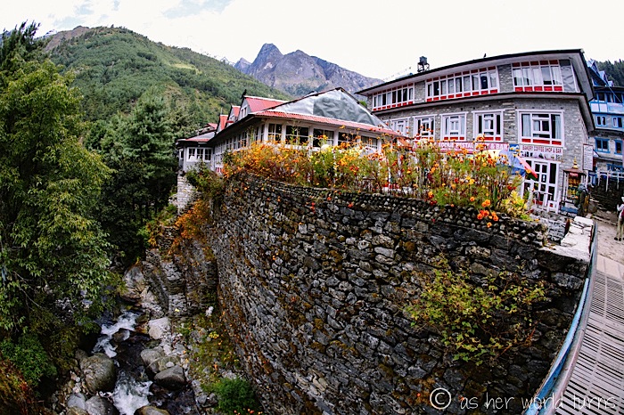
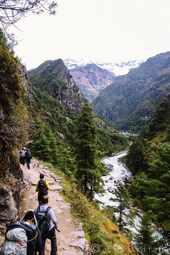
After a full night’s sleep — thanks, Ibprofin PM! — I wake up ready to hit the trail for day two of our trek to Everest Base Camp. Today will be tough: we’re heading to Namche Bazaar, the largest village on the trail after Lukla. It will take me about 5.5 hours to hike there from Phakding, with the final two hours heading straight uphill.
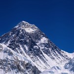
But you can’t beat these views:
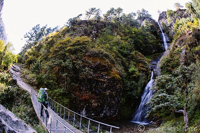
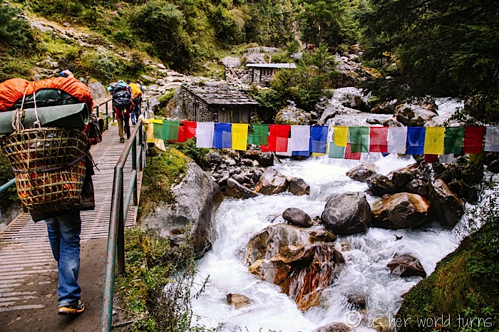
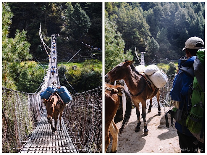
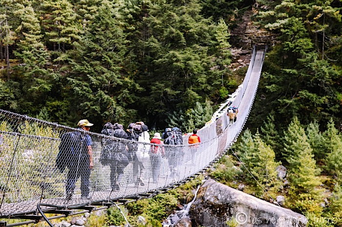
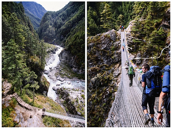
Here’s our first suspension bridge of the day. Little do I know what waits ahead… this is nothing! Luckily I don’t have a fear of heights.
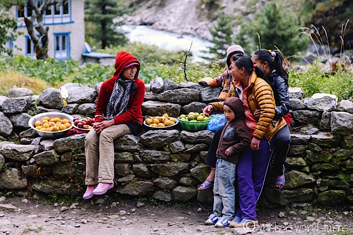
This family sells fruit along the trail.
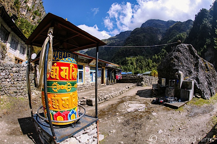
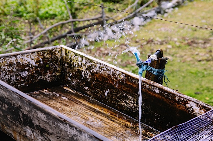
There are many places to refill water bottles, like at this makeshift water fountain pictured below. I’ve brought along water purification tablets (purchased very cheaply at a Kathmandu grocery store) and after I plop one into my freshly refilled canister, it’ll be drinkable in 30 minutes. I carry two water bottles with me and rotate between them so that I always have clean water readily available. Hydration is an important weapon in fending off altitude sickness.
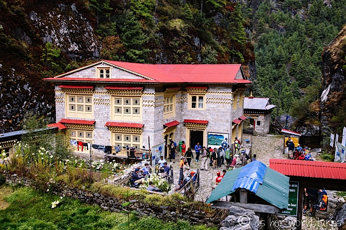
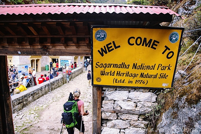
There are a number of check points where officials verify hiking permits. This is one of them.
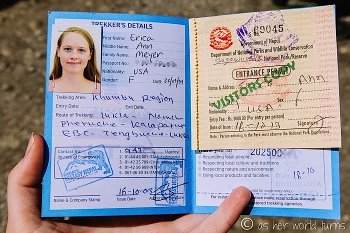
When I check in, they ask what brand of camera I’m using. The official writes down everyone’s answers in a column next to their name and permit number. I’m thrown by this and a little suspicious — why do they want to know? is there a camera permit fee I’m not aware of? — and I’m not totally sure how to answer (“Well, my DSLR is a Canon, then I’m taking video on this Canon point-and-shoot, plus shots on my Apple iPhone, and I have my GoPro just in case”). I simply say Canon and they don’t ask anything else about cameras. When I press my young guide about why they want to know, his English fails him and he can’t explain it. Can you imagine someone telling the officials they came all the way to Everest and DIDN’T bring a camera? I wonder if anyone’s tried that.
Here’s what my hiking permit looks like:
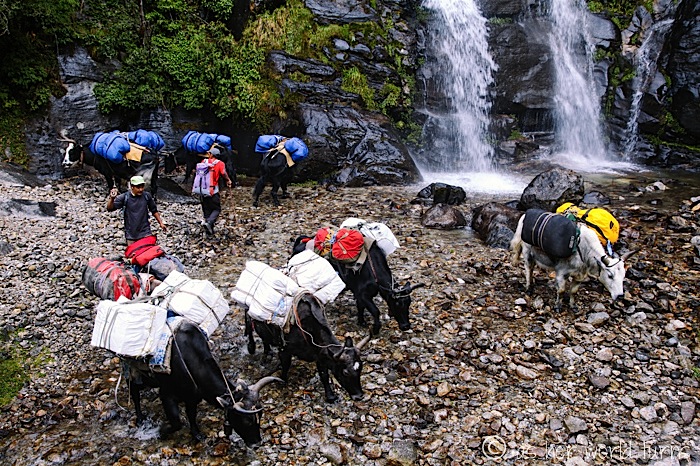
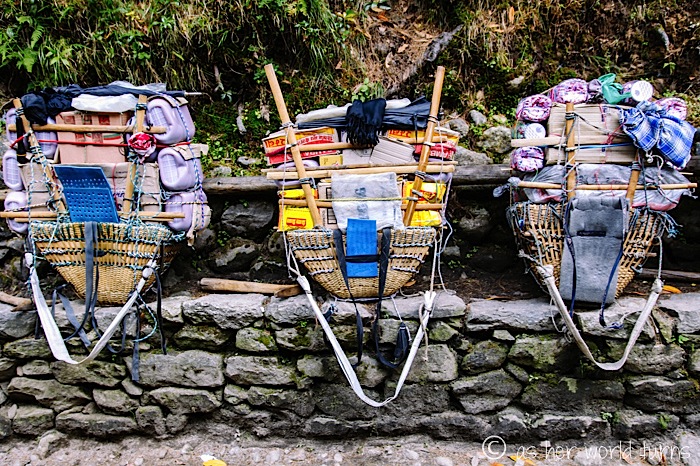
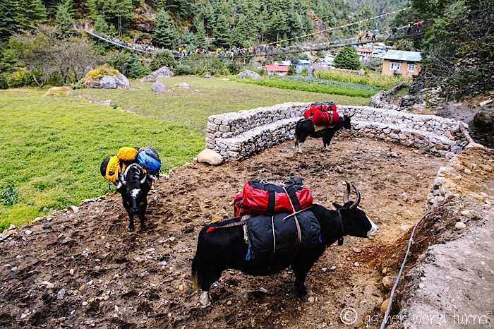
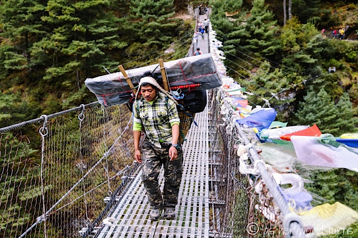
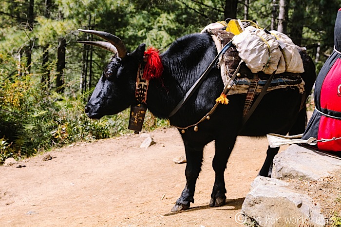
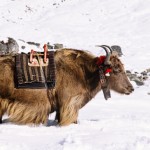
As you may have noticed in some of my photos already, local sherpas carry tremendous loads on their backs. The entire economy of the mountain depends on them — and the yaks — to get food and supplies to villages at higher altitudes. It’s a common job in this society but it comes with a price. I can only imagine the strain on the backs, hips, and knees of these men (and occasionally women) as they push forward uphill.
Here are some examples of the packs they carry. The white strap goes around their forehead to help balance the load.
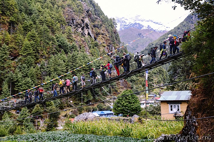
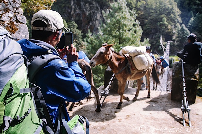
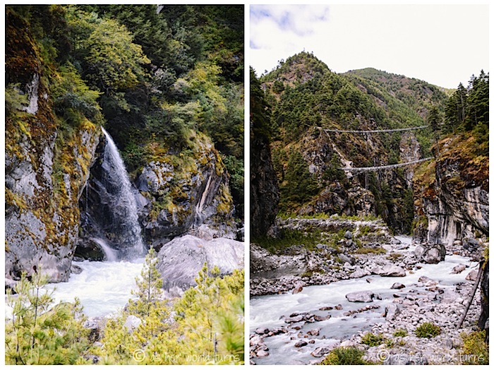
Check out another swinging bridge in the background of this photo. We cross more on this day than any other.
Here’s a sherpa in action; you can clearly see that strap across his forehead keeping everything balanced.
These next two photos are of the exact same bridge on the return trip down 10 days later. We happen to arrive just as hundreds — truly, hundreds — of donkeys cross before us. I think we pause for a good half hour (!) to let them pass.
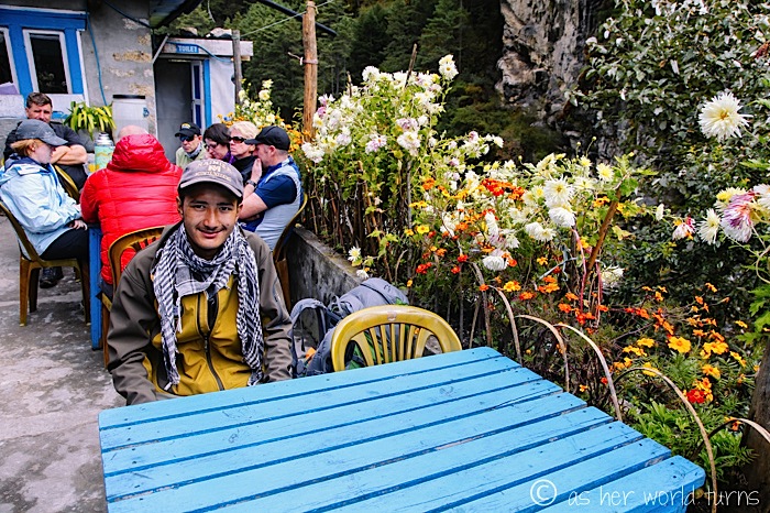
Halfway through our hike on day 2, young Mingma and I stop for lunch.
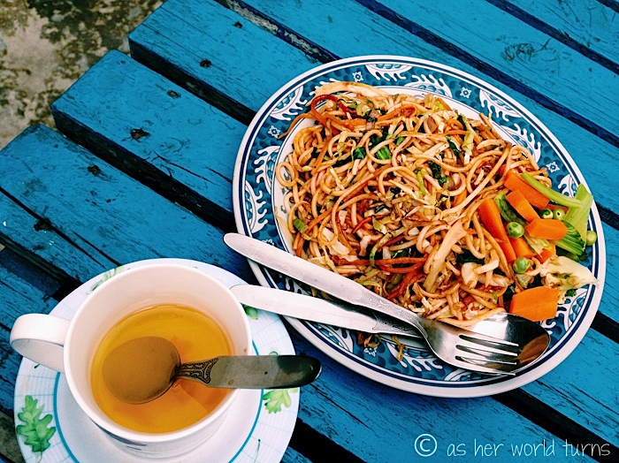
These fried noodles with veggies are delicious. So is the lemon ginger tea, my new favorite beverage. By the way, I don’t drink any coffee on this entire 12-day trek — quite a departure for me.
Yet another bridge… we’re not even at the best one yet.
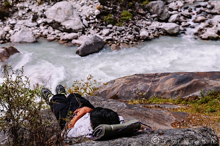
This sherpa takes a quick nap on the river banks:
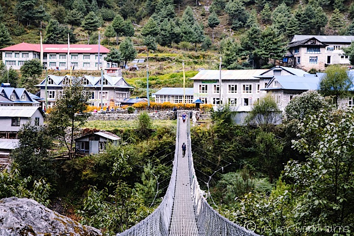
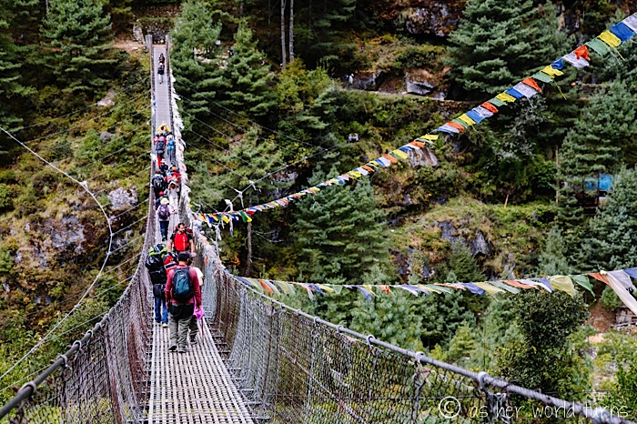
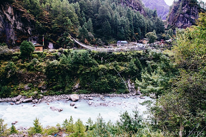
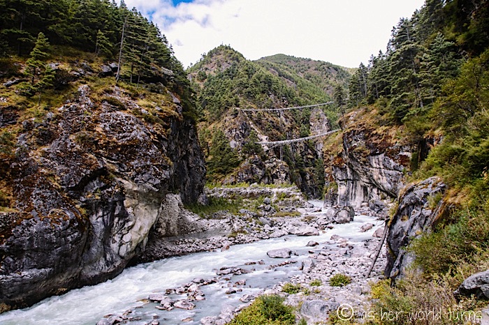
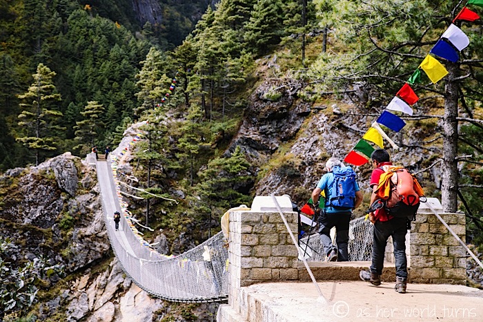
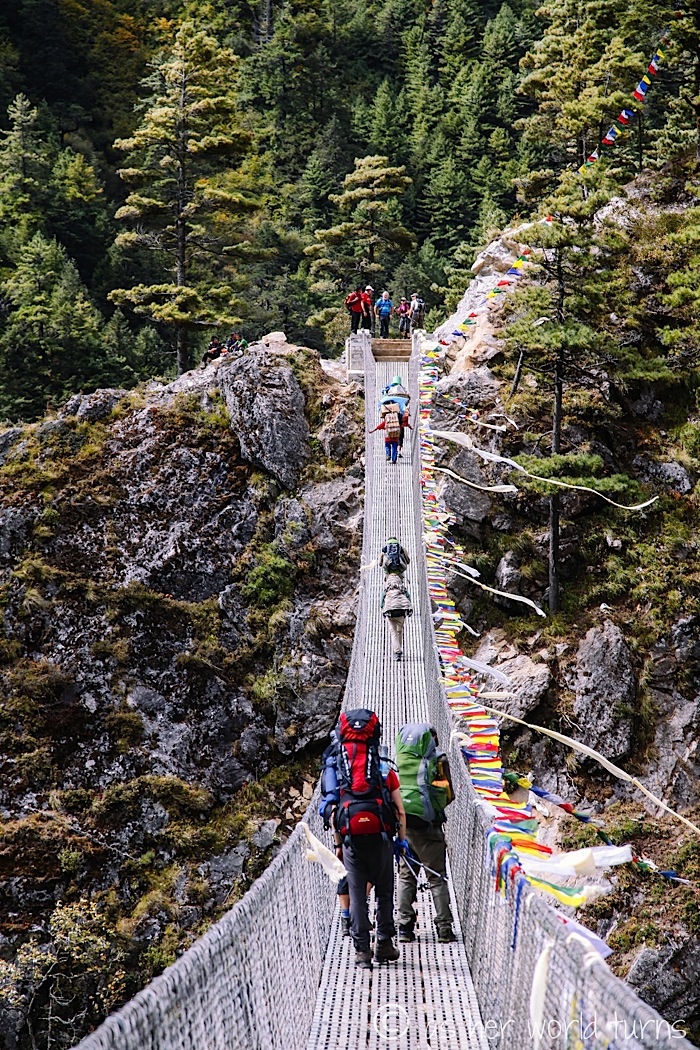
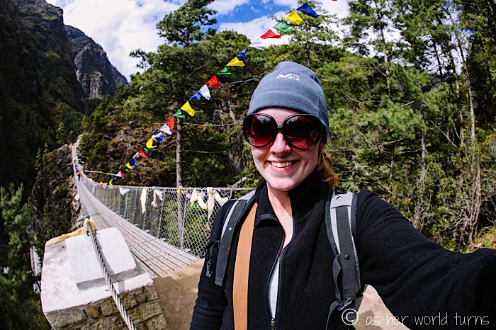
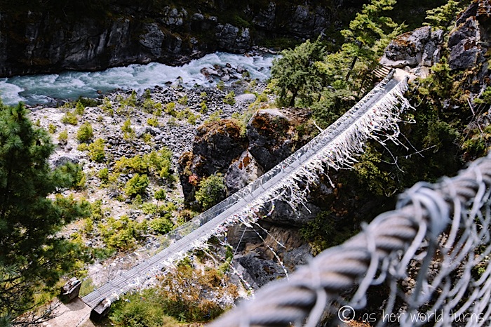
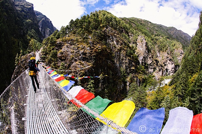
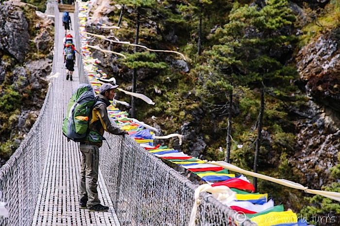
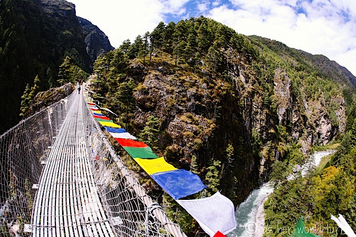
Ah, there it is… the grandest — or, depending on how you enjoy heights, scariest — suspension bridge of the whole trek. See two of them in the photo below-right? The lower one is the old bridge, and the upper one is the new bridge.
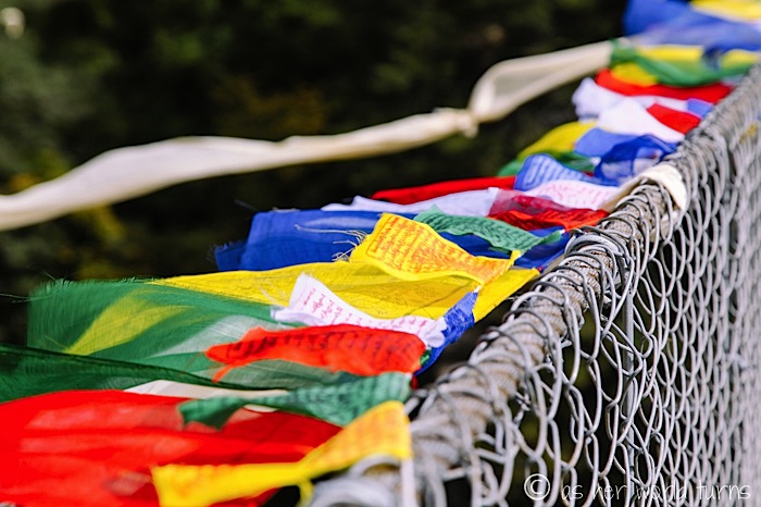
Now we’ve climbed up to the higher bridge. It takes me a good ten minutes to cross because I keep taking photos. I can’t resist the pull of those colorful prayer flags.
There’s the older bridge below:
Whew, we make it across just before a yak train comes along.
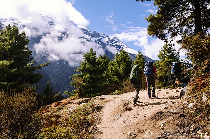
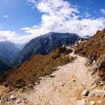
From here it’s about two hours straight uphill until we reach Namche Bazaar. For the first time on this trek, I put on my iPod and rock out to music as a distraction from the climb.
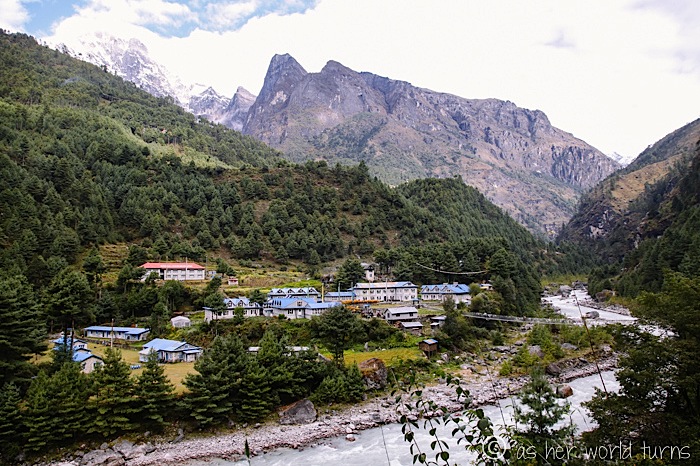
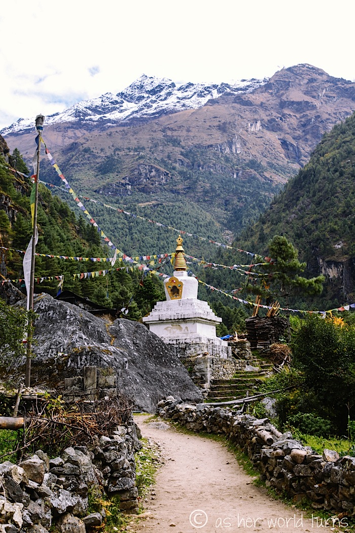
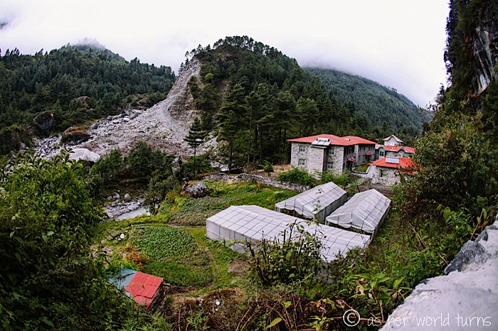
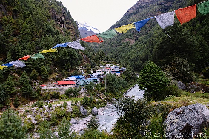
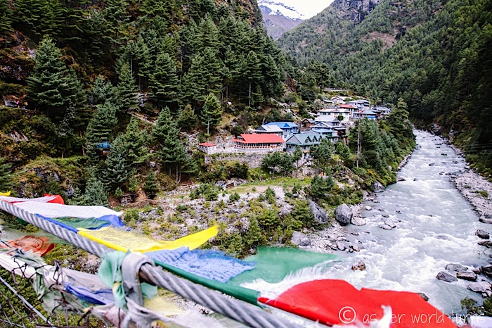
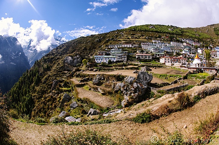
Allow me to introduce you to Namche Bazaar, my favorite village on the whole trek. Isn’t she pretty?
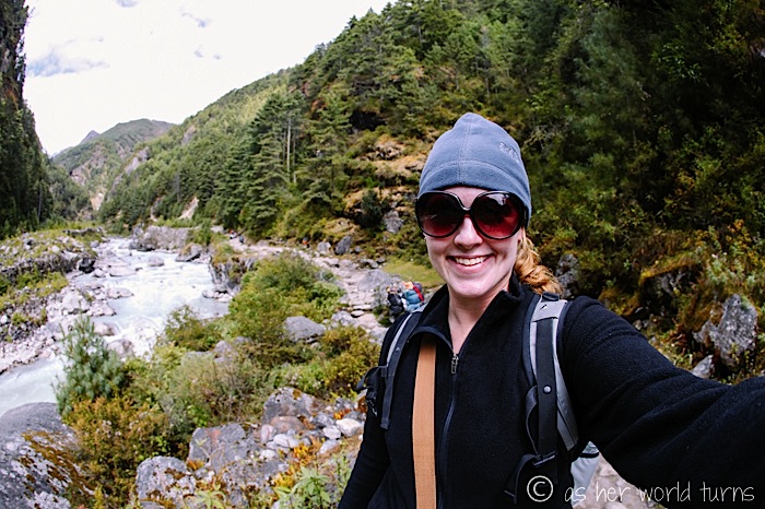
And here is your weary narrator.
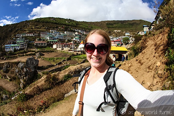
By now the heavy jacket and fleece have come off and I’m down to one layer. Temperatures shift drastically throughout the day so layers are crucial. I am thrilled with the sunshine!
We’ll spend two nights here. Tomorrow is a rest day, but we’ll actually hike about 4 hours to help my body acclimatize to the altitude.

I just ran into your blog. I love how you’re so detailed with your day to day itinerary. I’m doing this trip but only up to tengboche. Not interested in the headaches and altitude sickness. Besides you said the best days you had were up to that point.
Ok I’m terrified of the bridges. Does the highest one sways a lot of are they pretty sturdy?
I am so glad you like my blog posts! The route to Tengboche is incredible — you will love it, and you’ll still get outstanding mountain views but (most likely) without the altitude sickness. The bridges are not bad. They look rickety but are indeed sturdy. Good luck with your trip!!
Thank you for the reply. I can’t wait to do my trip. It won’t be till November so I am constantly thinking about it. I’m glad I have your blog to refer to from time to time. You have the best one that I’ve read regarding the Everest treks.
Boots, I did this same trip last year. Loved it. No, the bridges donor sway at all. But they bounce slightly upon each step. They are marvelously strong and were built. Sides are cyclone type fencing. I loved crossing those bridges. End of out trek, I injured my knee and my guide had to hire a Himmalayan horse to ride me off the trail. If you have any fear if heights the bridges will be scary.
Pls disregard the grammatical errors on my first comment. I type so fast and post without checking for errors 😉
Hi there, I was googling EBC suspension bridges and came across your blog. You have amazing photos!!! I’m quite scared of heights so was hoping a good preview of what I’m in for (have signed up to hike EBC in October 2018) would help ease any terror…err, I mean trepidation lol.
Your pictures are so amazing they make me think I can do this, thank you!!
cheers,
Holly (Sydney, Australia).
Thank you, Holly! The bridges aren’t as scary as they look — they are pretty stable when you are walking across them. Only a few are high (like the one in this post); the rest are closer to the ground. Good luck on your trip! It’s the best hiking I’ve ever done; the views are other-worldly!
10-12,000 feet is about average going over all 5 of the Hillary bridges. Secret is simply to gaze ahead, skim your eyes a couple of feet ahead. You can hold onto side of fence, but its rough and pointy. Once, my Parker sleeve got tangled and i got stuck, with a mule team behind me rapidly approaching! All part if the adventure. My guide untangled me and we high tailed it to other side. Keep calm crossing and know thousands of trekkers, mules and yak cross daily. Its that safe!
I just loved reading your pist. We are going May 2018. Looking sooooo forward to it.
Glad to hear it! Enjoy your trip!!
I should have been in better shape. The altitude never bothered me. What was my undoing was the rocks. The entire trail is 99% made up of Cathederal like steps and stones. Steep is one thing, but its constantly like being on sets of stairs…both up and down. Your knees take a beating. You’ll go up like 40 steps, a small break, make a turn and then 50 more and 49 more etc. Only break you get is stopping at the Tea houses or flat Hillary bridges. Altitude never effected me, but my knees were shot. Nontheless, no regrets. The people, take, monks, food in tea houses were brilliant. Trip if a lifetime. All of the guides and Sherpas were amazing. To see the mighty Himmalayan mountains were unreal. I’ve never seen mountains as majestic. It truly humbles YOU.
Hi Linda! Glad to hear you enjoyed seeing this beautiful area of the world. I hadn’t looked at this post in awhile and seeing your comment got me to look over all the photos again — this is probably the most beautiful place I’ve ever seen!
I am so appreciative of your blog documenting your hike to Namche. My boyfriend and I are headed there at the end of the month, but up to this point I’ve not googled much because I wanted to be surprised —- but I’ve been getting more and more curious as to what to expect from the suspension bridges and terrain, your pictures were beautiful and helpful, thank you!! Not being a heights person, I am a bit nervous crossing over the “big one” AND all the stairs, but am determined to be in the moment taking in all the surroundings — with my big dark sunglasses in tow!!! Thank you! 🙂
Thank you for the kind words! Have a WONDERFUL trip!! It will be way more impressive in person, the photos can’t do it justice. Good luck with the suspension bridges and terrain!
Are the suspension bridges manageable for people with a fear of heights?
Good question. I am not sure. I found them to be manageable, but someone with greater sensitivity to heights might have a really hard time with it. Some of the suspension bridges are lower to the ground, but a couple are high up. Sorry I don’t have a better answer for you!
I am terrified of heights (or falling) and I made it across the bridges. Deep breaths and look ahead. I missed out on the chance to gaze around because I knew I would lose my nerve, so slow & steady while looking straight ahead.
This is the trip of a lifetime – really enjoyed this blog, before & after my trip.
Thanks Carol! So glad you had a memorable trip, and made it across the bridges safely!