Last week I detailed camping at Lake Myvatn and the nearby Nature Baths, and today I’ll share photos of other highlights in this area. In my opinion, Myvatn is the best place to visit in northern Iceland — if you only have time to stop in one area in the north, let this be it. There is so much geothermal activity here.
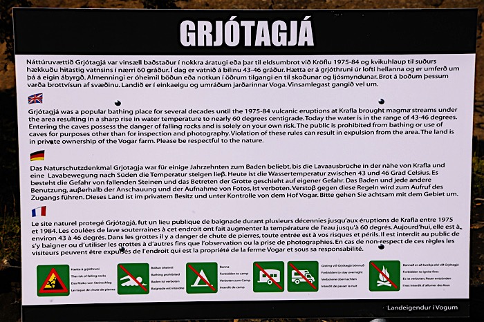
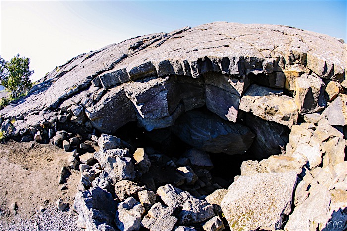
After packing up my campsite I drive to a place called Grjotagja just a few minutes away — it’s a natural hot spring located under a pile of rocks. It’s right near the Myvatn Nature Baths, but if you’re heading this way look for detailed directions on-line since it’s not well-marked from the main road. This site is technically on private property but visitors are welcome; there is a car park and signage once you arrive.
This is the unassuming entrance… there is no hint of the beauty that lies just a few meters below these rocks:
I scramble down the boulders…
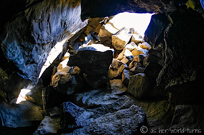
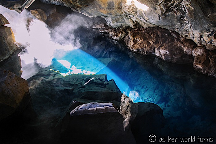
… and am greeted with this rather stunning sight:
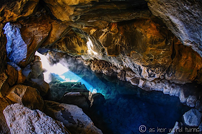
The reason I looked up this cave is because I hear it was used for a memorable sex scene on the HBO series Game of Thrones. I have not actually watched this show but am sure I would like it — I’ve been to enough of their filming locations! — and hope to someday find the time to watch it along with so many other series I intend to catch up on.
Right after I snap this photo a van of 20-somethings arrives and they all strip down to go swimming. Technically entering the water is forbidden, but there isn’t anyone around to enforce it.
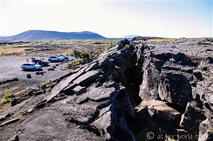
Here’s a view of Grjotagja from the top of this pile of rocks — that’s the car park on the left:
On the short drive back to the main road, I pause to photograph the steam rising from the ground — this is looking towards the direction of the Myvatn Nature Baths. There is clearly a large reservoir of intensely hot water just under the surface.
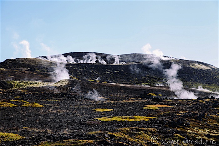
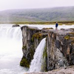
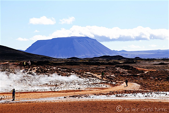
That is Hfverjall crater in the distance — visitors can walk the perimeter:
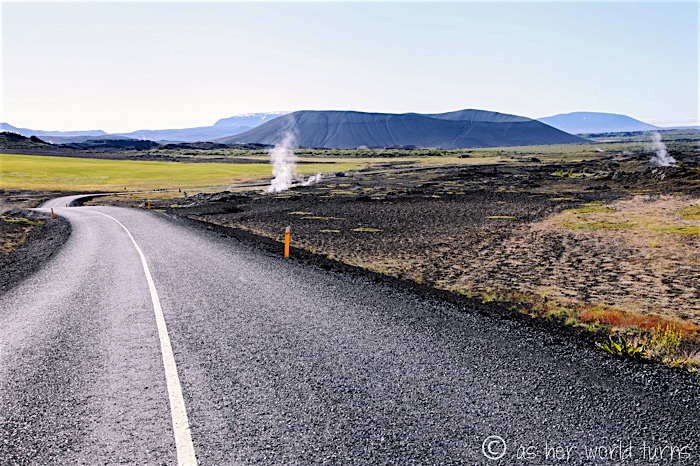
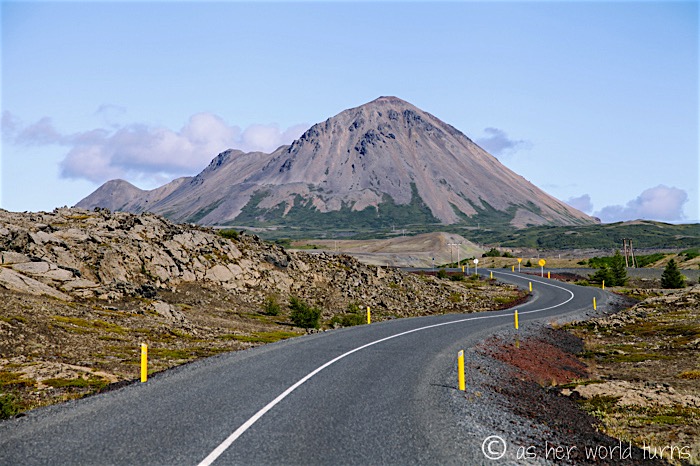
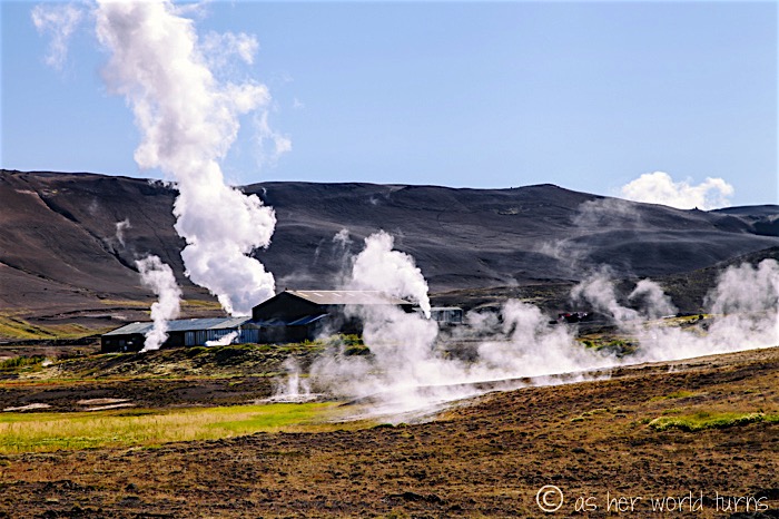
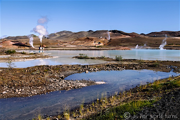
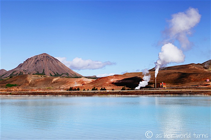
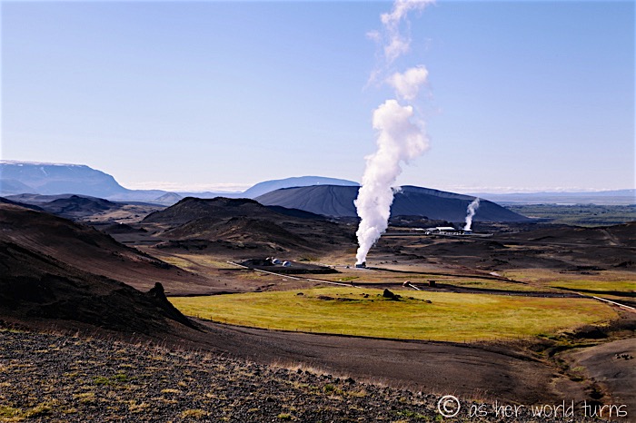
Back on the main road, I continue to see more evidence of geothermal activity. There are so many stacks of steam rising across the horizon. I think the structures you see in the next few photos are plants harnessing this heat and maybe converting it to energy?
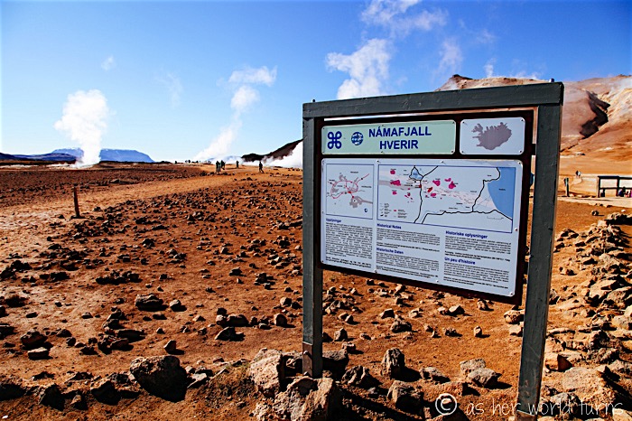
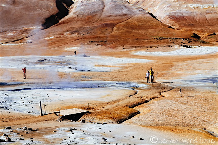
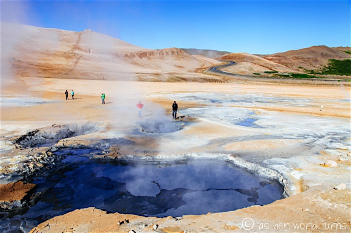
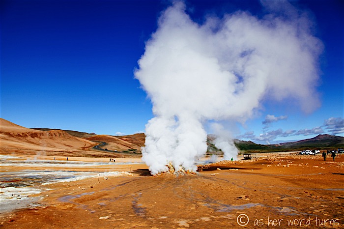
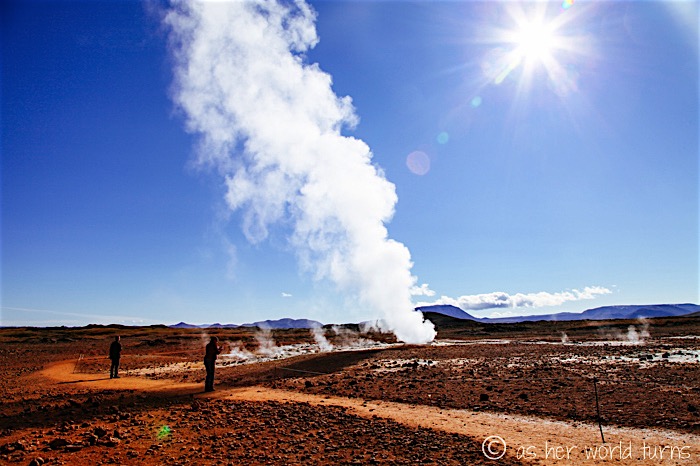
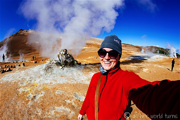
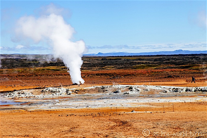
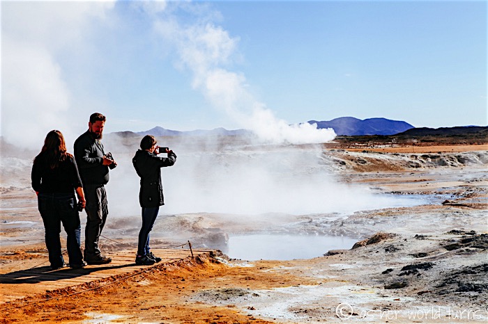
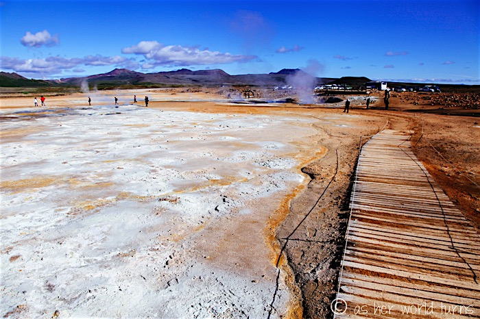
Just a short drive away from Lake Myvatn is Hverir geothermal field. This place is so impressive, and I almost missed it entirely because I hadn’t flagged it on my notes for today’s road trip — luckily it’s on the side of the road so I couldn’t miss it. I spend a good 45 minutes here walking around and photographing everything; it reminds me of Yellowstone or some of the active geothermal areas of New Zealand. The earth is literally bubbling all over this place. Watch where you step.
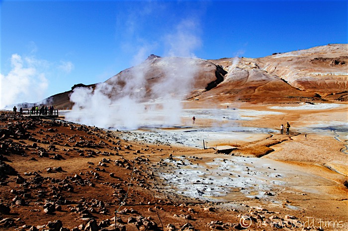
There’s a basic path looping around this area, but its not well marked in some places. At one point I realize the path has disappeared and I get nervous about falling into hot mud.
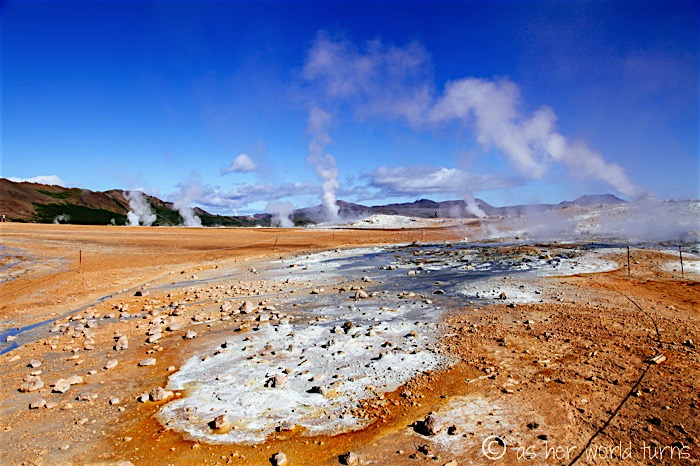
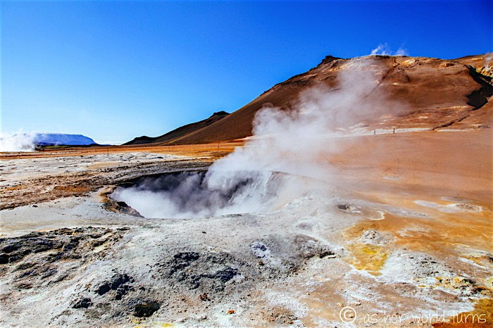
I believe this is called a steaming fumarole: “an opening in the planet’s crust, often in the neighborhood of volcanoes, which emits steam and gases such as carbon dioxide, hydrogen chloride, and hydrogen sulfide.”
It smells really bad. I cover my mouth to limit my exposure to the gases but it’s hard to avoid them. I recall being in Hawaii at Volcanoes National Park a few years ago and there were signs indicating that the air near these fumaroles is harmful; pregnant women are advised to stay away. No such signage here! Exercise caution as the fumes are overpowering. The scenery is undeniably awesome, however.
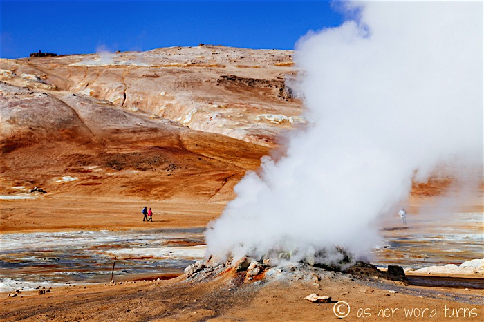
Volcanic evidence in the distance:
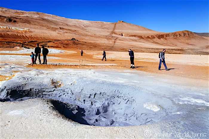
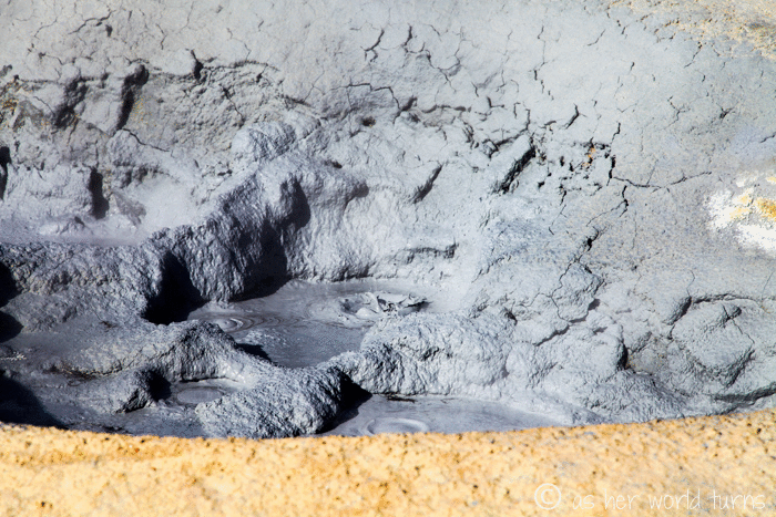
A bubbling mud pit:
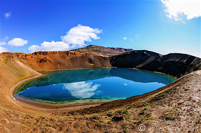
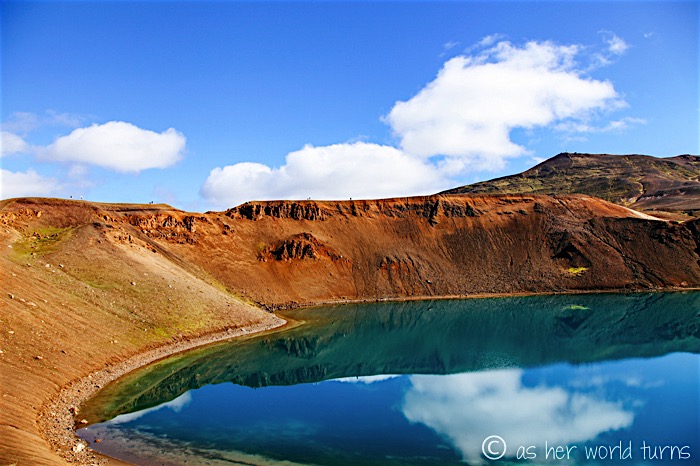
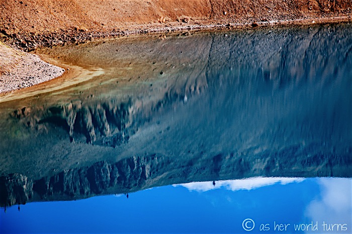
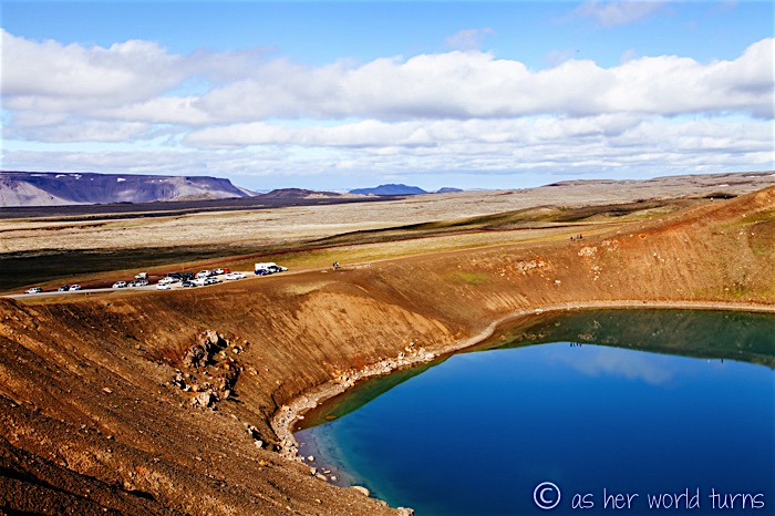
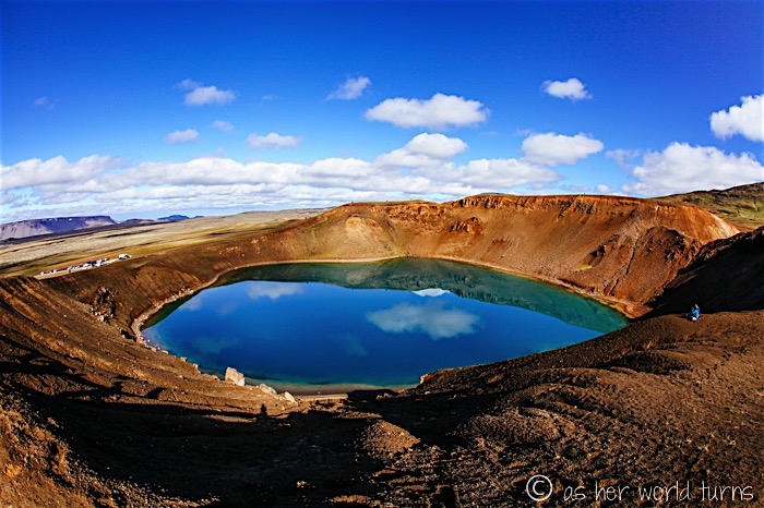
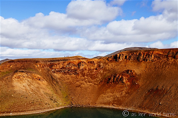
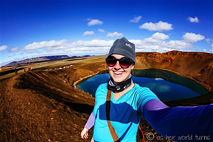
Just across from Hverir is a road that leads uphill several kilometers to Krafla Viti Crater. It’s easy to get to and very much worth a stop — there is a carpark right next to the crater lake, which is very muddy on the day I visit.
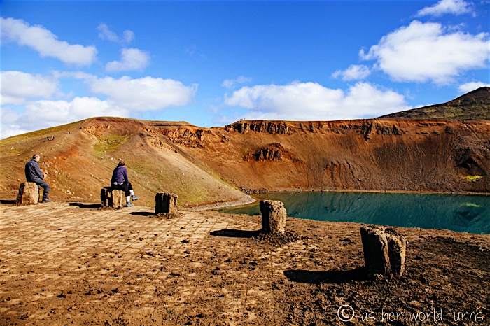
There’s a walking path around the entire perimeter of this crater lake:
That wraps up the (literal) tourism hot spots in the Myvatn area. These sites are really impressive and take me all morning to visit. Next up: the best driving day of my Iceland road trip along Route 94 to the puffin colony Borgarfjodur Eystri. Can’t wait to show you the landscapes I encounter up there. More tomorrow!