I am thrilled to share photos from my hike to Everest Base Camp. At some point I’ll detail the trek more specifically, but for now my aim is to give you an overview of the experience.
Let me start by saying this — I did ZERO to prep for this trip:
- I did not train because I was busy traveling these past few months
- I did not book a tour before arriving in Kathmandu, even though it was October (high season)
- And I did not bring any trekking equipment (not even proper hiking boots… only sneakers)
If going “cold turkey” means to abruptly stop doing something, then I did this trek “hot turkey” because I abruptly started Everest with no training. Yet I still managed to successfully hike to Base Camp! Let this serve as encouragement for anyone at home wondering if they can do something of this magnitude. If Erica can do it with zero prep, you can TOTALLY do it.
Flashback to four weeks ago.
I consider going on an official tour with G Adventures or Intrepid, two companies who fit my style of travel. Their tours last 15 days and cost around $1,400 USD depending on the exact departure date. But I quickly realize it will be far cheaper to simply book it on my own upon arrival in Kathmandu. I credit the travel blog The Planet D and their comprehensive posts about Everest Base Camp for motivating me to arrange it on my own.
First things first: I have to book my flight to Lukla, which is the gateway to Everest Base Camp. But I arrive in Kathmandu on a holiday and discover it’s been raining for several days, so all flights are backed up. Yikes. I begin to talk myself into doing the Annapurna Circuit instead of Everest.
Two days later I have dinner with Aoife and Ger, an Irish couple I met in the Galapagos nearly 4 years ago. At that time they were just beginning their own RTW adventure. Now they’re in Nepal on their honeymoon, and our time in Kathmandu just happens to overlap! It’s a treat to see them and compare notes. They suggest I book my flights through the owner at ACME Guesthouse, who has been of great assistance in planning their own travel. The next day I stop in and BAM — I’m on a 9am flight to Lukla departing the next morning. The airfare prices are fixed: according to signs at the airport, the round-trip flight costs $324 for foreigners, $160 for citizens of India, and $80 for local Nepalese.
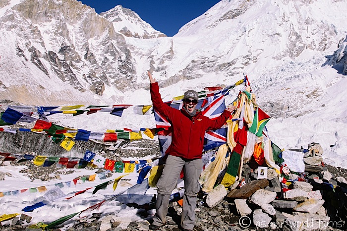
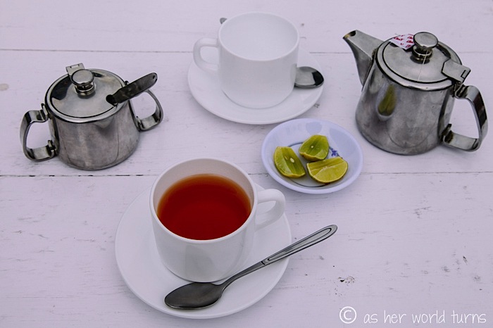
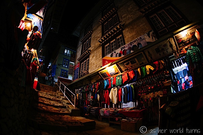
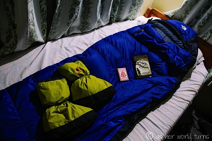
So… now I need gear. Luckily for me, Thamel (the main tourist neighborhood in Kathmandu) is lined with trekking shops full of all supplies you could ever need for an Everest Base Camp hike. Two hours and $130 USD later, I’ve purchased a North Face down sleeping bag, rainproof winter jacket, thermals, new trekking pants, wool socks, a hat, some serious gloves, and a bag to carry it all in. A quick trip to the grocery store yields some meds (water purification tablets, altitude sickness pills, cough drops, Vic’s Vapor Rub, Vaseline)… and food (granola bars, CHOCOLATE, Tang to flavor water)… and supplies (toilet paper, baby wipes, and a quick-drying towel). I also pick up a Nepal Lonely Planet guide at one of many bookstores in town.
Here’s what it looks like before I pack (and add some more of my own clothes):
My plan is to fly to Lukla and hire a guide/porter there — one dude who will both carry my bag AND guide my trek. There are lots of qualified men waiting at the Lukla airport and this way I can meet a few in person before deciding. If I go with an agency, I’m assigned someone at random (plus it’s more expensive because the agency takes a cut of the guide’s daily salary).
But the night before my departure I have a freak-out moment — I need a TIMS hiking permit ($20), and the only way to get one is through a tourism center in Kathmandu (which closed at 5pm) or through any trekking agency. The agencies will only sell it to you if you book a tour guide with them. It may be possible to get a TIMS card in Lukla but no one will give me a straight answer. After going back-and-forth, I finally decide to just book my guide/porter with an agency at the rate of $22 per day (a total of $264 for 12 days). He’ll meet me at the airport. And success — I have my TIMS card!
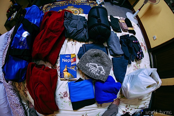
The next morning I wait at the airport for what feels like an eternity. I’m flying on Tara Air and the check-in process is nothing short of chaotic.
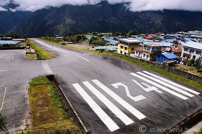
But eventually my number is called and we board. Forty minutes after take-off, we are landing at one of the most dangerous airports in the world.
The Lukla runway is 430 meters long… but the tiny planes that land here require a runway of 900 meters. Now I went to a college that did not emphasize math, but I don’t think those numbers work out to a successful landing.
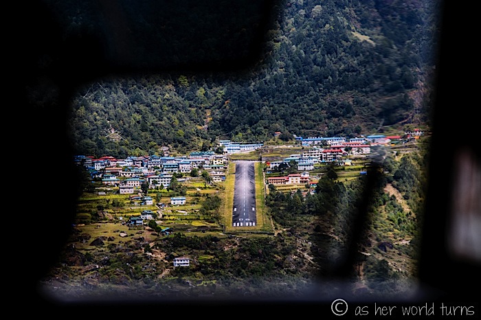
It turns out the engineers who designed this runway employ gravity to help stop the plane. One end of the runway is 60 meters higher than the other end, so the plane glides uphill and loses steam as the pilot furiously slams on the brakes.
Here’s the video. I’m sitting directly behind the pilot.
I meet my guide/porter, Mingma, at the Paradise Lodge just across from the airport. I don’t find out until later that he’s only a placeholder until his older brother (also called Mingma) returns in a few days from another trek and takes over. The younger Mingma is very kind but his English is lacking. Luckily the older Mingma will fill in the blanks in a few days about some of the cultural stuff we encounter on the trek.
Let’s skip ahead and talk about highlights of the trail!
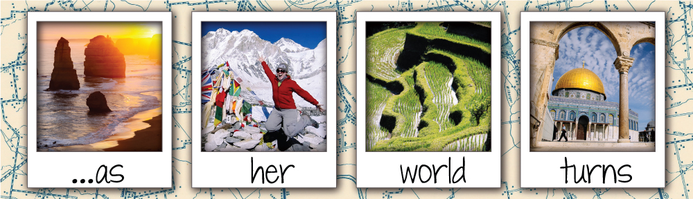
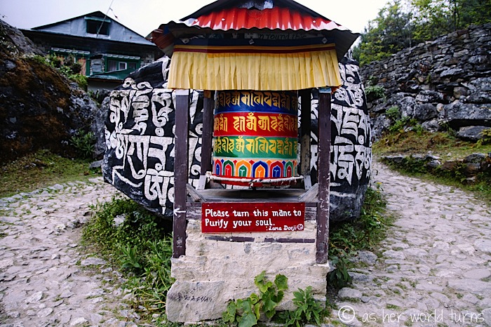
This is a prayer wheel and they are everywhere. Turn it as you pass and it dings like a bell; as the sign reads below, it will purify your soul.
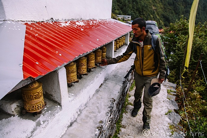
This is the younger Mingma, purifying his soul:
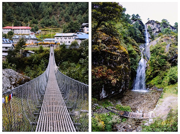
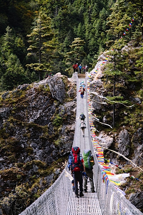
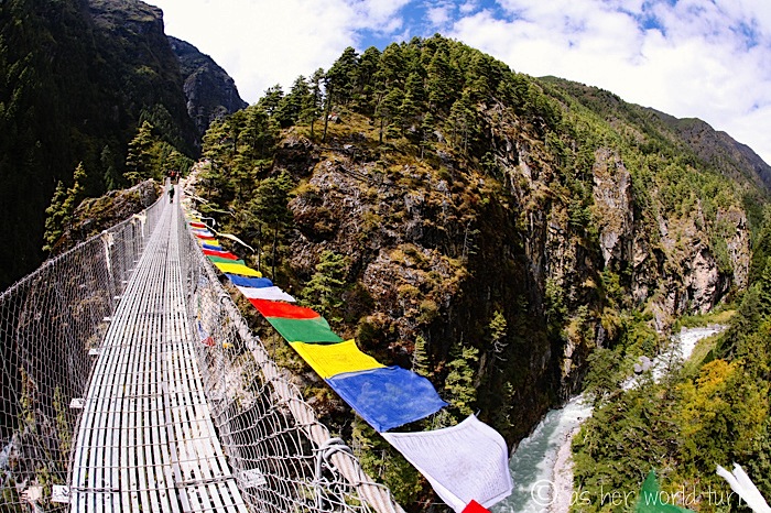
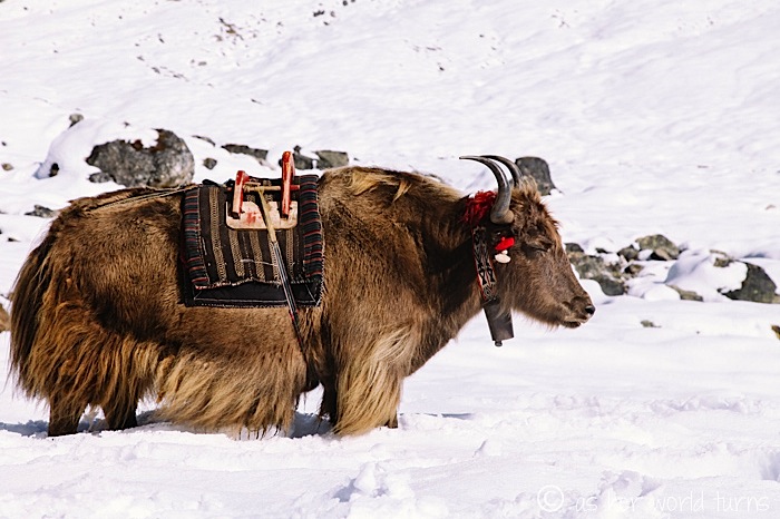
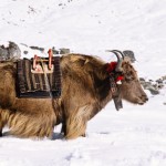
There are suspension bridges throughout the trail. They are not as scary as they look! The most annoying part is waiting for the yak train (or donkey train) to cross, as the animals tote supplies up the mountain. There are no roads so everything must be carried up.
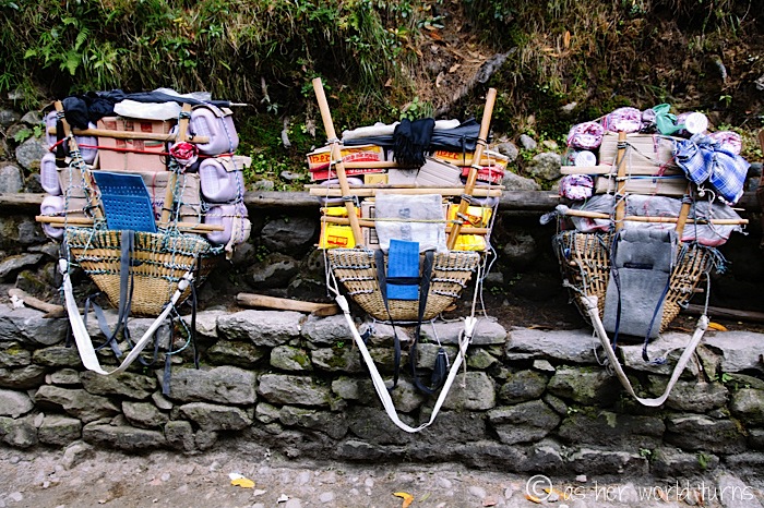
Yaks and donkeys aren’t the only means of transport — we frequently encounter sherpas bearing enormous loads upon their backs.
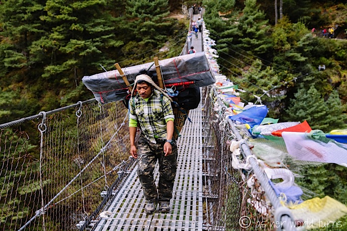
Here’s an example of what they carry uphill. The white strap goes across their forehead to help balance the weight.
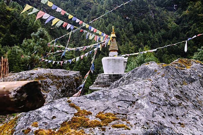
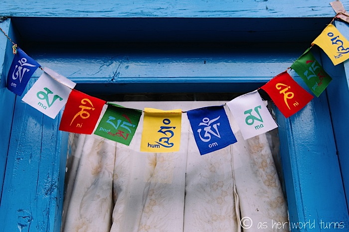
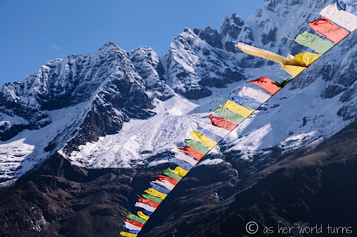
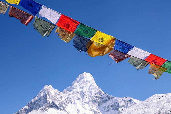
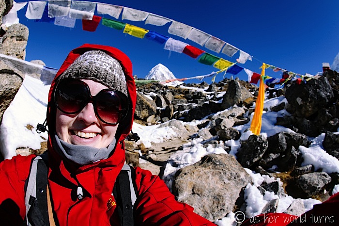
Here’s the first of MANY prayer flags decorating the trail. The colors make me happy and provide a tiny boost of energy while I huff and puff my way uphill.
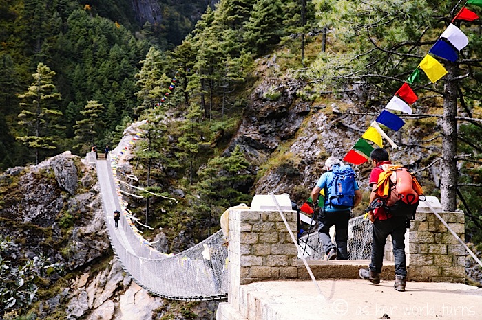
This is my favorite suspension bridge — it’s very high up because it has replaced an older bridge hanging below it.
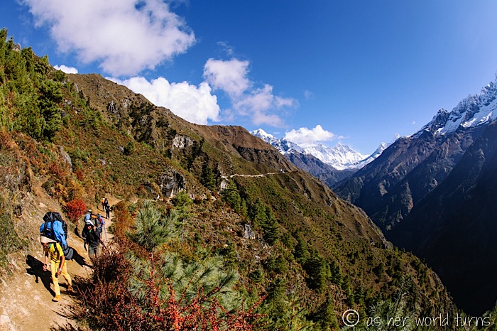
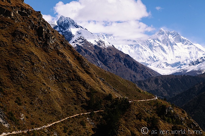
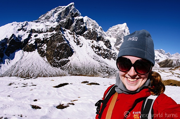
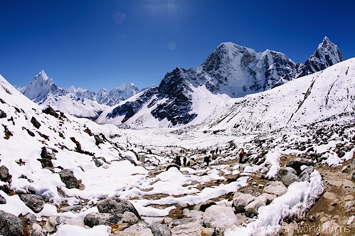
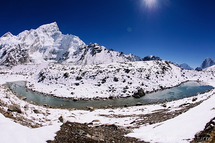
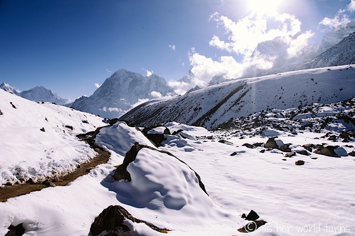
These views on day 2 are just a taste of the beauty to come.
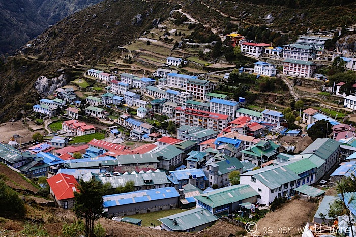
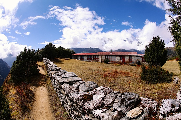
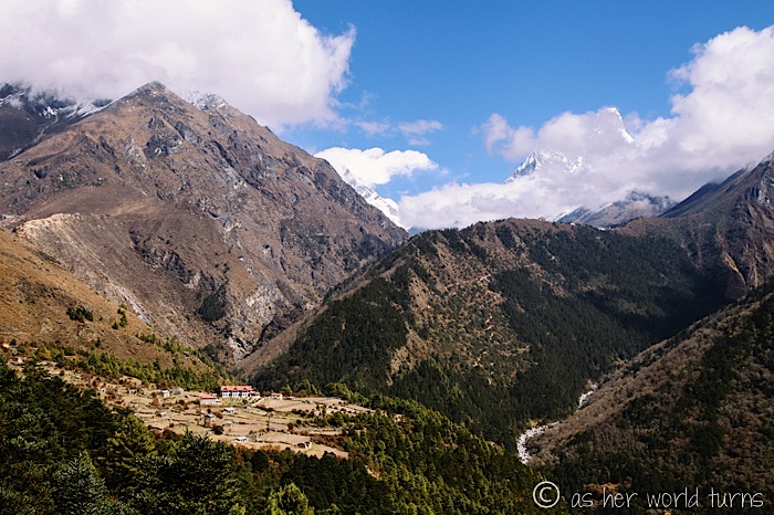
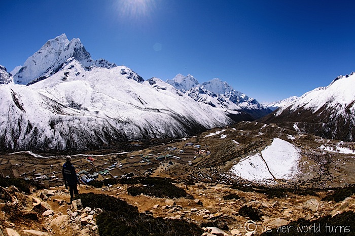
We spend an acclimatization day in Namche Bazaar, which is the largest village on the trek (next to Lukla). It’s a delightful place to stay for two nights and a good spot to pick up any final supplies you might need… like Oreos. Or down booties. Or a deck of cards.
We spend every night sleeping in tea houses, which are very (very) simple structures. They don’t provide much relief from the cold, but it’s better than sleeping in a tent. I never pay more than $3 per night for my own room. There’s usually a toilet down the hall.
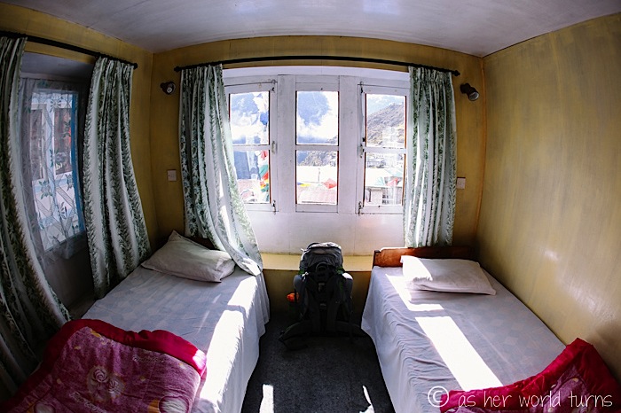
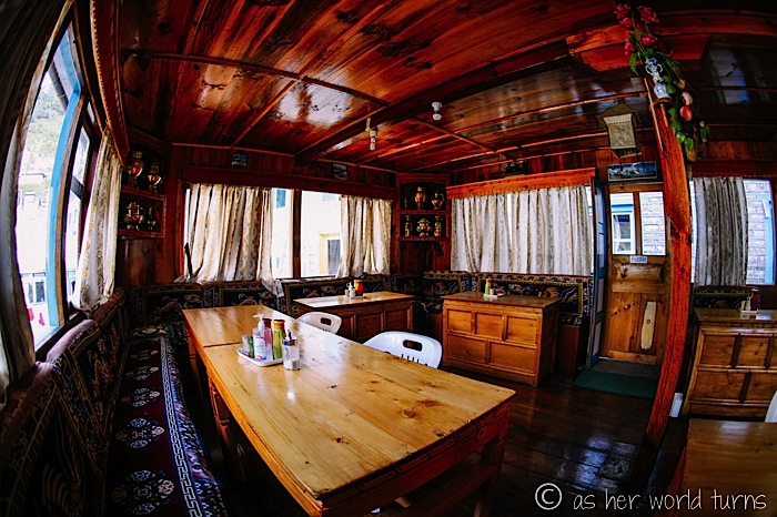
While not trekking, most of our waking hours are spent inside the tea house dining rooms because they have HEAT.
The tea houses stipulate that you must eat in their restaurants; if you choose to eat elsewhere the room charge jumps up to around $10 per night.
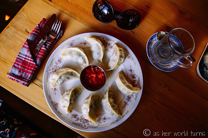
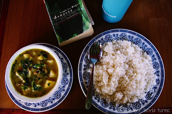
These are momos, or Nepalese dumplings. They are SO FREAKING GOOD. My favorite are the meat-steamed kind pictured below, but I was warned not to eat meat above Namche Baazar because they carry it up and it’s not properly refrigerated. Turns out the veggie and (canned) tuna momos aren’t nearly as good as the meat ones.
And I’ve never drank so much tea in my life! But the warmth factor makes it hard to resist. I also drink mugs and mugs of “hot lemon,” which is essentially a sugary powder mix added to hot water. It’s delicious.
There are two scheduled acclimatization days (one in Namche on Day 3 and the other in Dingboche on Day 6) but they are not rest days — we’re encouraged to do a short hike in each place (around 3-4 hours) to give our bodies a better chance to adjust to the elevation.
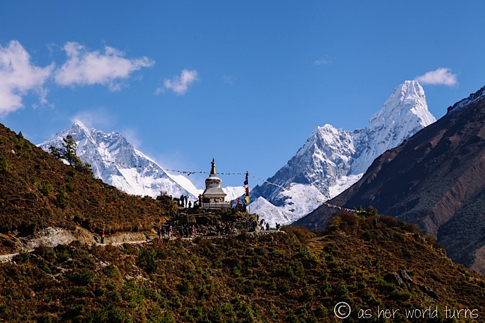
In Namche we hike to the Everest View Hotel & Restaurant, which (as the name suggests) offers views of the world’s tallest peak. But by the time we arrive it’s too cloudy to see anything. No matter — the views on this day are outstanding in every other direction.
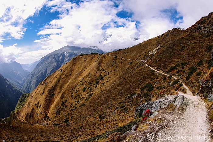
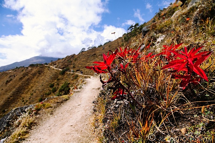
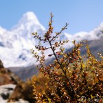
While the trail is very crowded in October — about 10,000 people hike Everest Base Camp this month, compared to about 3,000 in September and 5,000 in November — the benefit is mostly clear weather and beautiful fall temperatures. And fall colors! I admire the red and yellow flowers dotting the trail.
On the second night in Namche I pick up a few final items for the trail.
These down booties prove to be a clutch purchase — they keep my feet toasty every night.
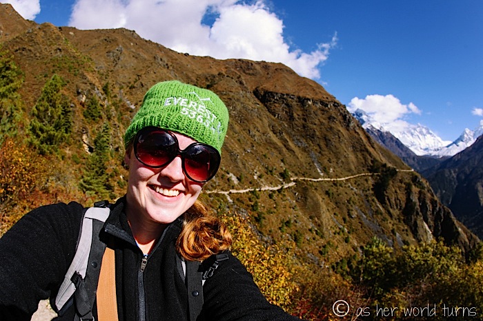
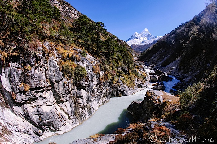
My favorite day of the whole trek is day 4, hiking from Namche to Tengboche. I take more photos this day than any other.
At this point I’m ready to declare the Himalayas the absolute highlight of my RTW trip… but little do I realize what the next few days hold.
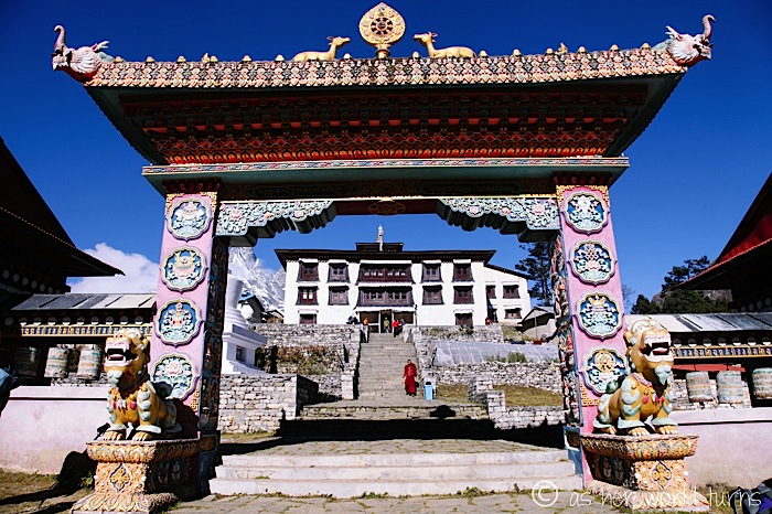
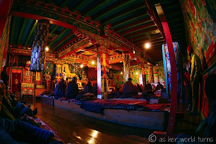
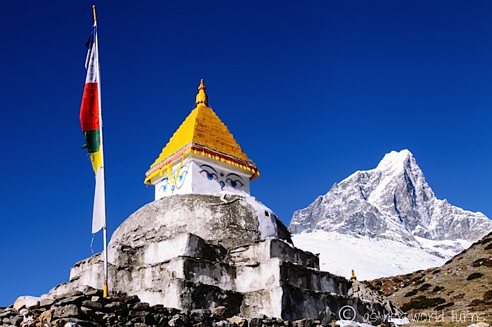
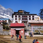
This is the Tengboche Monastery. All of the rooms in Tengboche are full so we stay about 20 minutes further downhill in Debuche. This is annoying because the monks chant daily at 6:30am so we have a very early uphill climb the next morning, back-tracking to Tengboche. But it’s worth it to witness the monks in action.
“Monks in action” just sounds wrong.
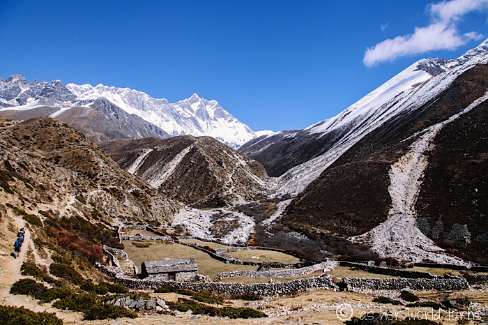
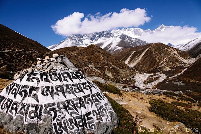
The stellar views continue on day 5 to Dingboche.
Day 6 is our rest day in Dingboche. We hike up to Nangkar Tshang and, for the first time, I realize how difficult the altitude makes breathing and walking. This is a hard day and we’ve only hiked for about 3 hours.
And you can see the snow line below. We have that to look forward to tomorrow.
Around this time my appetite starts to disappear. This is a veggie curry dish and after this meal I only eat Sherpa Stew (simple veggie stew with pasta) and Tibetan bread with honey for breakfast (which is like fried dough).
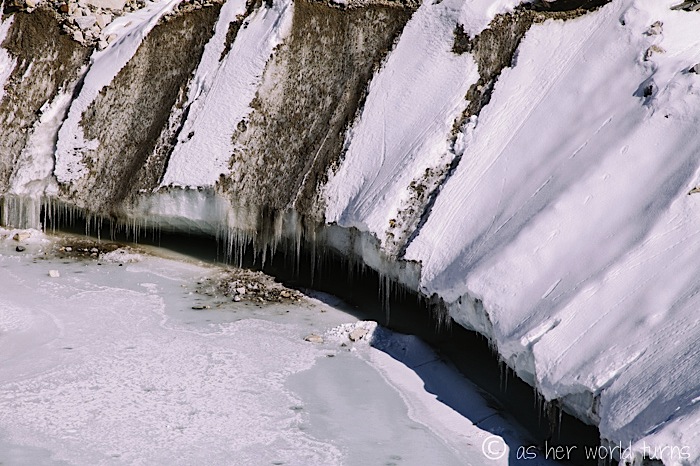
Days 7, 8, and 9 nearly kill me. It’s the hardest stretch of the whole trek. We trudge through mud, snow, and ice.
In need of more oxygen, my body sleeps restlessly all three nights despite a dose of Ibprofin PM. I have little to no appetite. And I am constantly freezing.
But here’s a smile. For the views.
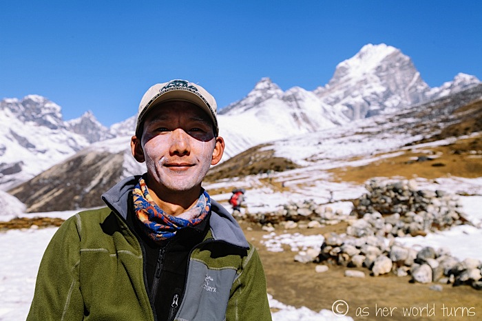
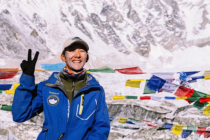
And here’s the older Mingma, who officially took over for his brother in Dingboche. He’s wearing lots of sunscreen.
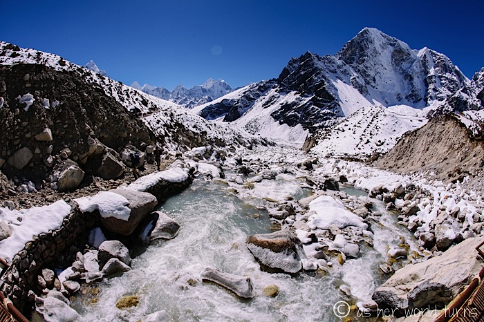
A wintery shot from Day 7 en route to Lobuche:
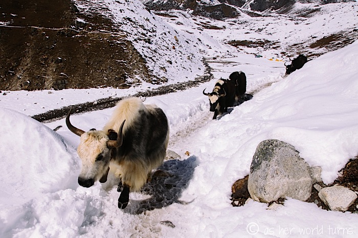
A word about the yak train… they pass by quite often, and trail etiquette is to move uphill and allow them to pass. But sometimes it stinks (literally… they poop everywhere) to let them pass you because then you’re stuck behind the yaks. So despite my slow-as-a-snail pace, I endeavor to speed up when I hear them coming behind me (they wear bells around their necks to alert trekkers of their arrival).
They are beautiful creatures though:
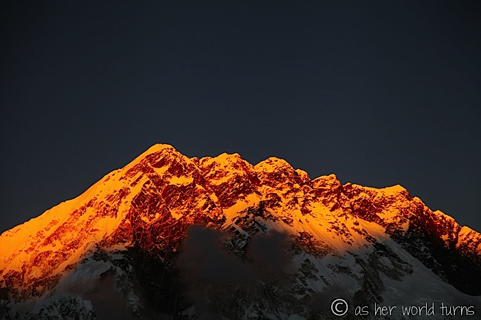
A shot of sunset in Lobuche at the end of Day 7.
Okay, now it’s Day 8 and it promises to be a tough one. It takes me 3.5 hours to hike from Lobuche to Gorek Shep, then about 6 hours round-trip to Everest Base Camp and back to Gorek Shep. Which adds up to nearly 10 hours of hiking today.
A shot from the start of our 6-hour return trip to EBC:
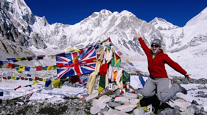
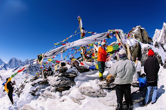
…AND HERE WE ARE!!! Everest Base Camp, at long last.
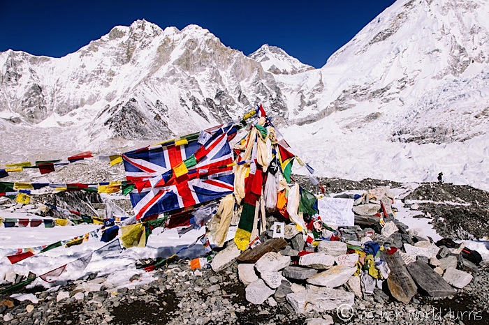
It’s really just a pile of stones and prayer flags where trekkers can pose for photos. My guide says the actual Base Camp is about 30 minutes further… perhaps they keep this spot separate so that trekkers don’t disturb the “real” climbers?
I am nearly a zombie by the time we get back to Gorek Shep at sunset. The only thing that sounds remotely palatable is Pringles so I eat half a can for dinner (not even the whole can… after nearly 10 hours of hiking today!). I settle in for another cold and fitful night of “sleep.”
The next morning we trek to Kala Pattar. This is the best place from which to view Mt. Everest, since you can’t actually see the Everest peak at Base Camp. While the EBC trail is relatively flat, Kala Pattar is straight uphill, requiring nimble navigation over boulders of snow and ice. It’s supposed to take 3 hours round-trip to complete… but it takes me 4.5. I am so slow but refuse to turn around when I’m this close to completing both Everest Base Camp AND Kala Pattar.
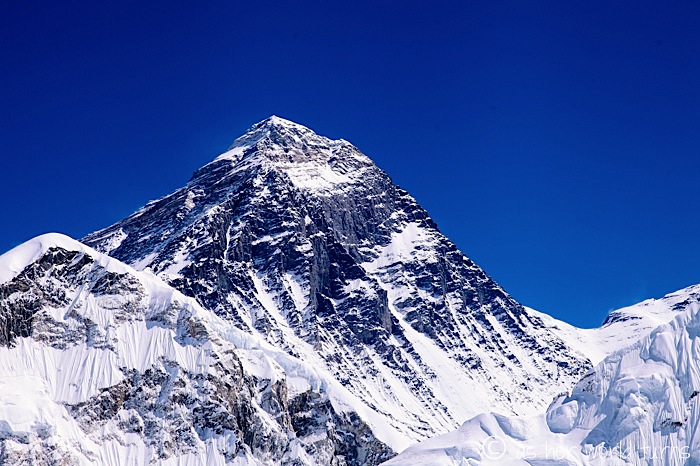
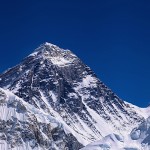
Here’s a view from the top; Everest is the second peak from the right:
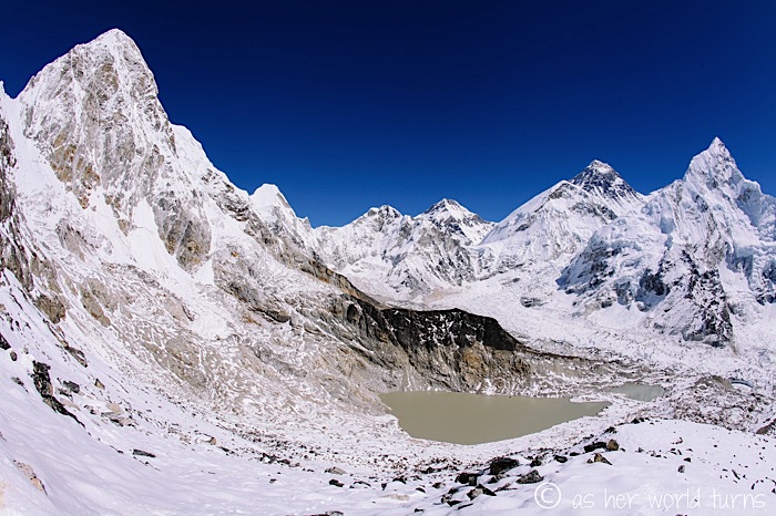
And here she is, in all her glory: the tallest peak on Earth.
After that we turn around and trek several hours back to Lobuche for one final, cold, uncomfortable night at this elevation.
Then days 10, 11, and 12 are glorious — we cover in three days what it took nine to climb uphill. With every step down we take in more and more oxygen and my body is so happy. And as soon as we cross below the snow line everything becomes more pleasant.
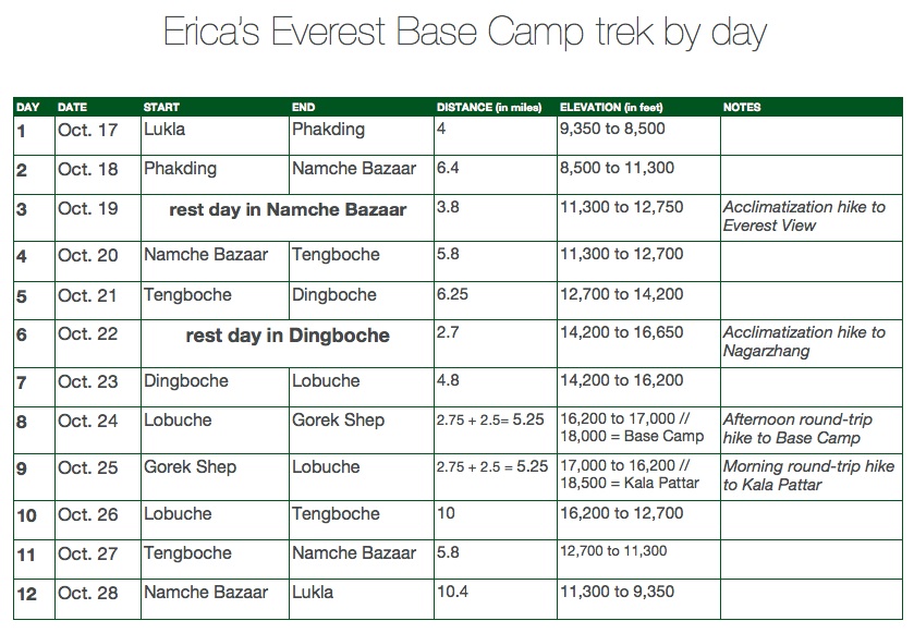
Here’s the day-by-day breakdown of my trek. I hiked just over 70 miles…!
Whew! A gold star for you if you’ve read this far. I have so many more photos to share with you when the time comes, but for now I’m thrilled to have showed off the highlights.

This is amazing. Well done. I can’t wait to see the rest!
How does hiking Everest compare to the Burbank mountains 😛
Thanks Buddy! Ha, remember that Burbank hike when I was prepping for Mt. Whitney and going SO SLOW in the heat? That was about the pace I went during the hard parts of Everest 🙂
Stunning and exhilarating! This is absolutely wonderful – thanks for sharing the trek.
Thank you Erica! It’s my pleasure to share these. And humbling to bear witness to the beauty up in those mountains.
This is insane and makes me want to hike it too! Such great shots and explanations. It looks so beautiful (and painful) and it’s wild to think you’re seeing things most of the population will only ever see in photos. Lets go back and climb it together!
Aww thanks B! I thought of you often; you would love it up there (minus the suspension bridges). And I also thought about how few people get to see this and how lucky I was to be up there. Very special indeed!
Such great pictures. 🙂
Thank you Andy! Nature did all the work; I showed up 🙂
So glad u had a safe flight and a great hike.
Thank you Aoife! It was a joy to see you & Ger in Nepal!
How different from down under !!
Yes, could not be more different! Might as well call Nepal “up over” instead of “down under” 🙂
Wow! This sounds like my hike down into the Grand Canyon. No prep and I was the slowest getting out of the canyon. So I can imagine how tough that trek to base camp can be. You must be so proud to have done it! Love your photos!
Thank you Maritza!! It’s so neat that you’ve done the Grand Canyon hike! I’ve visited but only done short hikes near the rim. Would love to get down to Phantom Ranch one day! Did you enjoy it?
Were you hiking solo with the Sherpa? Or was there a group of trekkers/sherpas? You are my hero. You are so brave. I can’t wait to hear more stories in person soon!
I hiked with the Sherpa. He’s a lot faster than me (even when he carried my backpack!) so sometimes he’d go ahead and then wait for me at the next rest stop. But I was never alone because so many people hike the trail. In fact, I often wished I picked a less popular month to go because some solitude would have been nice! Regardless, the scenery was breathtaking.
I went for the Poon Hill trek back in May of this year. It was an absolutely wonderful experience, even though I was cursing my decision to trek mountains for a ‘holiday’ when I was panting up the N-th mountain. i doubted whether vegetarian food would be able to provide me with enough energy during the trek, but i was never hungry and i loved all the meals i had in the teahouses. i also drank lots of tea! i have to applaud you for bringing your gear up and taking so many pictures. i was too occupied with trying to finish the trek for each day to care about capturing shots. Nepal is a magical place. I was reminded that we really do not need a lot to be happy 🙂 made me more grateful for the things i do have.
Thanks for your comment Jay! Nepal is really special. And even when I was frustrated with the added weight of my camera and lenses, I’m so glad I documented the trip. I’ll have to go back and try the Poon Hill trek someday! Lots of great hikes there. Thanks for reading!
Hey Erica,
Awesome post, and amazing pictures! What camera do you use?
Also, I am looking to do the same as I plan to travel for a year (and quit my job…) – how did you find the altitude sickness? Did you take any Diamox? How did you find the breathing?
You were just the inspiration I needed!
Hi Thomas!
I use a Canon Mark D II (more info about my camera equipment here – http://www.asherworldturns.com/my-photography/).
RE: Kilimanjaro, I didn’t find the altitude that bad. I did take Diamox, but my sister could not due to a sulfa drug allergy, and she did okay with just Ibprofin.
Good luck on your future travels! Planning is a fun stage; there are so many options, and no wrong way to do it!
Although your story is now a few years old, I am still awed and bowled over; your pictures are amazing I could almost imagine being there. Will be heading back to Nepal for EBC Gokyo in early spring next year – thank you for sharing your experience :)))
Thank you! Good luck with your trek! I hope to get back myself someday; it’s probably the most impressive place I’ve ever been. I’m glad you liked the blog post!
I am booked, but now freaking out after watching videos of so many people saying they were miserable and getting air lifted out. I hike regularly and have done the W in Patagonia but would not describe myself as althletic. Would you say just move past the fear and do it anyway? Thanks!
I think you’ll be fine on Everest Base Camp. The only danger is altitude sickness, which can affect even the most athletic hikers, so just take it easy and don’t push your body too hard. The terrain is not that difficult. The only altitude-related factors for me were a constant dull headache, not much appetite, and trouble sleeping — but that was only for a few days leading up to base camp. As soon as I started descending, everything went back to normal. I took ibprofin regularly for the entire trek which was a real help. Good luck!!!
Brilliant photos. Thanks for sharing them and for your honest and candid account of your trek. Looking forward to seeing more when you get the time. It’s my turn for EBC next month and hoping to see the scenery in as much splendour as you did. Regards, Raymond (Northern Ireland)
Thank you, Raymond. Good luck on your EBC trek next month!