At 14,505 feet in elevation, Mt. Whitney is the tallest mountain in the contiguous United States. That sounds like a pretty daunting hike, right? I first heard about Mt. Whitney through a co-worker and a friend who (separately) hiked this mountain and lived to tell the tale. Never did I think it would be something I’d accomplish with my own two feet, but then I stumbled upon the website of a friend-of-a-friend: Casey, the Modern Hiker, who chronicled his Mt. Whitney adventure with gorgeous photos, frank facts, and idyllic prose. And suddenly I was hooked… how could I plan a Mt. Whitney experience of my own?
It does take some time and energy to figure out the red tape of Mt. Whitney. In an effort to protect the environment and cut down on trail traffic, hiking permits are required. There is a lottery each year on February 15th that doles out permits for May through November. They only issue 100 day hiker permits and sixty overnight permits for each day, so space is limited. All permits are $15 per person. Weekend permits are extremely sought after, but if you put in for a mid-week date, the lottery is more likely to work out in your favor.
As luck would have it, my sister knew a group of friends who had secured permits for late August and had space for a few more people to join them. I eagerly accepted, then did a rigorous “practice hike” on Mt. Baldy and promptly lost all confidence I could climb Mt. Whitney, but rallied and decided to attempt it anyways. When it came time to pack, I am embarrassed to admit I tossed in a book just in case I couldn’t hack it and had to kill time on the trail waiting for others to summit. (Spoiler alert: I did not need the book!)
Along with my sister and friend Lindsey, we drove up the day before our hike to begin the acclimatization process and get a good night’s sleep. This proved to be an excellent decision, as I’m not sure how we would have driven nearly four hours to the Mt. Whitney portal and THEN hiked for seven hours, all in the same day. So after checking out the cute town of Lone Pine, we drove forty minutes to Horseshoe Meadows (around 10,000 feet elevation) to set up camp for the night and give our lungs some practice operating on less oxygen.
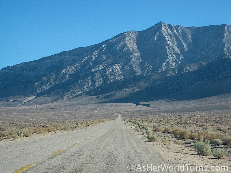
The drive to Horseshoe Meadows is stunning.

This photo looks down on the town of Lone Pine, a little oasis in the hot California desert.

Our campsite is a mere $6 for the night. Score! But we have to be very careful to remove ANYTHING with a scent from our car and store it in the nearby bear lockers so that the little furry dudes won’t attempt to break into our vehicle.


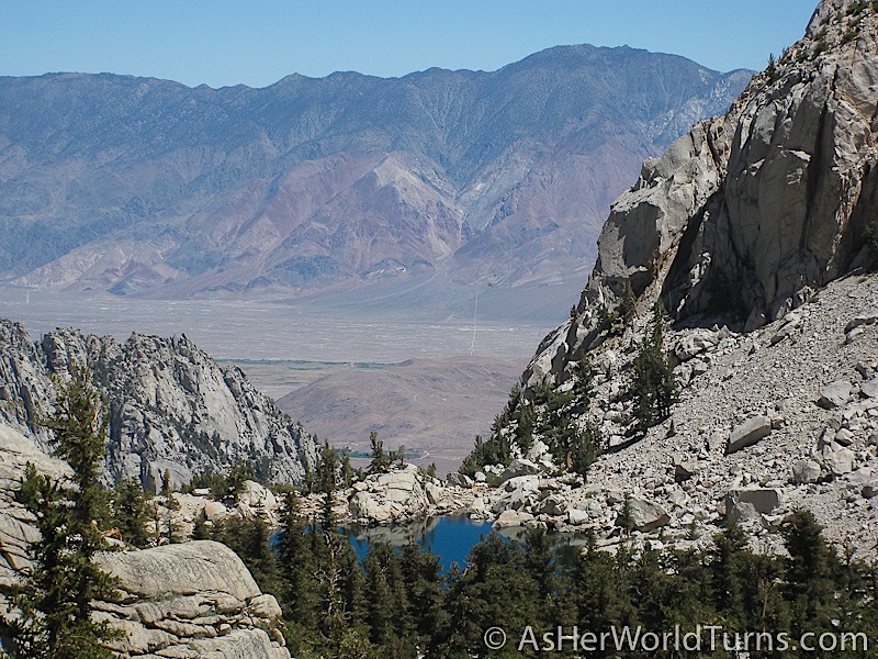
We wake up at 5am to break down our campsite in the dark. By the time we hit the road for our 45-minute ride to the Mt. Whitney portal, the sun is up and we are greeted with stunning views of the valley below.


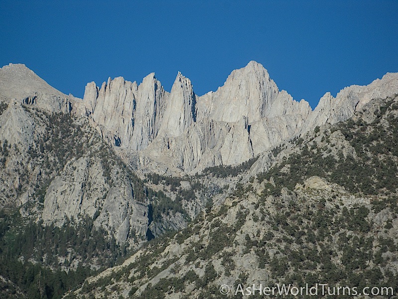
And here is our first glimpse at the peaks of Mt. Whitney. Hard to believe that in 24 short hours we’ll be at the very top.

At the Mt. Whitney portal store, the three of us indulge in the largest pancake I’ve ever seen.

We barely put a dent in the pancake before it’s time to go, but it feels good to have some warm food in our bellies before starting our massive hike. Today’s plan is to hike six miles at a slow and steady pace. If we get altitude sickness it would put the kibosh on our chances of reaching the summit with the rest of the group, so we make a point to stay hydrated and rest frequently. We also take it easy because the next day we will hike sixteen miles (you read that correctly) and we don’t want to burn out too soon.
Here’s my sister and I at the trail head:

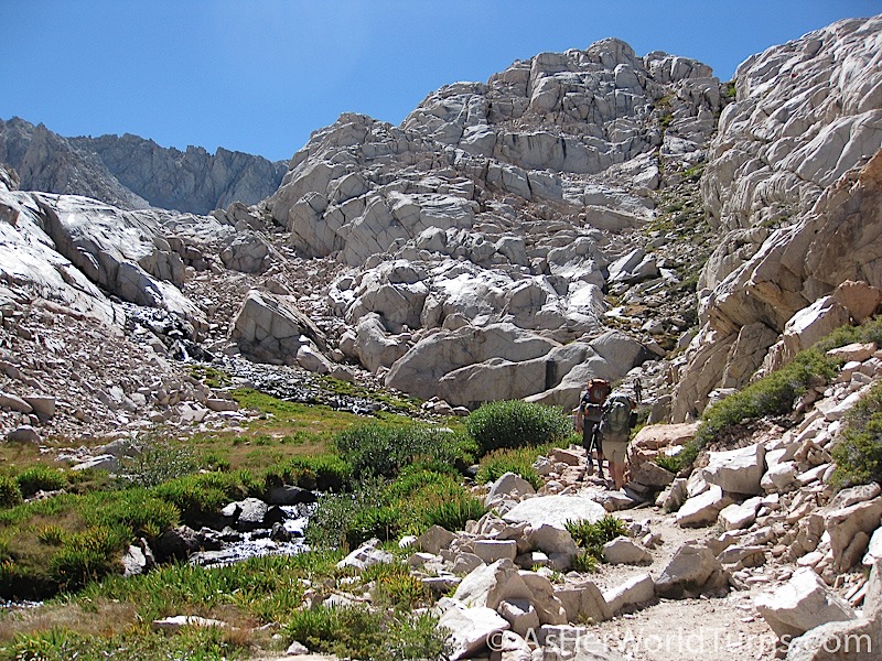
The trail ascends quickly and offers stunning views of the valley below.


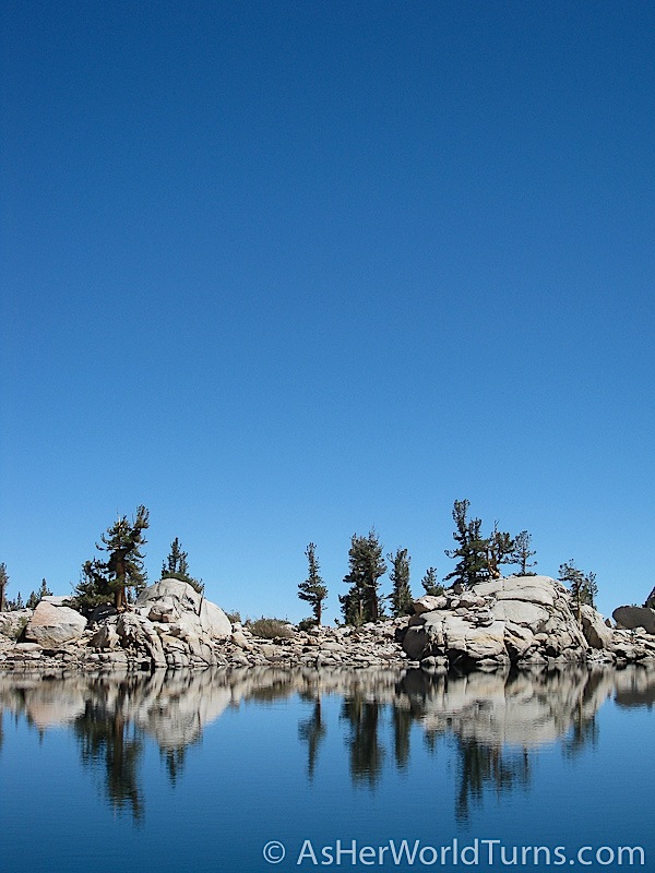
Lone Pine Lake is my favorite spot on the entire trail. And guess what: you don’t even need a permit to get there! (The “permit only” area begins just after passing this lake.) Hiking to Lone Pine Lake would actually be a great moderate day hike, or a good spot to camp overnight before continuing up to the summit with a day permit.

Due to space restrictions in my backpack, I made the painful decision not to bring my DSLR along on this hike. But I did bring my little point-and-shoot camera, plus a GoPro, which enabled me to take video as well as stills. In the Mt. Whitney, Part Two post I’ll share the video footage I shot and edited. In the meantime, enjoy the occasional fish-eye images from my GoPro.

It’s surprising how quickly we continue to gain elevation. Within thirty minutes of leaving Lone Pine Lake, I snap this shot looking down on the lake from above.
This is Bighorn Park. It reminds me of somewhere like Grand Teton National Park.

This is Outpost Camp:
Looking down on Bighorn Park:

And here is Mirror Lake. While not as breathtaking as Lone Pine Lake, it offers a serene place to rest. Our group travels at a nice and easy pace, for which I am very grateful.


Looking down on Mirror Lake:


We passed these donkeys at the start of the day and saw them again in the afternoon. They’d been working on trail maintenance on the upper portion of the trail.


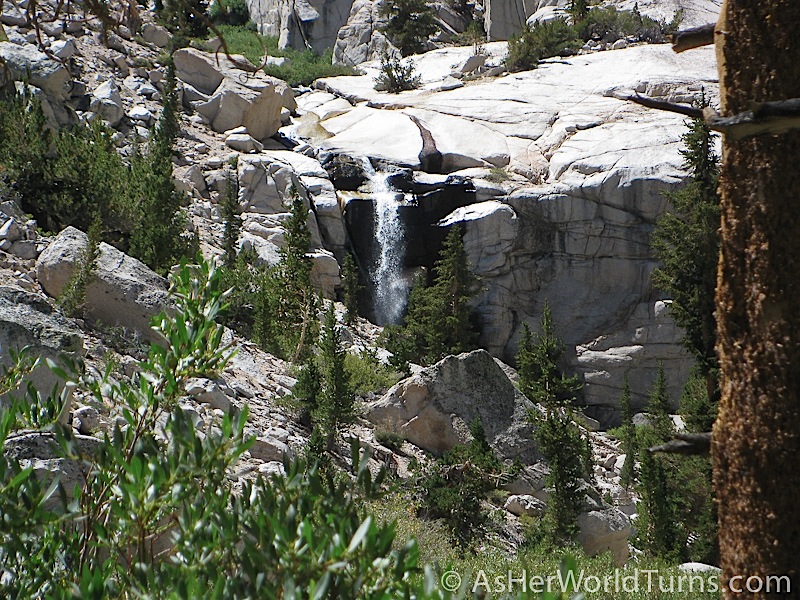
This is Trailside Meadow, which springs up like a sudden oasis in the middle of a million granite rocks. It’s most apparent in the second photo below, which shows the scale of the meadow compared to the rest of the mountain.

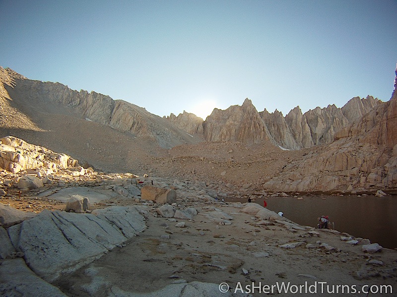
Here is Consultation Lake, very close to our campsite for the evening. At this point we are really, really tired.


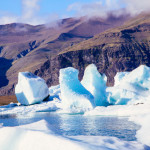
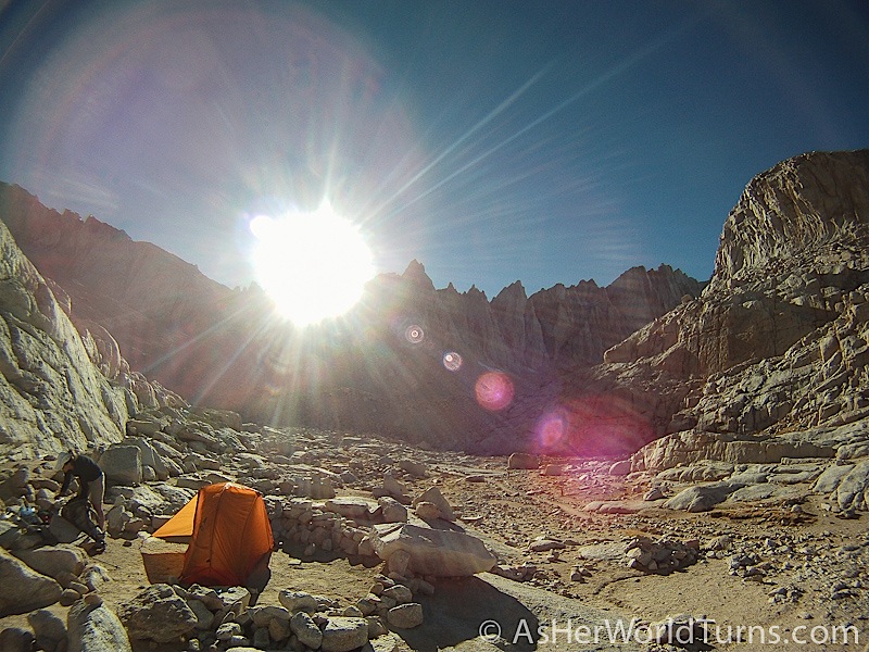
And FINALLY we arrive at Trail Camp! This is around 12,000 feet elevation, and it looks like the surface of the moon: sparse, expansive, and far away from civilization.

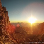
As the sun goes down, nearby mountains cast their shadows on the eastern peaks.


After a luxurious dinner of backpacking food (actually, my freeze-dried chicken and rice dish wasn’t the worst), we go to bed around 8pm. We set our alarms for 2am (!) and need a good night’s rest before tackling the infamous 99 switchbacks in the morning. I snap this shot of my sister shortly before we go to sleep:

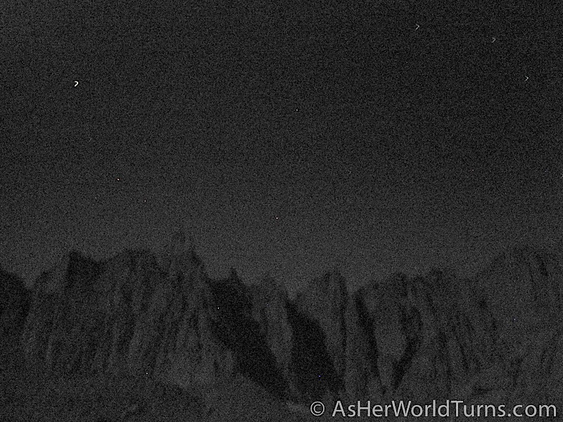
Here’s one last image of the surrounding peaks and stars. We feel very small.
Tune in tomorrow for Part Two of our Mt. Whitney hike!