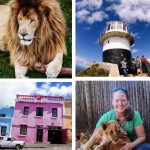
I have been wanting to share this post for MONTHS!
Have you ever been somewhere and thought, “Why isn’t this place more widely known? Why aren’t travelers all over the world talking about it, tweeting about it, and pinning its likeness on Pinterest? Shouldn’t this spot be getting WAY more attention on all those articles touting a growing list of places you need to see before you die?”
I felt that way about Havasu Falls in Arizona. Do yourself a favor and click through any of those posts if you haven’t already seen them — that place is a rare gem and it gets so little attention compared to its famous neighbor the Grand Canyon. And speaking of rare gems, that’s an apt description of the Amphitheatre hike in the Drakensberg area of South Africa. A preview:
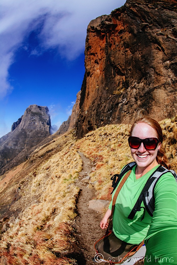
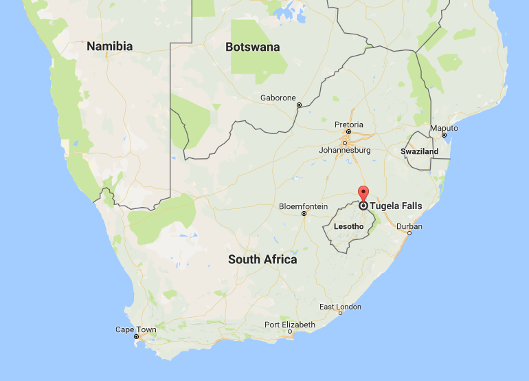
But let’s back up — let me tell you a bit about the Drakensberg region. It refers to the mountainous stretch of land next to Lesotho, a landlocked country within South Africa. Drakensberg literally translates to “dragon mountains” in Afrikaans (the language of South Africa) and looking at the above photo might give you an idea as to how it got that name. Doesn’t it look like that fire-breathing mythological creature might soar above those scraggly peaks and dense fog? I don’t watch Game of Thrones but I imagine this landscape resonates with its viewers. It looks so fantasy-esque that it can’t possibly be of this world. BUT IT IS. The Drakensberg actually exists and I feel like I’ve stumbled across a significant and underrated travel destination.
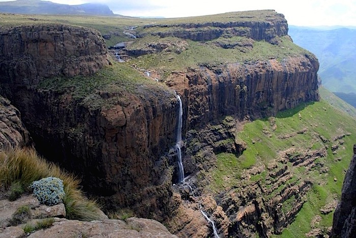
The Amphitheatre is a specific mountain plateau within the Drakensberg region (updated to add: it’s actually in Royal Natal National Park just north of Drakensberg — see map below). Here’s a stock photo (not taken by me) revealing the full Amphitheatre as viewed on a cloud-free day from a lower vantage point:
(image via)
I’ll give you a moment to pick your jaw up off the floor.
There is a seasonal waterfall called Tugela Falls at the very top of the Amphitheatre that drops over one kilometer (3,000 feet) — it is considered the world’s second tallest waterfall after Angel Falls in Venezuela. And I ask again, how has this hike stayed relatively secret in the world of travel with a statistic like that?! The only reason it’s not considered the world’s tallest waterfall is because it cascades partway down instead of one uninterrupted drop.
(image via)
Sadly the waterfall is not in season during my visit, so while we hike around the drop-off spot near the top, we don’t get to appreciate the falls in action. I would honestly schedule a return trip just for that.
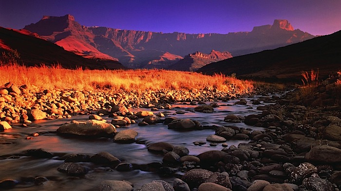
And here’s a map of the area to place the Drakensberg region in context within the whole of South Africa:
I’m staying at Amphitheatre Backpackers, named after the iconic hike in this region. They offer several day trips but this Tugela Falls hike is the big one — it costs around $55, the same price as the outstanding Lesotho day trip I detailed in yesterday’s post (you can save $5 for booking them both). It’s a great deal given the scope of this tour. That price includes round-trip transportation, tour guide, and a packed lunch.
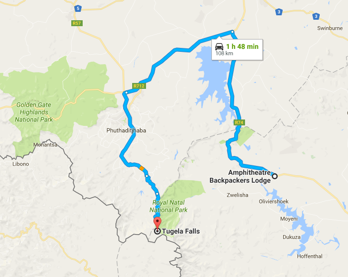
And here is the route from Amphitheatre Backpackers to the Sentinel Car Park for this hike (for anyone thinking of driving themselves) — it looks close on the map, but roads go the long way around:
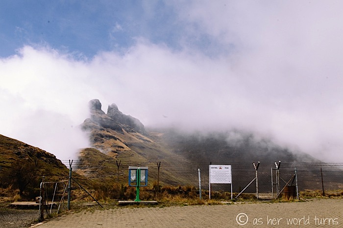
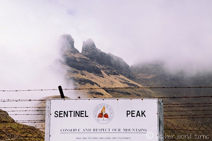
Fair warning — the weather is unpredictable and there’s a high likelihood of clouds or fog throughout the area. Do not let that deter you. Often the hostel itself is covered by clouds all day but the peaks of the Amphitheatre trail rise above cloud level and hikers return sunburnt at the end of the day. I would say that during our hike it’s cloudy 70% of the time, but about 30% of the time the fog parts to reveal glorious views of the mountain. It is totally, unequivocally worth it, as the photos below will attest. I would recommend wearing good hiking shoes and waterproof gear in case there is rain (a proper rain jacket would be ideal — you might be able to borrow one from Amphitheatre Backpackers). There might be snow during the winter (July-August in the southern hemisphere), but regardless of the season, it’s a good idea to dress in layers as the air temperature will fluctuate throughout the hike.
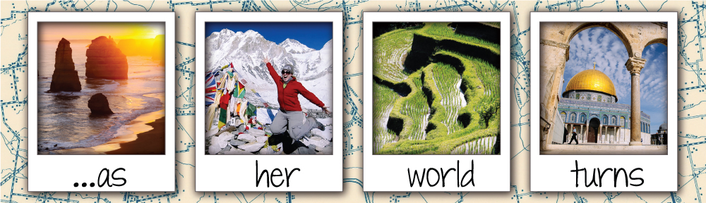
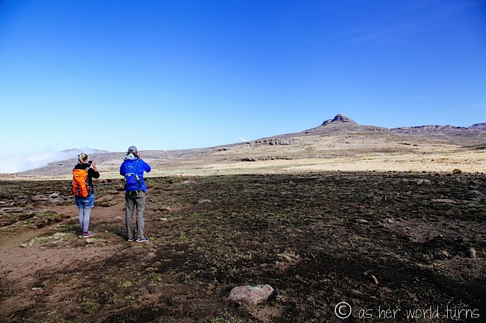
The mountain is located a good distance away so we drive maybe two hours to get to the parking lot (including a stop at a convenience store for drinks and snacks while the van refuels). By the time we reach the trailhead I can already feel the altitude — we’re starting at 8,200 feet in elevation and will eventually climb just shy of 10,000 feet above sea level (3000 meters).
We’re headed up the Sentinel Peak trail. This trek usually takes two days but this tour condenses the hike into ONE challenging day. It’s not a trail for beginners.
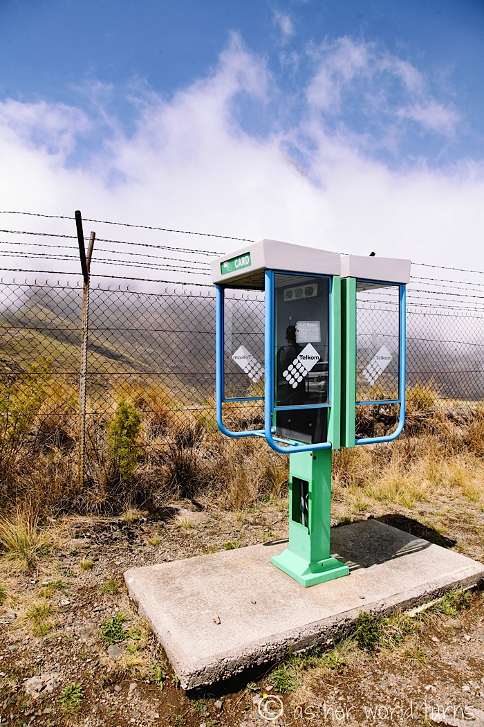
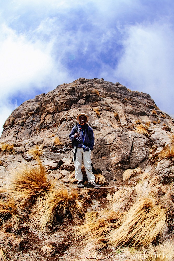
There’s a payphone up here! How antiquated.
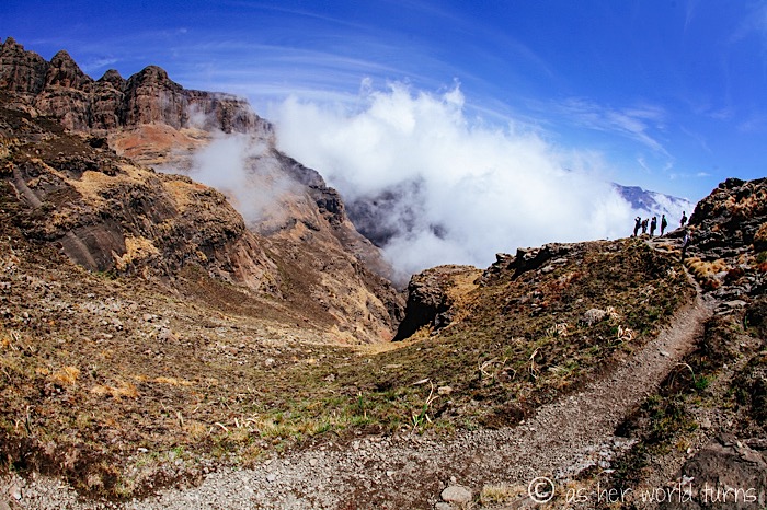
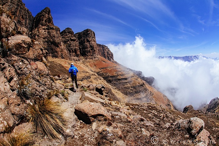
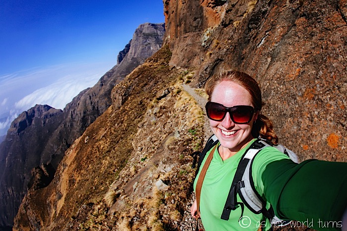
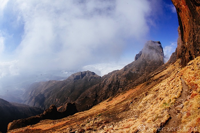
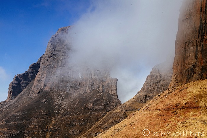
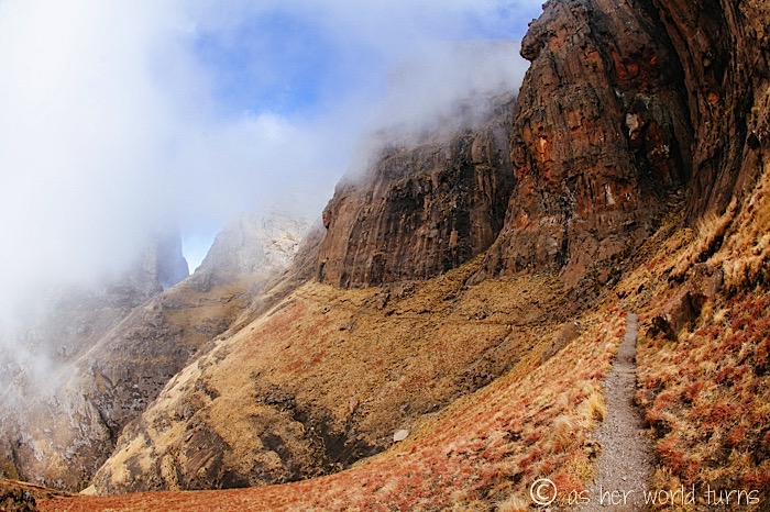
The fog moves in and out faster than I’ve ever witnessed elsewhere. One minute the whole mountain is shrouded in clouds and the next it’s clear. I keep my camera at the ready and pause to snap a photo every time the clouds part.
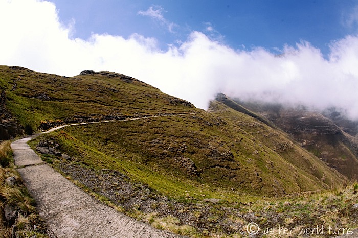
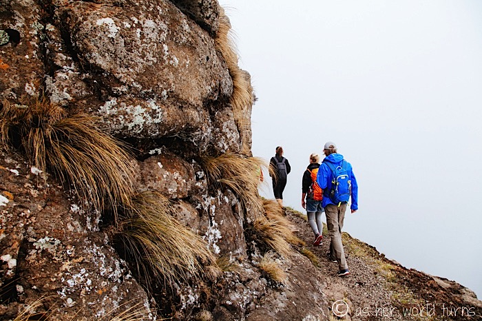
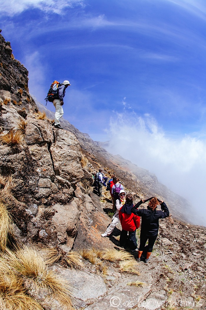
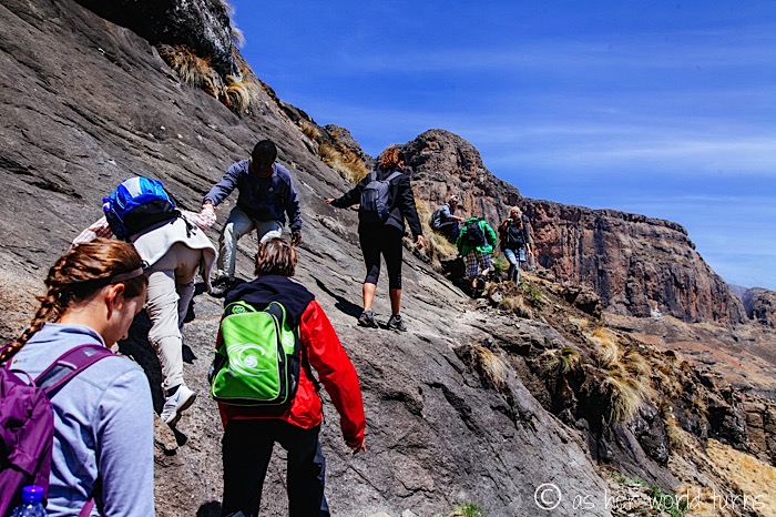
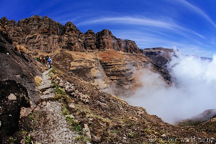
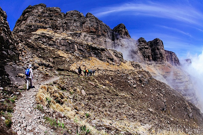
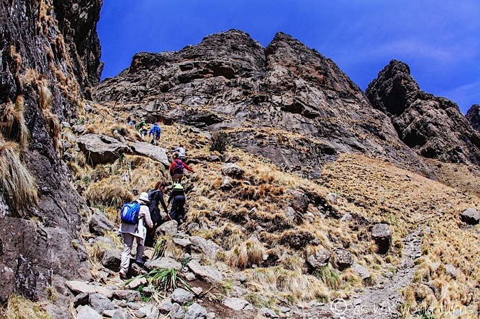
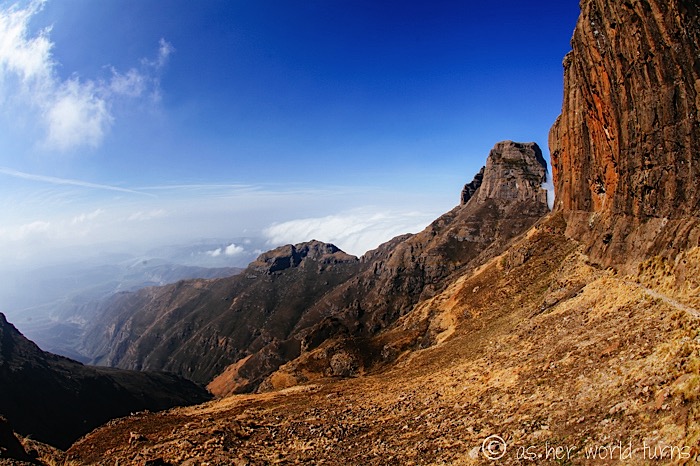
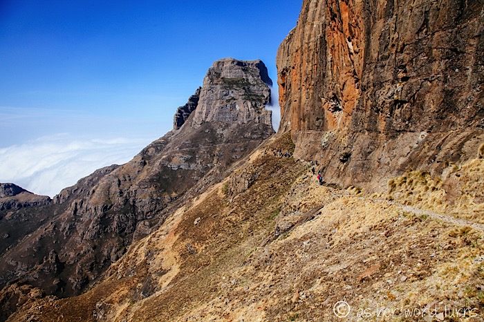
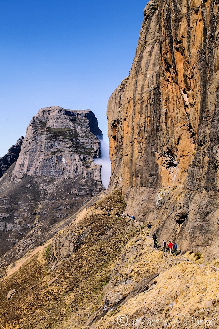
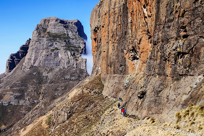
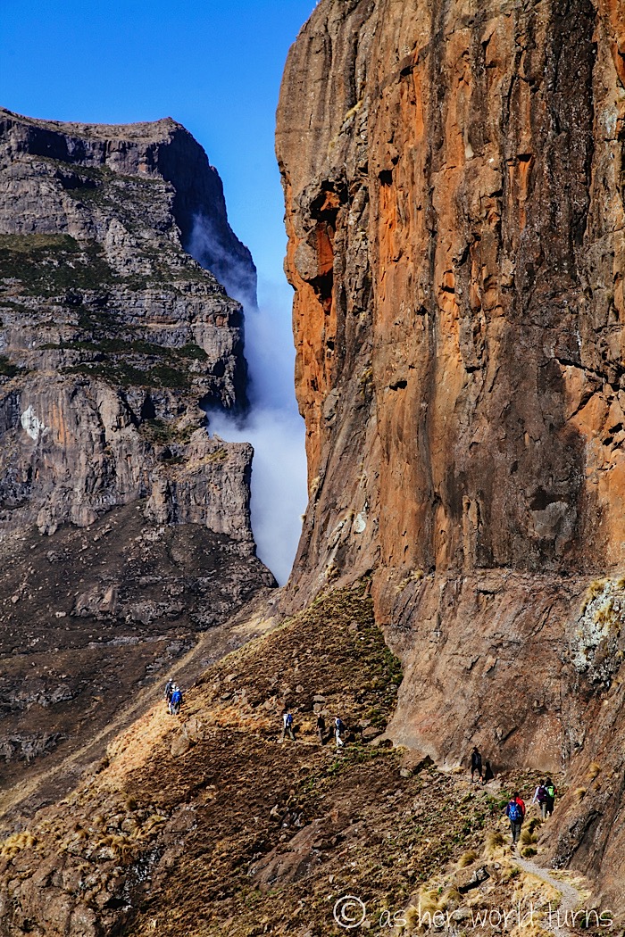
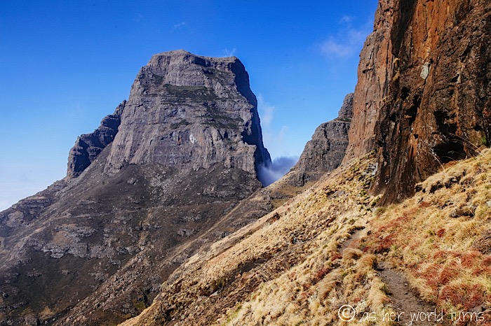
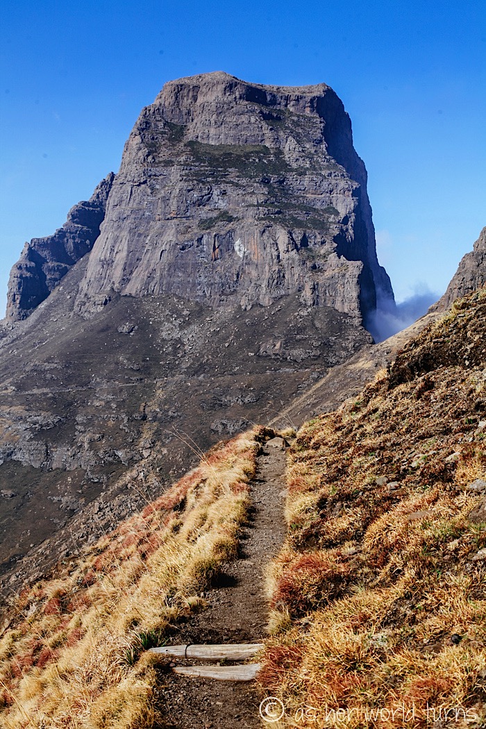
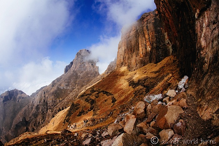
The trail cuts along the side of this cliff:
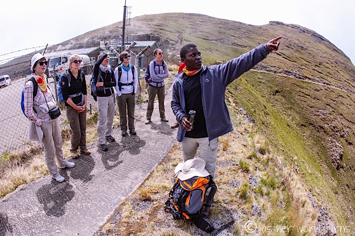
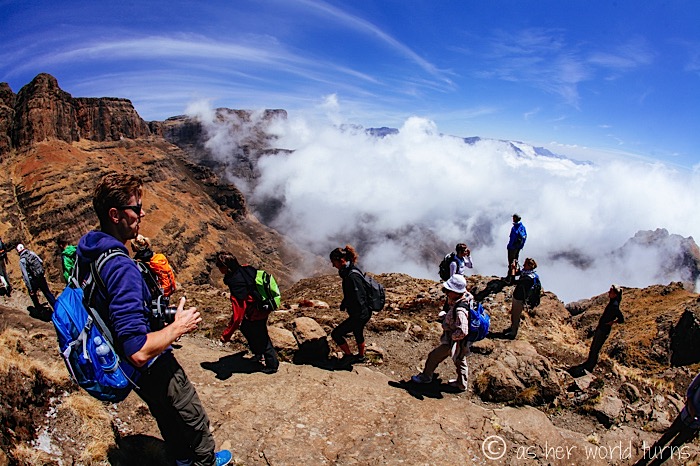
Everyone ready? Let’s do this! Our wonderful guide Siya leads the way.
I quickly become the last one in the group, snapping photos from the back. I’m used to it.
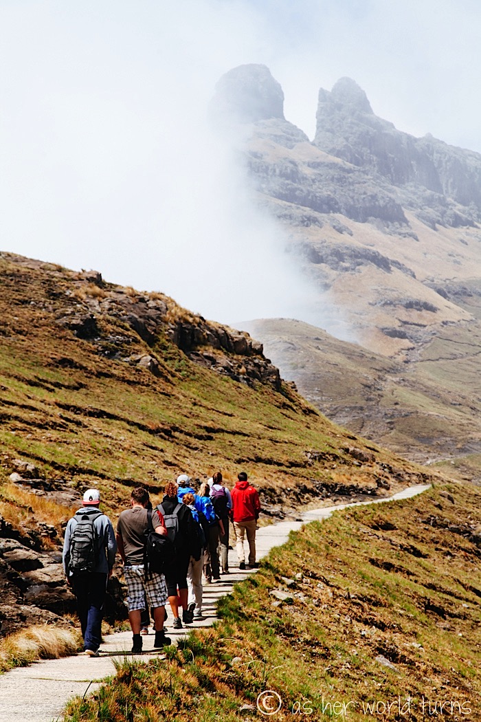
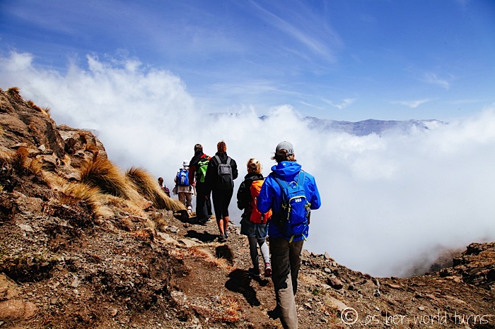
Watch the front of our group disappear into a wall of fog around this corner:

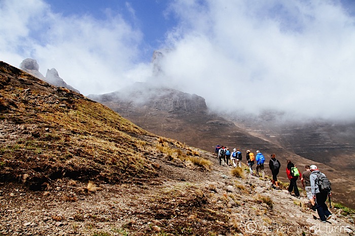
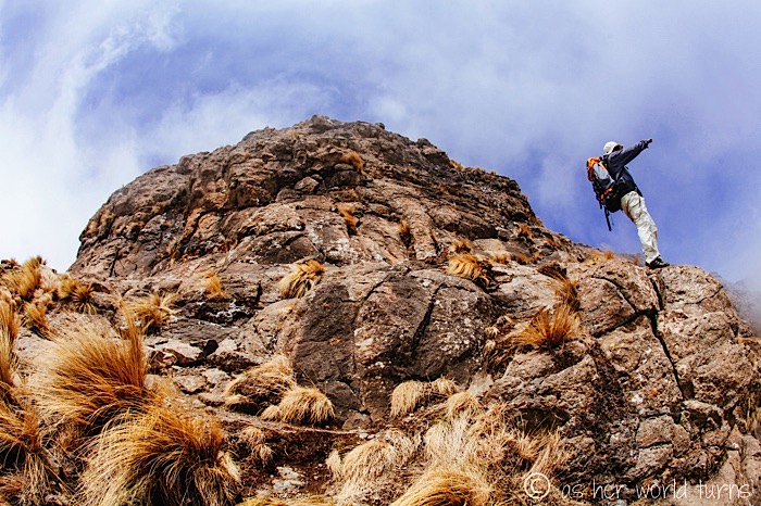
I spy the fog starting to lift… just in time for spectacular views.
Here’s Siya, our guide extraordinaire:
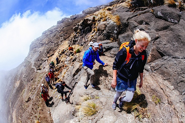
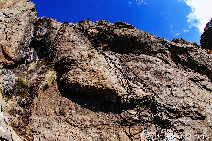
There are a few tricky stretches, and this is the first — we navigate a short ladder to reach the next stretch of trail.
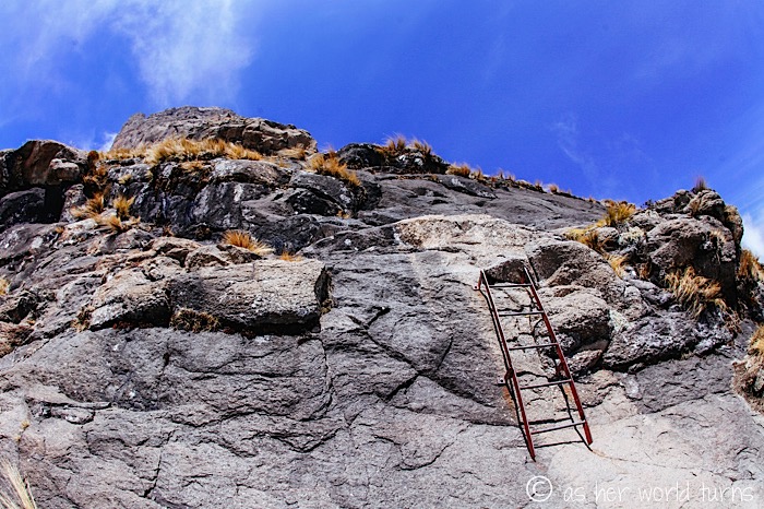
Literally climbing up the side of this mountain:
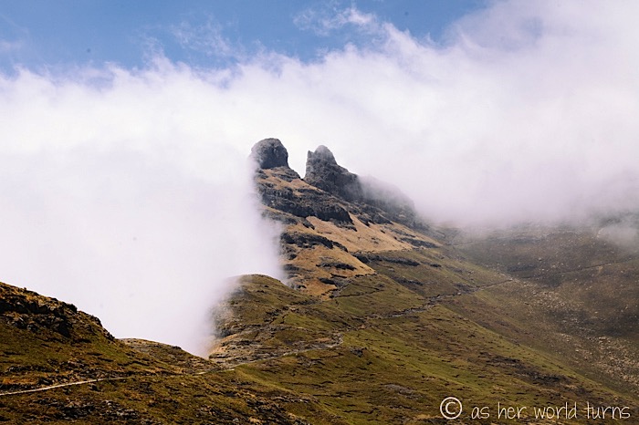
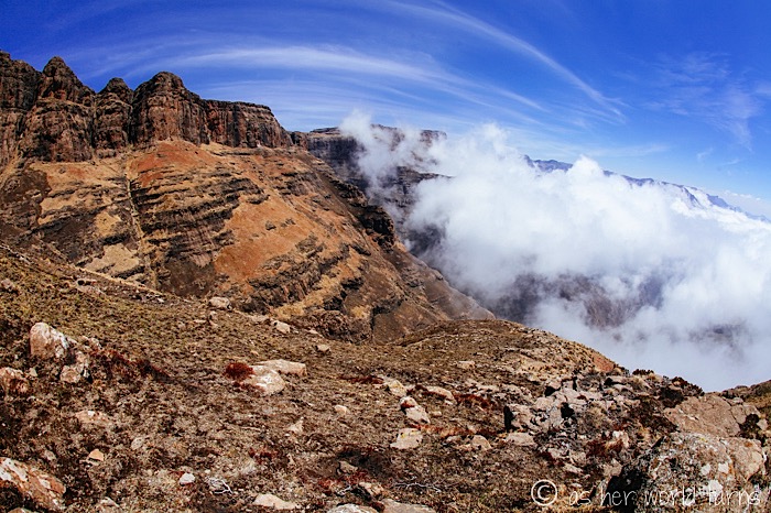
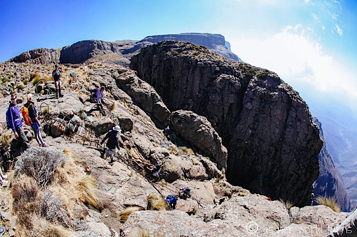
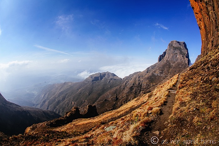
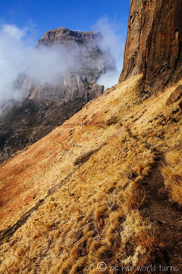
The iconic peaks of the Amphitheatre come into focus in the distance:
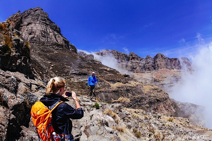
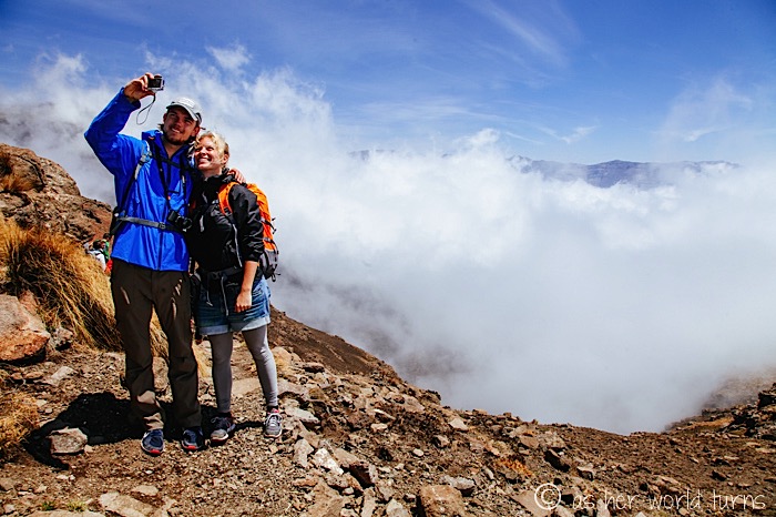
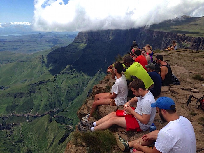
Our group is mesmerized by these views. Mercifully the clouds begin to part and we can fully appreciate the Amphitheatre.
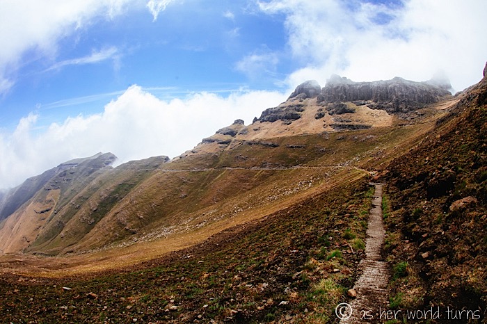
Climbing higher and higher…
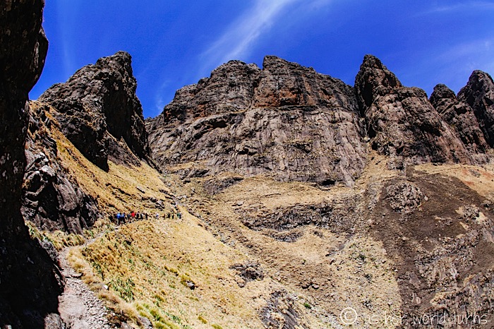
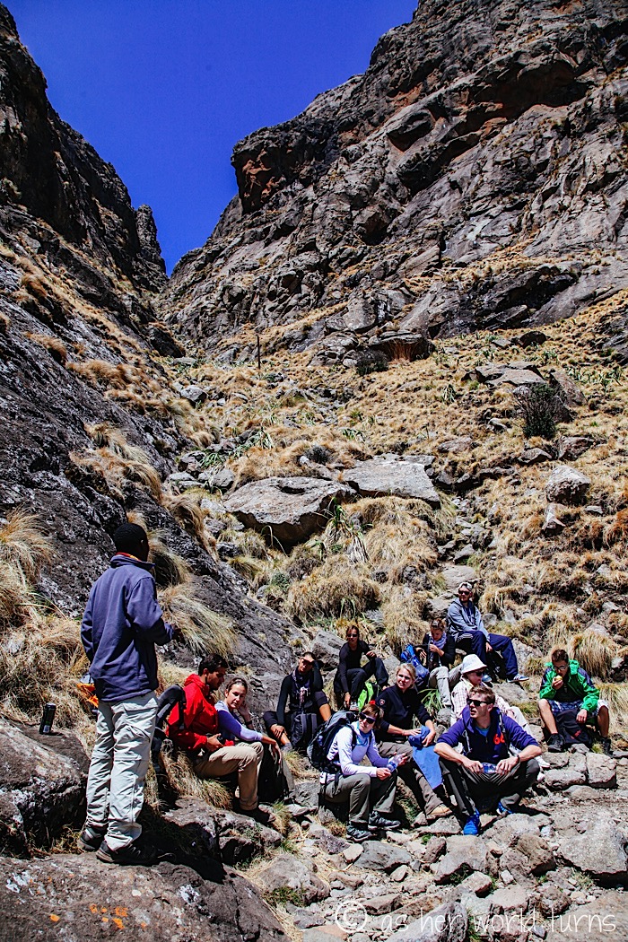
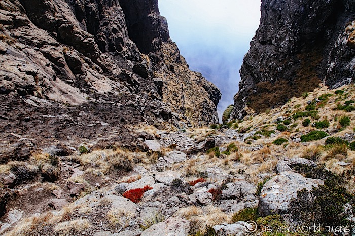
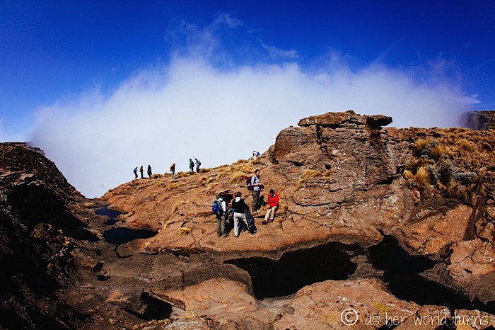
We reach a gulley and Siya stops us for a quick break.
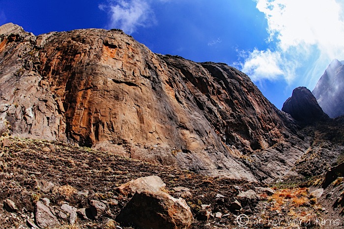
Our next task is to climb up the gulley, scrambling over rocks until we reach the top. It should take about 30 minutes or more. There is no trail — we just have to negotiate the rocks and keep putting one foot in front of the other until we reach the top.
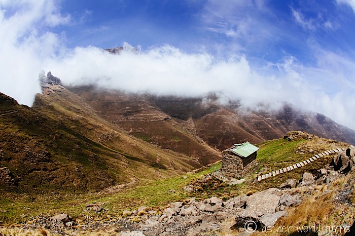
View from the top, looking back down towards where we started from:
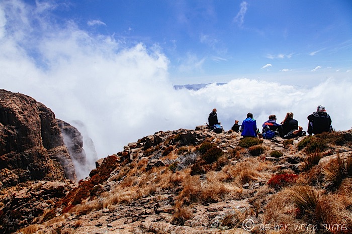
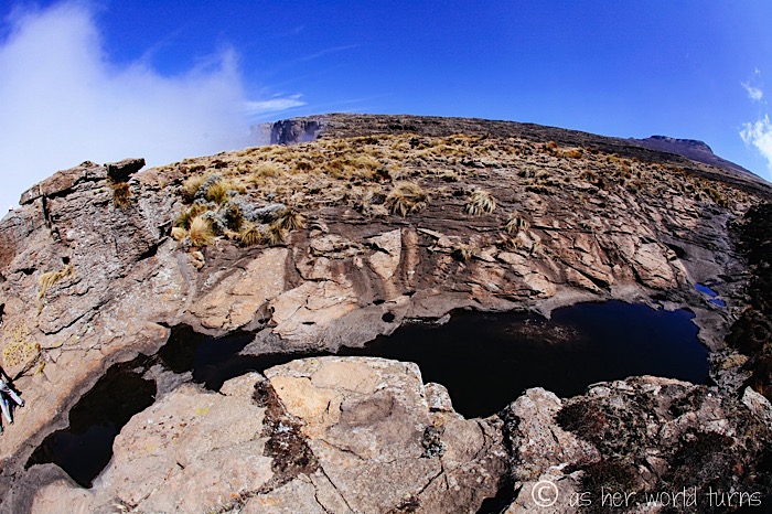
Once we reach the plateau on top of the Amphitheatre, we stop to enjoy our packed lunches.
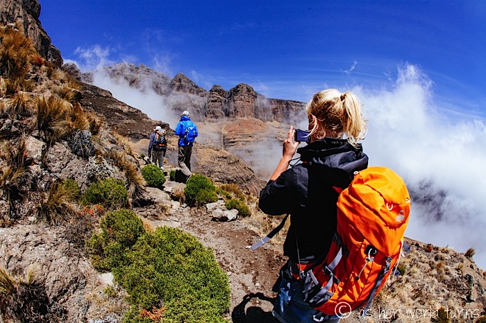
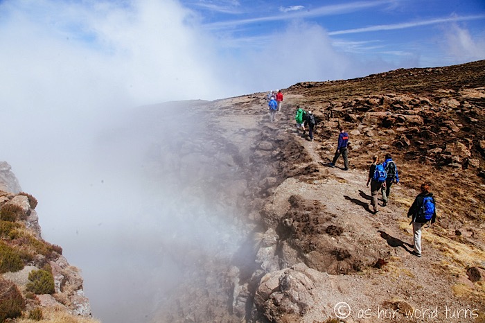
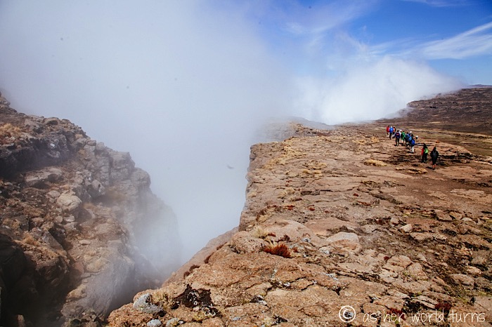
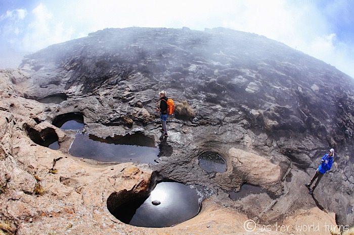
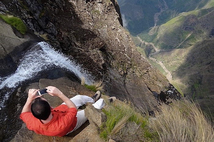
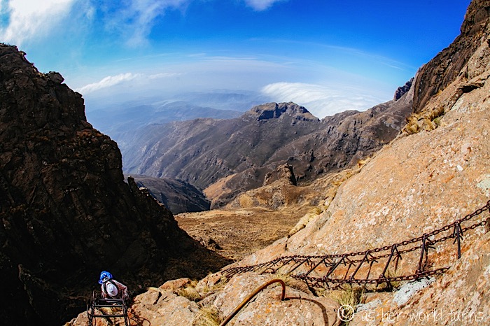
Next we head towards the waterfall drop-off, even though it’s not flowing this time of year (October). The mist starts to close in on us.
Here are remnants of the waterfall:
I’m so sorry the waterfall is not flowing right now. There are photos at the hostel of travelers frolicking at the top of the waterfall and it looks like the biggest thrill. Here are two I found via Google Images:
(image via)
(image via)
I can’t believe how clear the weather is in the above photo!
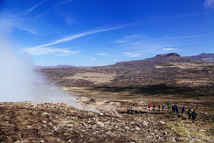
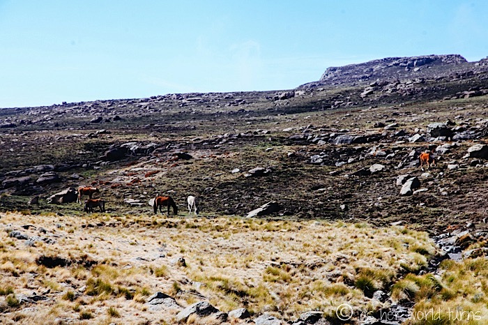
We leave the waterfall and press onward across the plateau.
There are HORSES in the distance. This blows my mind. How did they get up here?
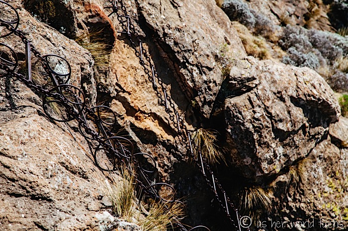
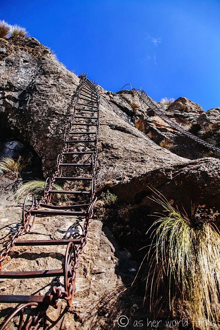
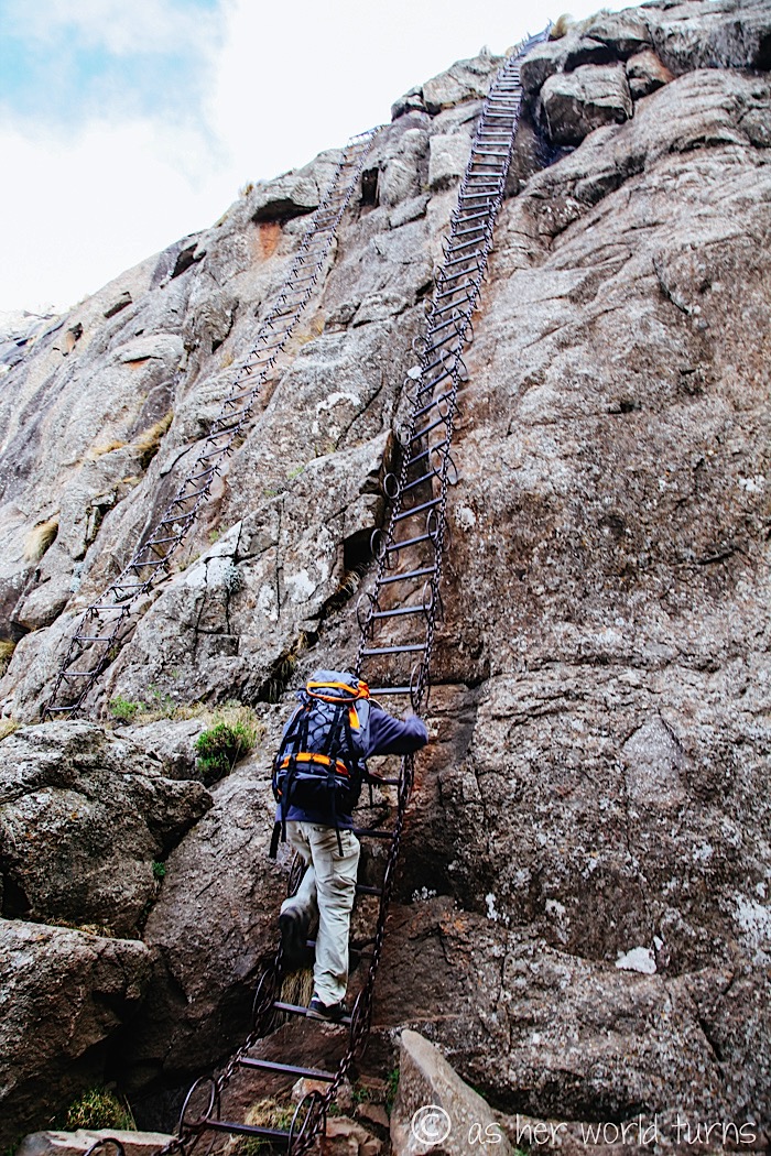
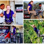
Our group reaches the far end of the Amphitheatre plateau. There’s one major stretch ahead of us… remember that gulley we climbed to get to the top? Now we have to descend that same distance, only this time it’s using chain ladders. This is not for the faint of heart!
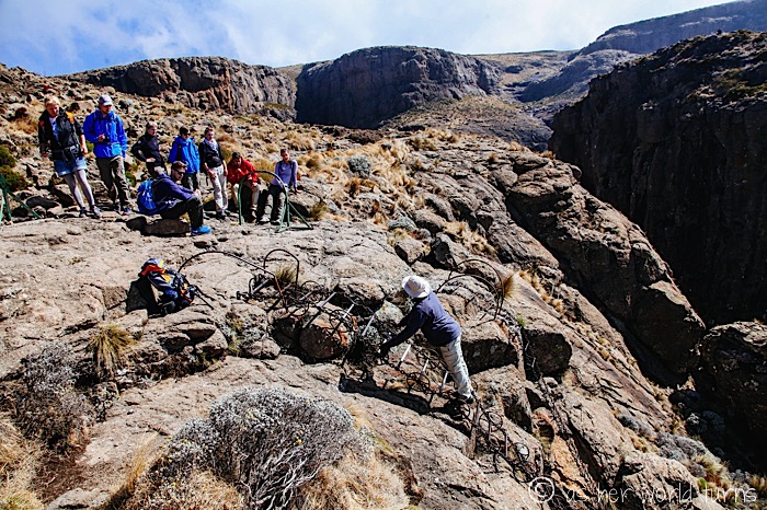
There are two ladders to pick from — the one on the left has metal circular grips, and the one on the right does not. How adventurous do you feel?
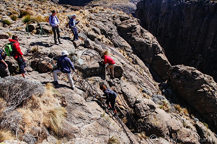
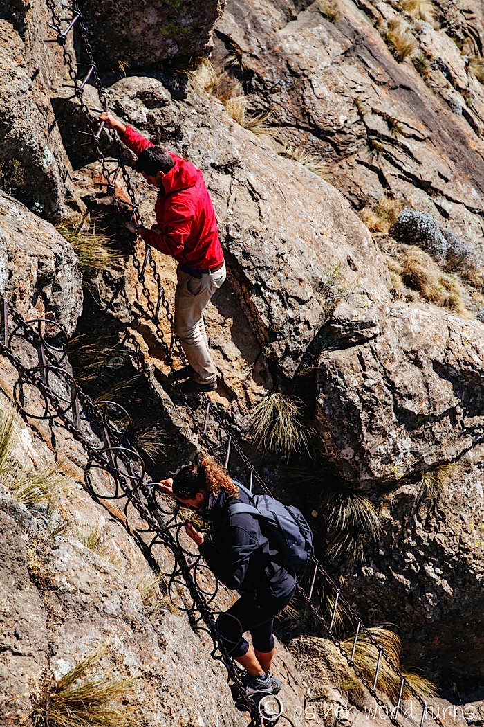
I don’t have an issue with heights and, thankfully, this isn’t a big deal for me. I just look directly at the stone in front of me and concentrate on taking each step carefully, one at a time, in a steady rhythm until I reach the bottom. (I use the ladder with the circular grips.)
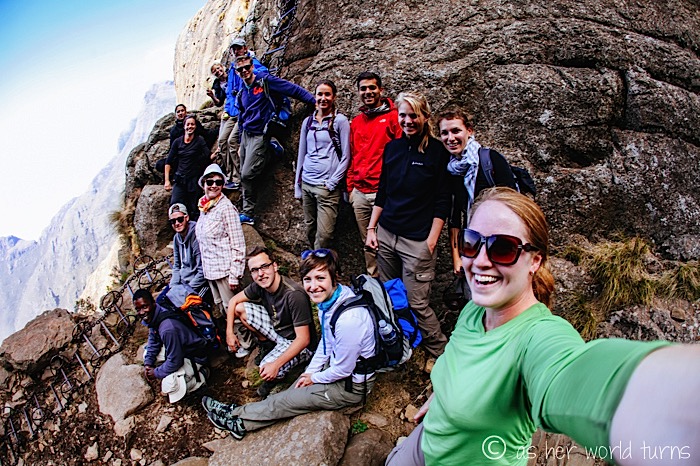
After the first set of ladders, there is another pair — it’s same deal again. We all descended slowly and steady, making it safely to the ground below.
Group photo after successfully completing our death-defying ladder descent:
Now this next stretch is my favorite part of the whole hike. The trail crosses back across the Amphitheatre towards the gulley where we ascended before lunch. The clouds disperse and blue dominates the sky — the timing could not be more perfect. I’ll stop talking now and let you enjoy these next photos uninterrupted.
And with that, the clouds return and I pack up my camera. I am walking on air (figuratively and almost literally) as we return to the parking lot the same way we came. In total I think the hike takes us around 6 hours? It feels so good to sink into our van seats and nap on the long ride back to the hostel. After weeding through nearly ONE THOUSAND photos I snapped during the hike, I sleep so soundly that night.
Should you find yourself planning a trip to South Africa, you would not regret including the Drakensberg region. The Amphitheatre hike ranks as my favorite day hike ever. Period.
Many thanks to Amphitheatre Backpackers for discounting my day trip to hike Amphitheatre in the Drakensberg. Opinions are my own.


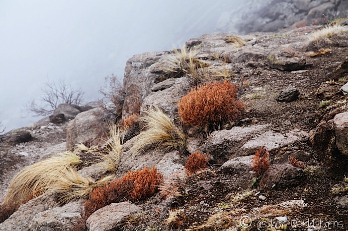
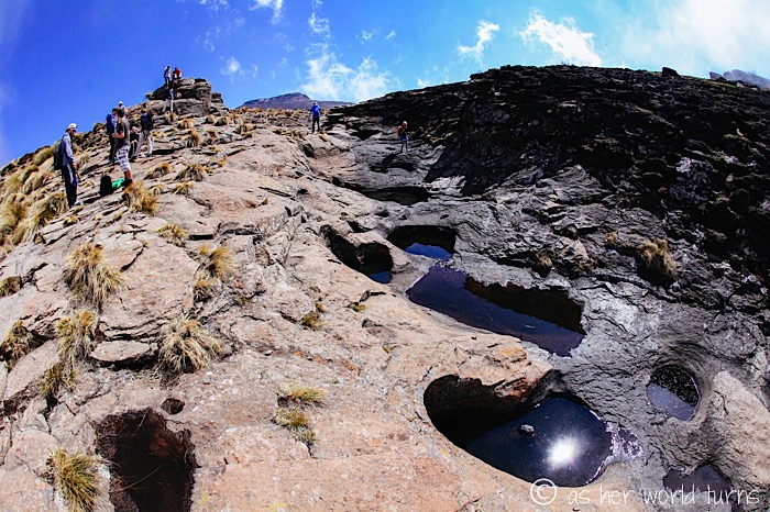
Very interesting rock formations.
Yes — I’ve never seen anything quite like them before.
Hi! I am planning a trip to South Africa and would really like to get to the Drakensberg area. I am potentially going to be traveling as a solo female traveler. I am wondering if you travelled there solo and had any advice for how you got to Drakensberg on your own. I am looking into flying to Durban and then from there I am not sure. Any advice you have would be welcomed!
Hi Sara! I would recommend taking Baz Bus — they have a bunch of bus routes around South Africa, in particular one from Durban to Joburg with stops in Drakensburg. It’s a tourist / backpacker type of bus, very safe and friendly, and they stop at the major hostels / accommodation in each area. Just book in advance when it gets closer to make sure they have seats on the dates you want to travel. You could rent a car in Durban and drive yourself; lots of people do this. My only caution is that the roads in Drakensberg were not great; there are lots of potholes. But it’s definitely doable if you prefer driving over the bus. Ampitheatre Backpackers hostel (they have private rooms too) is the ideal spot to stay for the Amphitheatre hike; they have tours either daily or every other day, and it’s not very expensive. One place in the Drakensberg area I didn’t get to but would have loved to see is Golden Gate Highlands National Park. I think I would’ve needed my own car to get there. It’s worth checking out if you go the rental car route. Good luck with your trip! Drakensberg area is one of the prettiest places I’ve ever been!
I was there 2 months ago. We used Spur Wing Transport as a shuttle service to get from Johannesberg to The Cavern located in the Drakensberg. Although it’s quite near the Amphitheater on a map, there is no direct route and it takes around 2 hours to get to the trailhead. Also, the road to Sentinal car park is quite horrendous if you don’t have a 4 wheel drive with decent ground clearance.
Luckily, the horel pointed us to Eunice Ntombiyodwa who runs a local transport service called Tugela Falls Transport. Her email is –
tugelafallstrading@gmail.com
She is a middle aged woman and a badass driver. We found her to be an extremely dependable and wonderful person.
Thank you for this, John! My trip to the Drakensberg area was over four years ago so hopefully your comment will help current travelers with more updated information. So glad you found a good driver in the area. Thank you!
Hey! Stumbled across your cool pics and thought I’d comment quickly cos this was my favourite day hike ever as well!
My comment is that a Czech expedition has twice measured Tugela now and concluded it is the tallest waterfall in the world. https://en.wikipedia.org/wiki/Tugela_Falls
Also, these pictures show it in flood! It must be amazing. It was flowing when I was up there, but not flooding.
http://peakhigh.co.za/blog/wp-content/uploads/2011/01/Tugela-004-Small2.jpg
Carry on travel blogging!
Thank you for the info on Tugela Falls! I would have loved to see it flowing / at its max. The Amphitheatre remains one of my all-time favorite hikes!
Hi Erica,
My partner and I are heading to Drakensberg region in July this year and are trying to pick a day hike to do and like the look of this one. We are considering doing the “short” version (i think) that goes from sentinel peak, up the ladders and then back again. Yours sounds like more of a loop (maybe the Gorge walk?).
We are both pretty fit but dont have much hiking experience. What are you thoughts on us being able to do the walk from sentinel peak carpark and back, then drive to durban all in the one day?
Thanks
Jared
Hi Jared! I am not an expert on South Africa so I hesitate to give advice, but I think your plan could work. It would be a VERY long day — Google Maps says the drive from Durban to Sentinel Car Park is 4.5 hours each way. (I remember the smaller roads were not in great shape during my trip in 2014 so the driving was slow.) So it’s possible, but consider staying overnight somewhere near the hike, so that you could do the hike the next morning and return to Durban in the afternoon. Just an idea. Or perhaps there are hikes within Drakensberg that are closer to Durban and might better fit your schedule — this one is up north in Royal Natal National Park (it’s described as Drakensberg but it’s not in Maloti-Drakensberg National Park). As far as physical fitness, I think you and your partner will be fine — it’s not a super strenuous hike. Good luck with your decision. I hear there are lots of beautiful hikes and I only had time for this one; it was incredibly stunning, but if it’s too far for a day trip I bet you’ll find good options that are closer.
Hi Erica! I’m thinking about staying at the Amphitheatre Backpackers and doing the Tugela Falls day trip as well.
However, do you know if it’s possible to do the hike on your own (without a guide)? Your pictures look amazing!
Thank you.
Hi Tita! I think you CAN do it without a guide, but the terrain was tricky to drive — I was glad to be in a giant van with huge wheels to navigate some of the rocky parts of the road. Hope that helps! Have a great trip!
Hi Erica,
My husband and I are on honeymoon in SA and almost at Bergville, nearby Drakensbergen. I would love to see the Amphitheater and Tugela Falls, but I’ not really fit. We would love to hike, just for about 1,5-2 hours total. Is there any way we can see the Amphitheater that beautiful? And the Tugela Falls? Thank you in advance for the advice.
Hi Daphne! I don’t know how it works to do a shorter version of the hike — I went with a group tour through Aphitheatre Backpackers, so perhaps if you contacted them they would have a better idea. There is one uphill during the hike that was pretty challenging, but we were told to go slowly (it took about 30 minutes climbing uphill over rocks). And the downhills on the ladder aren’t physically difficult, just require precision not to fall. If you go on your own without a tour, then you could do an abridged version of the hike yourselves and still see some nice views as long as the fog isn’t too bad on the day you’re there. It’s a little tricky to drive there on your own since the roads are bad; our tour guide drove in a big van that handled all the potholes well. But with the right vehicle you could certainly go on your own and still enjoy the views on a shorter hike. Good luck deciding!
Hi Im intrested in doing this hike to.
Who can I contact for bookings
Thanks
sean
Hi Sean — I booked my day trip through Amphitheatre Backpackers. Here is the link. Good luck planning your trip!
Hi Erica,
What a lovely description of the hike. Thank you so much for it.
We are planning to do this hike and also stay at the Amphitheater Backpackers for a couple of nights. Could you please give me an opinion of how the accommodation and the overall cleanliness and vibe at the lodge was?
Thank you
Archana
It was a fine place to stay. I was concerned it might have more of a party vibe given the extensive bar area (including a hot tub and rock climbing wall IN the bar) but that wasn’t the case when I was there; it was pretty relaxed. I found nooks in the common areas to hang out and work on my laptop or read. It’s been awhile since my stay but the internet was not great, if I remember correctly. Overall I was very happy with my stay here. Good luck with your trip!!