After dropping my stuff off at the tea house in Gorek Shep and forcing down more Sherpa Stew, we set out for Everest Base Camp at 11:30am. It should take between 5-6 hours round-trip.
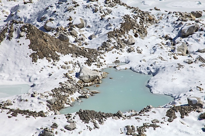
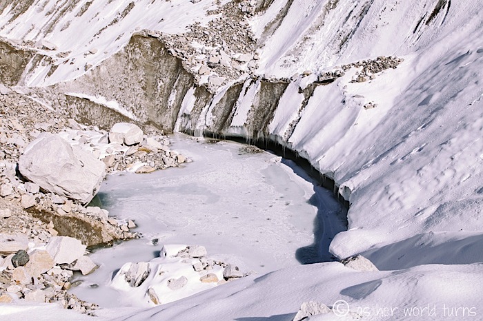
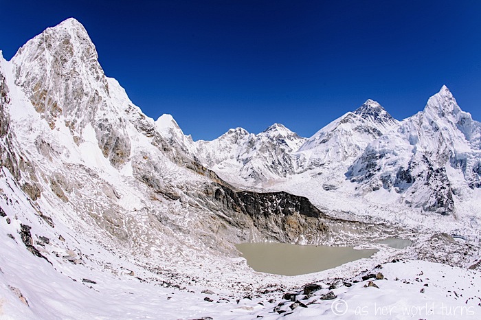
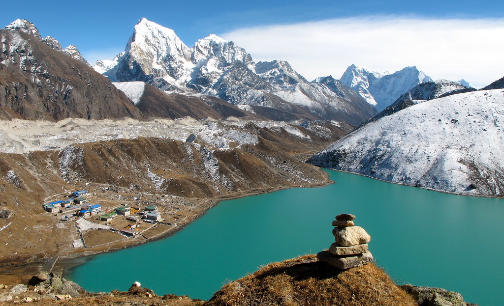
That’s the village of Gorek Shep in the distance below. We hike past this lake, which we’ll see in full splendor from a higher altitude in the photo after this one…
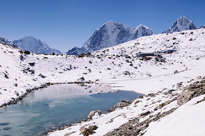
Here’s the full lake. Gorgeous, right?
I start off strong. It’s like the final stretch of running a marathon; you get a burst of energy in the last mile, just knowing the end is near… except in this case, the end is really the half-way point because I still have to trek all the way back down the mountain to Lukla.
SO HAPPY I’ve made it this far. Headaches, sleepless nights, and lack of appetite be damned!
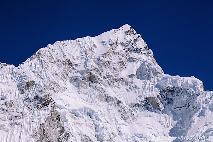
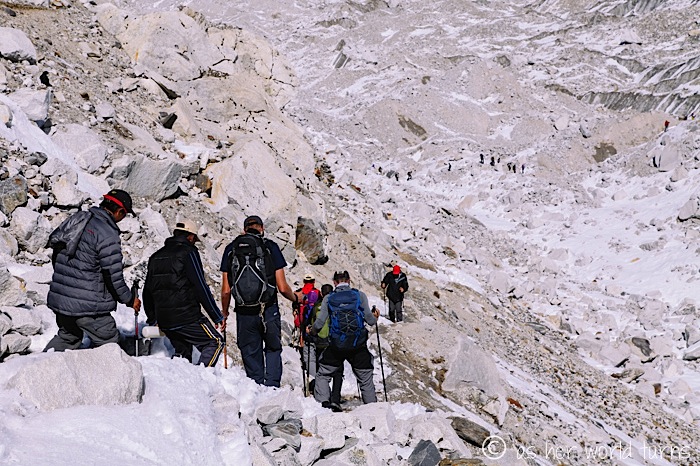
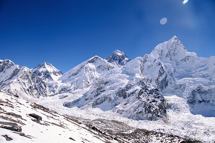
Check out the lines all over this peak below where it looks like Nature has scraped her fingernails against the snow. Those are from mini-avalanches. We hear them happening around us — an echoing rumble as patches of snow and rocks trickle down cliffs.
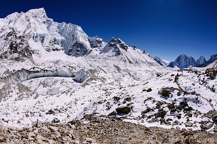
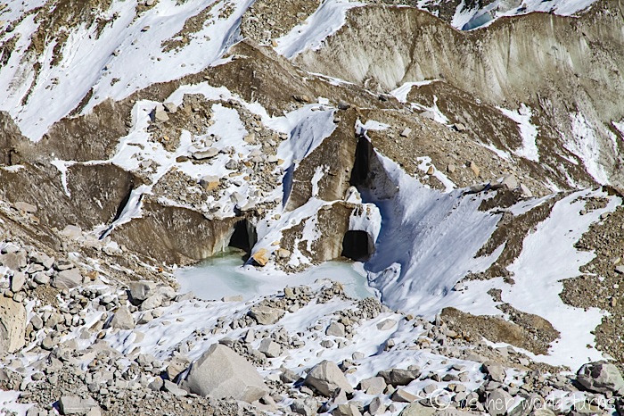
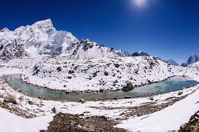
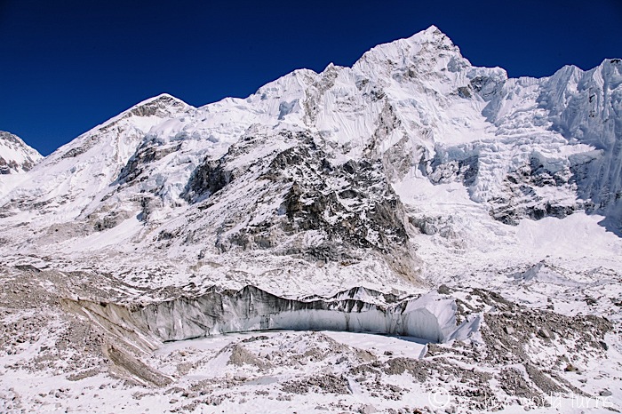
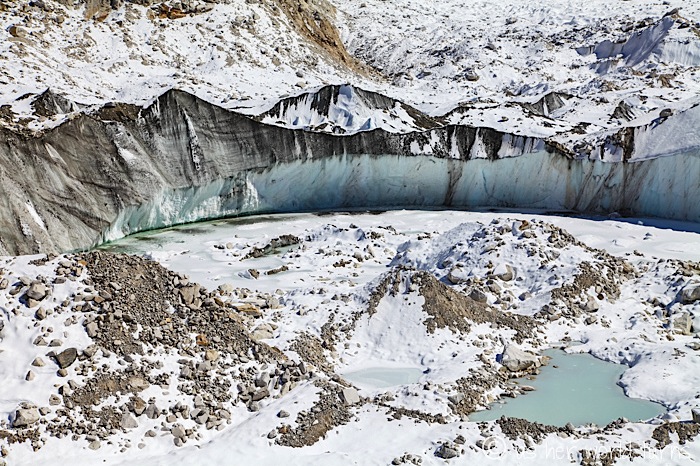
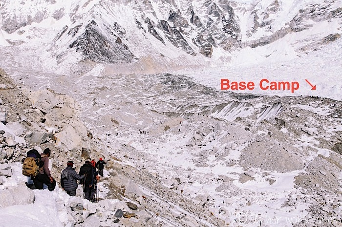
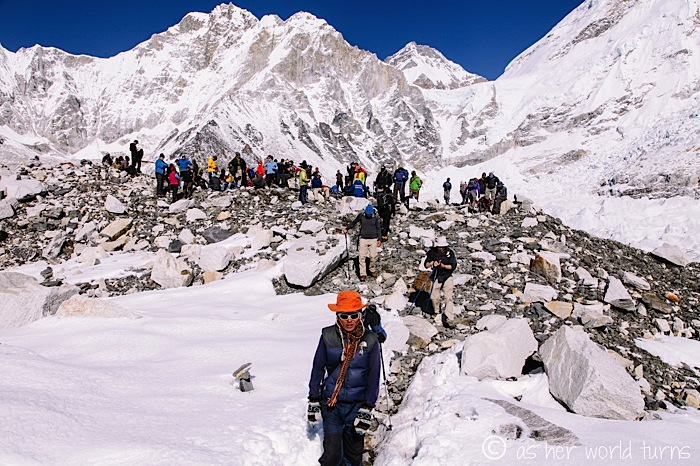
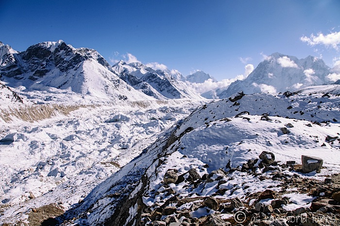
It’s hard to tell the scale, but everything around us is GIANT. Those glaciers and lakes and caves in the photos above are all huge.
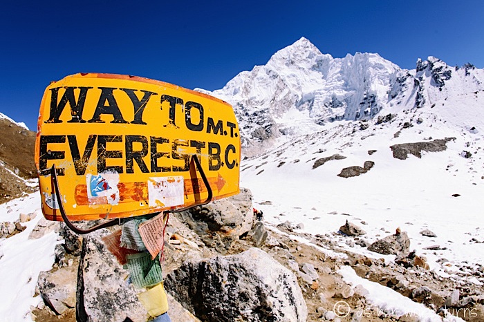
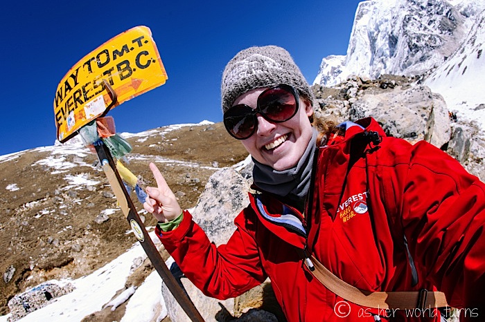
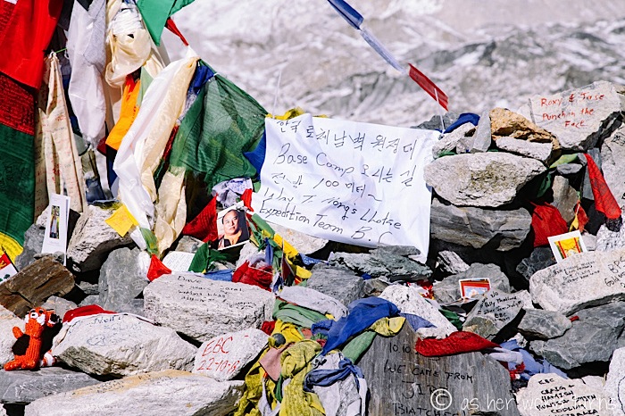
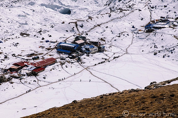
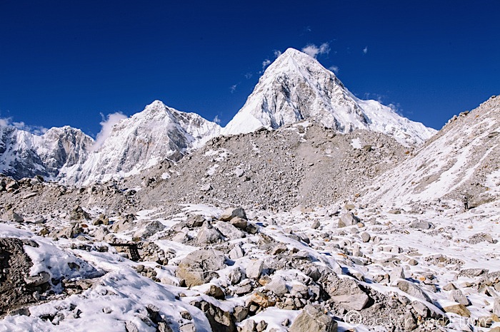
I’ve highlighted Base Camp below to give you a better idea of perspective:
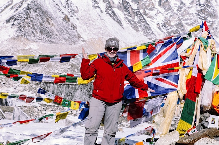
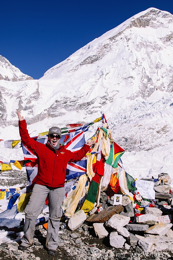
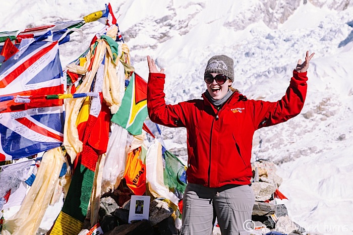
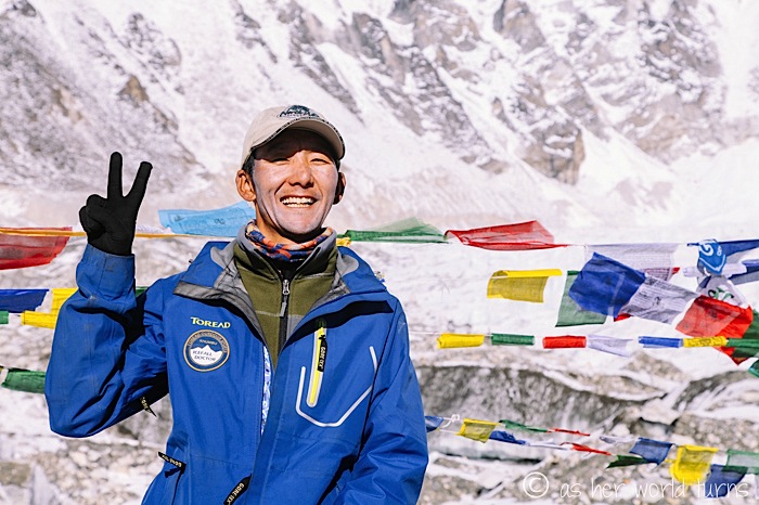
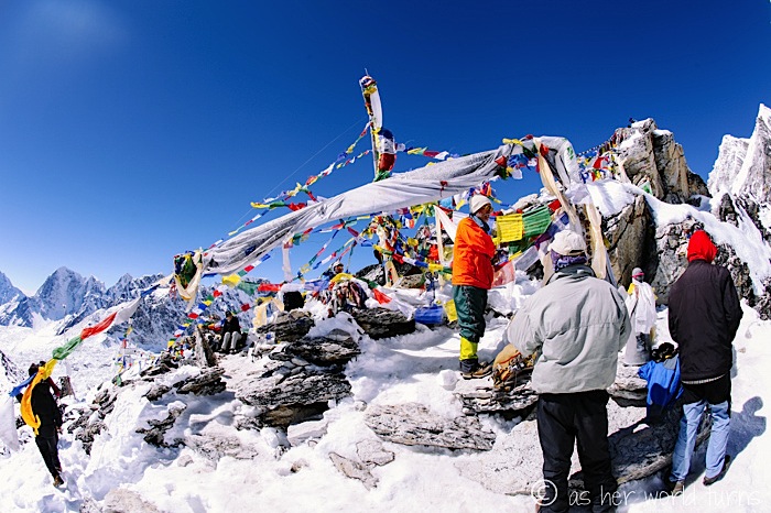
I MADE IT…!!!
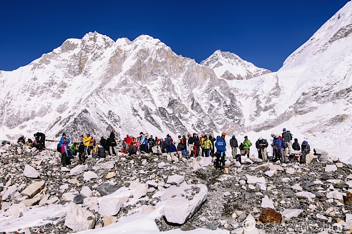
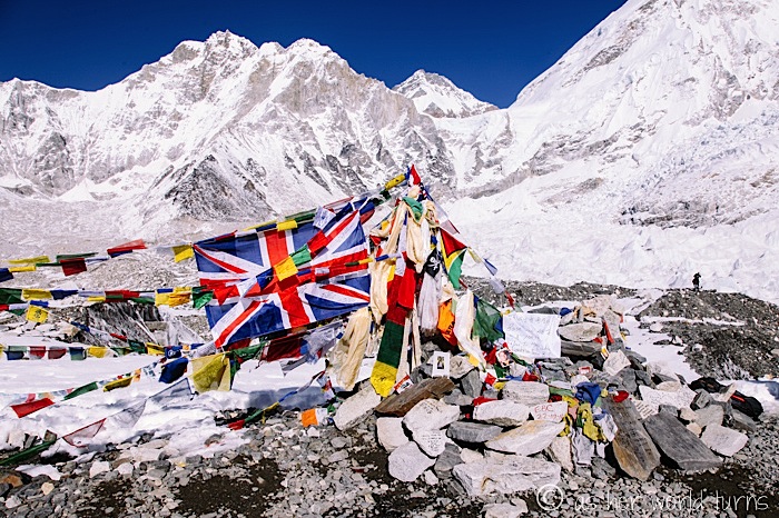
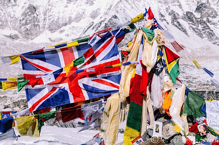
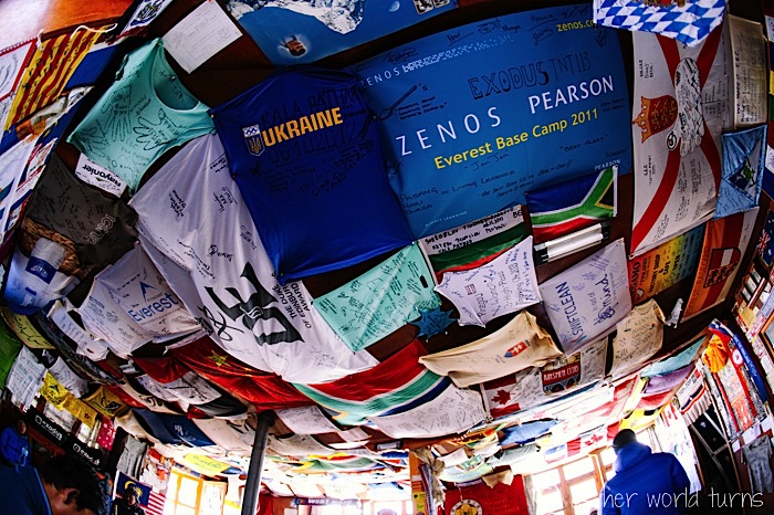
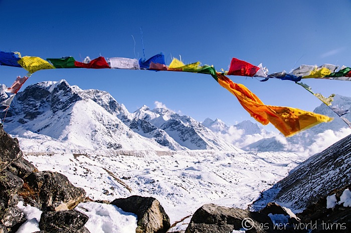
So in case you didn’t know, Everest Base Camp is essentially a pile of rocks and flags. That’s it. If I wasn’t prepared for this sight, I might be disappointed, but I’m just relieved to see those prayer flags.
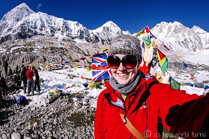
As I wait in line to have my photo taken, I wave to familiar faces I’ve passed along the trail. Most of us have been on the same schedule since arriving in Lukla nine days ago and I even spot a father / son team who were on my tiny flight of 14 people departing Kathmandu. It’s one big celebration.
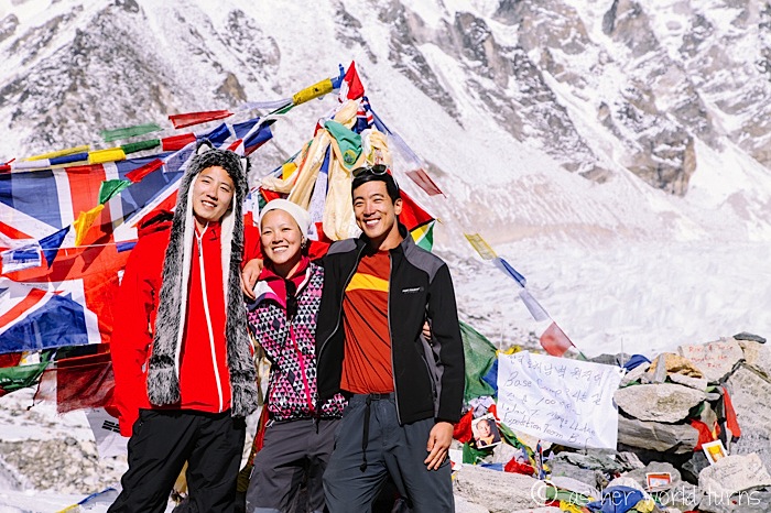
Thanks to Mingma for helping me get here successfully!
Good-bye, Base Camp… time to head back to Gorek Shep.
The return is brutal. I think it’s because I’m coming down from the high of reaching Base Camp and my body is ready to crash. By this point my lack of appetite has resulted in not eating enough food, so I throw back granola in a desperate attempt to restore my energy. I’m still not hungry, but I fantasize about my favorite foods back home: iced coffee, guacamole, sushi…
I feel like a walking zombie. We finally make it back to Gorek Shep right at sunset, and thank God, because the cold is setting in. The trek to Base Camp and back takes me the full 6 hours round-trip.
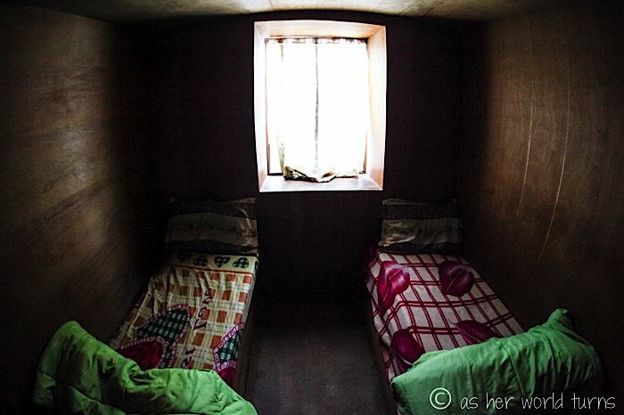
I eat Pringles for dinner. It costs $5 for the big can — and I’m only paying $3 for my room at the tea house! Crazy enough, I can’t even finish the Pringles, despite 10 hours of climbing today. I have little appetite and almost no energy.
I wake up ready to face my final challenge of the trip: a hike up to Kala Pattar, the viewpoint of Everest. Kala Pattar sits at 18,500 feet — a full 500 feet taller than Base Camp — the highest elevation I’ve ever climbed.
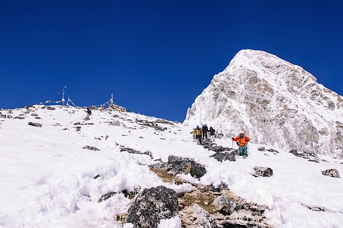
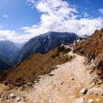
It’s supposed to take 3 hours round-trip… but it takes me 4.5 hours. As I write in my journal, it’s the hardest hike of my life. It starts out innocently enough:
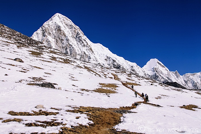
But the longest stretch is straight uphill scrambling over boulders and snow. I have to stop and just breathe every few steps. I’m terrified of twisting my ankle as I navigate these rocks.
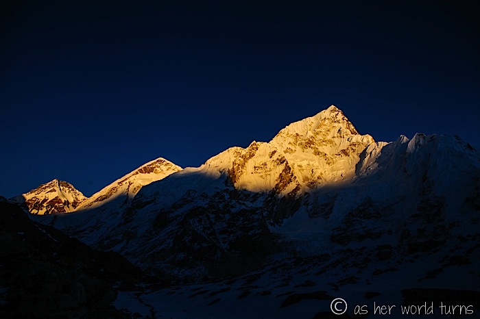
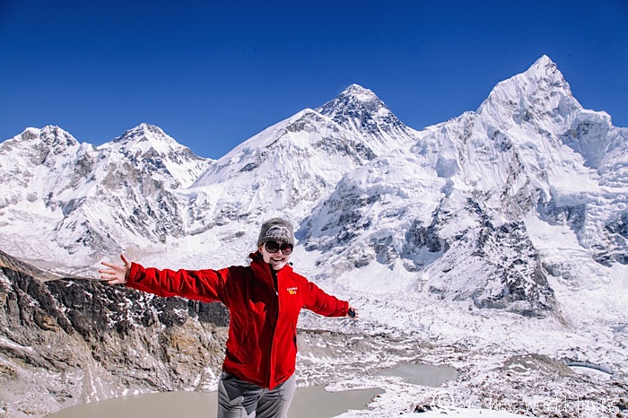
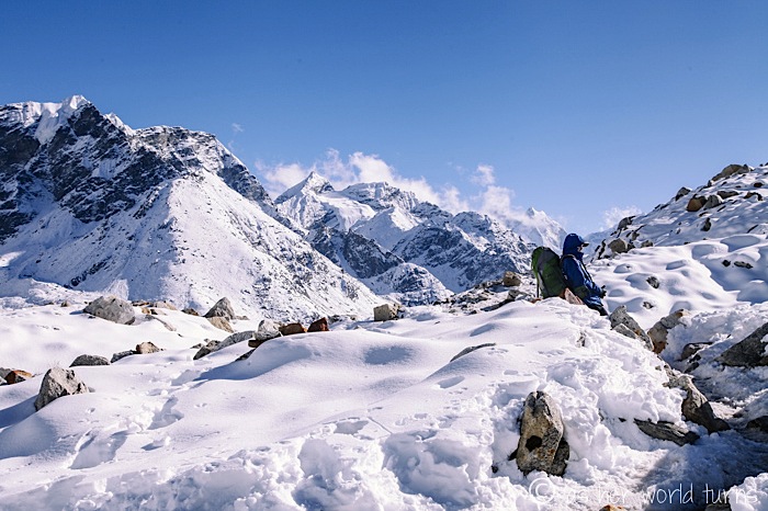
But I finally make it to the top, and the views are indeed stellar.
Can you spot Mt. Everest, the highest point on earth at over 29,000 feet in elevation?
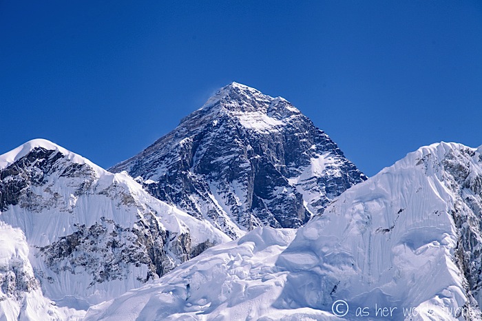
In the photo below, isn’t it funny how that peak to the right looks bigger than Everest, when in fact Everest is several thousand feet taller? For comparison, Mt. Everest reaches 10,000 feet higher than where I stand taking this photo:
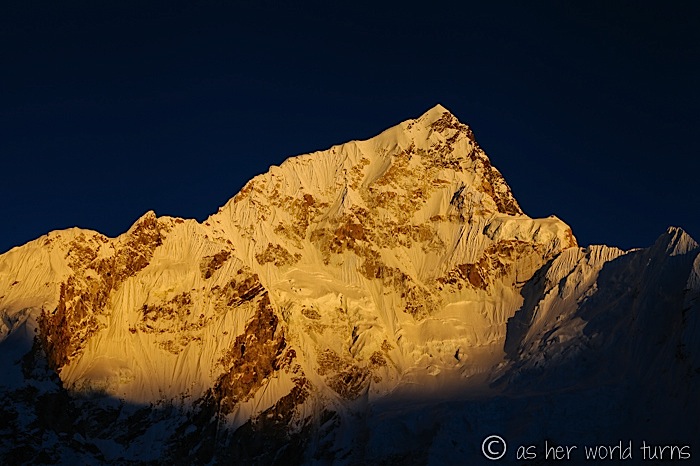
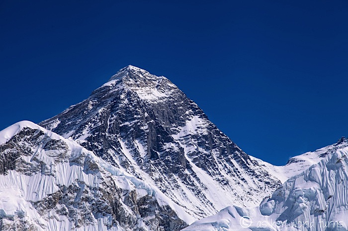
One more close-up for good measure:
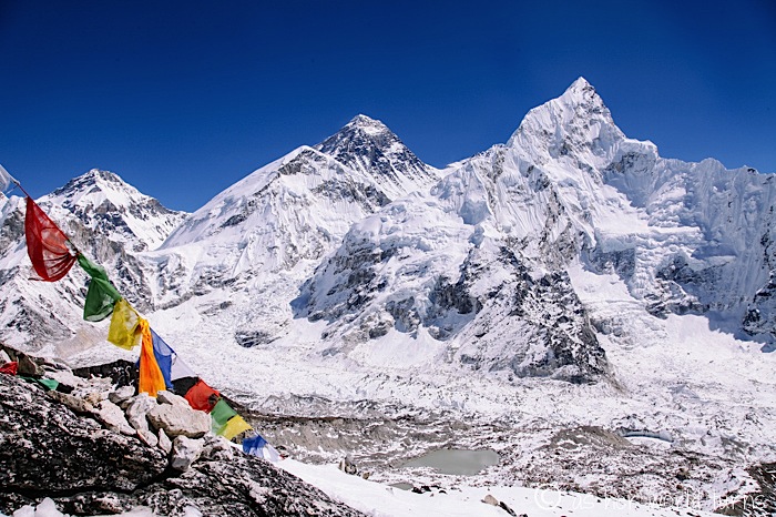
I love this image below. Everest is the second peak from the right:
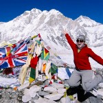
Here’s me standing in front of Mt. Everest. I truly, genuinely, cannot believe I made it here.
Now get me the heck off this mountain!
True story: I lose patience with these snow-covered boulders and decide to sit on my bum and slide down. Other climbers see me doing this and yell out, “Stop, you’ll rip your pants!” but I do not care. I cover the distance in the photo below in about 30 seconds, whereas it takes everyone else several minutes. And my pants are intact! Mingma reaches me first, laughing, saying he’s never seen anyone do that before.
One more epic view from this vantage point:
There’s Gorek Shep below:
I reach Gorek Shep by 1pm and eat lunch in the tea house before setting out for Lobuche.
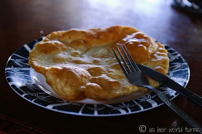
This is chapati, a Nepalese bread that is kind of like fried dough (i.e. it’s awesome). And this is the only tea house on the whole trek that has peanut butter. It’s stale, but I don’t care.
Now begins the long trek back to Lukla. It will take me three days to make the reverse trip, a mere third of the time it took me to get this far. With each step downhill, my oxygen intake increases and my body is happier. My appetite doesn’t return until the end of day 10. Similarly, I don’t sleep well until I get back down to Tengboche (12,700 feet in elevation). By then my constant headache disappears as well.
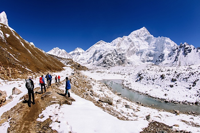
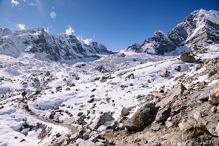
We’ll spend tonight in Lobuche — unfortunate since I’d love to get down to a lower altitude, but hiking Kala Pattar this morning took me too long to go farther. Here are some images I snap just after leaving Gorek Shep. Doesn’t the snow makes it look like a magical winter Himalayan wonderland?
Here’s a recap of my trekking itinerary:
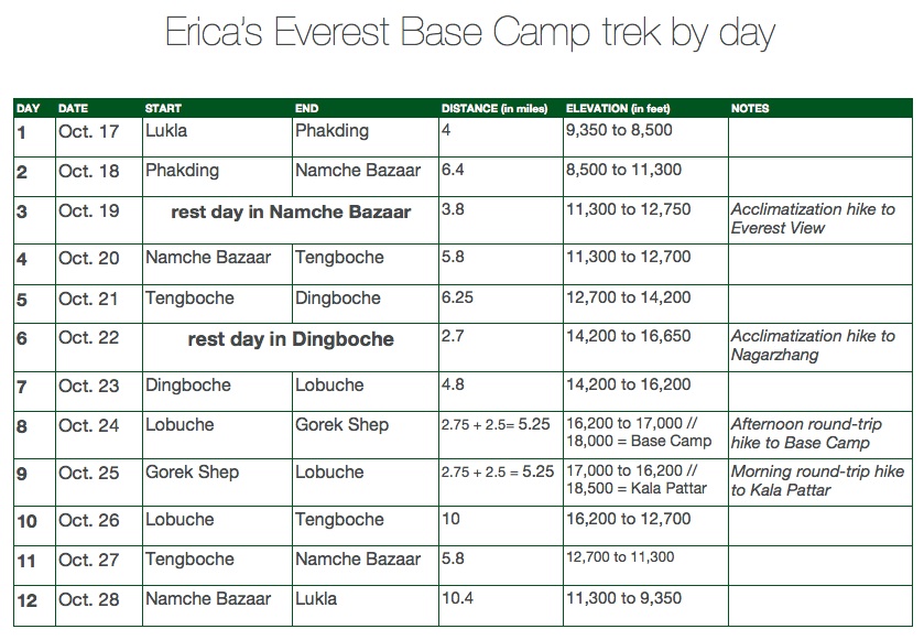
That’s just over 70 miles total. The highest elevation reached is 18,500 feet at Kala Pattar.
Whew, I still can’t believe I did all that. It’s the hardest thing I’ve ever done, succeeding marathons — which, for me, have been at sea level and completed after 5.5 hours. But add in a zombie-like state from being at high altitude, freezing temps, occasional squat toilets, fitful nights of sleep, and headaches — all of which last for OVER A WEEK — and this is a new milestone in the “hardest things I’ve ever done” category.
But for anyone who wants to tackle this trek, remember that I did zero training since I was busy traveling before my arrival in Nepal. Let that be a boost of encouragement — if Erica can do it with no prep, you can totally do it.
For more info about how I organized my trek, check out this post — Everest at a Glance.
And here’s a complete list of all posts about my Everest journey:
- Everest Day 1: Adventure and Apple Pie
- Everest Day 2: Epic Bridges to Namche
- Everest Day 3: Namche Bazaar ‘Rest Day’
- Everest Day 4: Chanting Monks in Tengboche
- Everest Day 5 & 6: Gaining Altitude
- Everest Day 7 & 8: Trudging to Gorek Shep
- Everest Day 9: Base Camp & Kala Pattar!
Final thoughts:
Days 1-4 were the highlight of this trip. The elevation isn’t too bad, the trail is relatively easy, and the views are otherworldly. Until the altitude hit me around day 6, I thought this was the single best thing on my entire RTW trip. I still think it was pretty freaking fantastic, but those tough days did a number on me, so I have to factor them in. It is absolutely possible to trek from Lukla to Tengboche and back if you want to see gorgeous scenery but avoid the higher altitude.
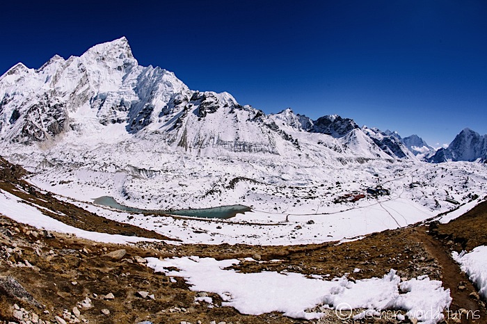
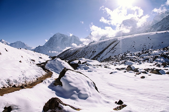
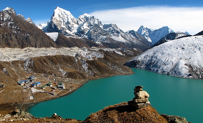
If I were to plan this again, I’d add a side trek to visit nearby Goyko Valley (pictured below). Supposedly those views are even better than Everest and it’s close by, so why not do both on the same trip? I wish I’d done more research to figure this out before I went, but honestly, with my lack of training I’m not sure I would have had the confidence to tack on five extra days on the trail. Ultimately I think I could’ve handed it. Maybe I’ll go back someday?
[image via]
While Everest was my first choice, there are plenty of other epic hiking adventures to be had in Nepal. The second most popular trek is the Annapurna Circuit. I hear it’s not quite as stunning as Everest, but less crowded and still exceedingly beautiful. Beyond that, there’s Langtang, which isn’t far from Kathmandu.
Finally, if you’re looking to do this trek for as cheap as possible, just show up in Kathmandu and book a guide / porter through one of the travel offices in Thamel. You’ll get someone to carry your bag and lead the way for a mere $22 dollars per day (roughly) and the tea houses cost about $3 a night per room. If you book a tour in advance from your home country, a good deal is $1,400 USD for the trek (this includes roundtrip flights from Kathmandu to Lukla, but not flights from your home country). So don’t book from home! Show up and do it locally to save hundreds of bucks. I think you can do this entire trip — domestic flights, guide / porter services plus tip, tea house accommodation, three meals a day, and hiking permits — for around $850 USD by booking it yourself once you arrive in Nepal. And if you buy all your gear in Kathmandu (which I’d recommend because it’s quite cheap), including a sleeping bag, waterproof coat / shell, and about a dozen other clothing items plus groceries, that totals around $200 and brings the overall Everest Base Camp trek cost to $1,050 USD. Not too shabby. I’ll have more specific info in my Nepal budget breakdown post in a few days.
If you’re looking for a list of packing tips for Everest, I found this blog post from The Planet D to be super helpful. And their post about Everest trekking tips is a gold mine if you’re planning your own trip here.
And that is a wrap on Everest. I have one final morsel coming tomorrow — a video I’ve cut together with footage from the trek.
Thanks for going on the digital journey with me!

Thanks for taking us on ur EBC trip Erica. Last yr (2015), I organised for a group of us to go to Namche, then 2 day trips to Everest View Hotel & another to Thame. 6 days all up due to time restraints.
I’ve just researched another which is the same as your (& ours) to Namche etc, but then onto Thame & Kongde, which towers over Namche etc, then return a short route back to the Lukla track. This is another alternative where you’ll see spectacular scenery without the hard work of battling altitude sickness & bitter cold.
This yr we trekked to MBC & ABC in the Annapurna Mntns, which for nature lovers I fully recommend. It was moderatly hard due to going up & down mntns each day (rock stairs much of the time), however you end up in an amphitheatre of towering snow covered mntns (inc Machhapuchre) at 4,130 mtrs, which most of us reached with only mild altitude problems. We took a risk of going in Sept, which can still be wet from the monsoon, but the lush greenery & waterfalls in full flow in every direction were worth the risk. Also much less congestion from other trekkers than later in the season.
Thank you for that account of your Himalayan treks around Nepal! They make me excited to someday return and do more hiking. I did not have time to get to Annapurna and would like to check it out. I also wouldn’t mind doing more around the EBC route, maybe going over to Goyko. Thank you for the other suggestions, too!